We have a cool 39° this morning at 6:30. The weather has been enjoyable this week with lots of sun and low dew points, a great time to be outdoors. Though I have limited use of my left arm due to restrictions of my implant and still healing I have the farmer attitude of things don’t stop needing to be done I do what I can. I planted a row of gourd seeds yesterday – I use the gourds to make birdhouses after they have dried over the winter.
A layer of smoke in the upper atmosphere will create a hazy appearance to the sky today. A cold front will pass through Michigan on Friday, bringing a period of much-needed rain before another long stretch of dry weather occurs next week with temperatures rising into the upper 70s to around 80°.

The National Weather Service in Grand Rapids has issued a Red Flag Warning, which is in effect from noon today to 9 PM EDT this evening. The Fire Weather Watch is no longer in effect.
* Winds…South around 10 mph.
* Relative Humidity…As low as 22 percent.
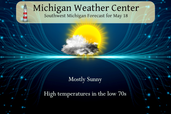
* Temperatures…In the lower 70s.
* Impacts…burn restrictions are likely in effect. For more
information on burn restrictions…visit the Michigan DNR
website at www.michigan.gov/burnpermit or call 866-922-2876.

U.S.A and Global Events for May 18th:
1883: The massive tornado outbreak on record in Illinois affected the northern and central parts of the state. At least 14 strong to violent tornadoes touched down killing 52 people. The largest death toll from a single tornado was 12, with 50 injuries, from an estimated F4 tornado that moved from near Jacksonville to 5 miles west of Petersburg. This tornado destroyed the town of Literberry. Another tornado, with an estimated F4 intensity, killed 11 people and injured 50 along its path from the south edge of Springfield northeast to near Kenney. This particular tornado reportedly drove 10 inches by 12-inch oak timbers 10 feet into the ground. Another estimated F4 tornado in far northern Illinois touched down near Capron and tracked for 17 miles before lifting in far southern Wisconsin. Lastly, an estimated F4 tornado tracked 20 miles through Kenosha and Racine Counties in Wisconsin. Eight people were killed, and 85 were injured. Click HERE to view a YouTube video.
1980: Mount Saint Helens erupted, spewing ash and smoke sixty-three thousand feet into the air. Heavy ash covered the ground to the immediate northwest, and small particles were carried to the Atlantic coast. Click HERE for more information.
Forecast Discussion
- Showers Along a Cold Front for Friday

Good model consensus exists for showers on Friday ahead of and along
a cold front that will push through the region. An intensifying
upper level jet moves into the Great Lakes ahead of an amplifying
upper wave that becomes a closed upper low over Michigan late Friday
into early Saturday. Rapid advection of higher dew points ahead of
the front is shown by the 00z HRRR as upper 50s to around 60F dew
points enter Lower Michigan Friday morning.

Showers are expected primarily during the morning hours near and
north of a Holland to Mount Pleasant line. South of this line,
showers are more likely during the afternoon hours. MUCAPE values
look meager ahead of this front, perhaps 100-200 J/kg or so, but
that may be enough to get some occasional lightning. In terms of
rainfall amounts, a general range of 0.20"-0.40" is favored across
the region. A few locally higher amounts are possible. Also, given
the frontal passage during the day, most locations will not warm
above the 60s.

- Chilly Start to the Weekend, then Warming Up

The core of the coldest air at 850mb swings through Saturday morning
into early afternoon, with temps at that level only a few degrees
above 0C, at least initially. This will make for some rather cool
temperatures during the day. The ECMWF/ECE remain on the cooler side
of guidance given a slower progression to the upper low across the
area, with temperatures mainly in the 50s during the day. The
GFS/GEM are a bit warmer with highs into the mid 60s. Will have to
do some fine tuning of those temperatures as we get closer and
hopefully a model consensus emerges.

Warmer 850mb temperatures and building upper level heights on Sunday
should boost highs back into the 70s, though a potential back door
cold front could cool us off into the 60s for Monday. Following
this, upper ridging moves in with modifying temperatures. Highs in
the 70s should eventually inch up into the 80s by mid to late week.
Additionally, dry conditions are favored for much of next week.
Ensemble guidance indicates a prolonged dry period is ahead
following Friday`s showers. Given the positioning of the upper ridge
midweek, I suppose it would be possible to generate isolated lake-
breeze showers if low level moisture becomes sufficient. Outside of
this, expect next week to largely be dry at this point.
Just another well below normal temp day! Wow!!!
Beautiful blue sky here in Arizona and 95 degrees. Incredible weather!
Enjoy!! Have a great time.
The smoke is still thick today. Looks like another day of solid cloud cover… hopefully it clears out by the weekend
Fells like Fall outside love it!! NO big heat waves insight …INDY
Yesterday was yet another well below normal temp day and today will be no different, in fact the next few days all look cool! GR had below normal temps in March and is heading there again this month! The overall cool pattern is still rocking! Wow, just wow, WOW!
CPC looking warm! Going for our 13th straight warm month in a row.
It seems a bit early for wildfire smoke to infiltrate west Michigan? Usually I think of August and early September as the main timeframe. With highs in the 80s and sunshine next week, it might feel more like August than May
Beautiful milky sunrise this morning here at Chicago O’Hare airport. I’m off to Arizona. Enjoy the weekend everyone!
My bro just flew in last night from Phoenix. He said it’s been 100 there recently. Enjoy your travels, Kyle.
Thanks!
My grandfather (the D-Day veteran) was an over-the-road trucker. He was in Washington on May 18, 1980 when Mount St. Helens erupted. He brought my siblings and me each a Mason jar filled with volcanic ash, which was SUPER cool.
Oh gee, another clear and sunny morning, rinse, repeat.
Wow that is cool…both tht Ash and him being a Dday Vet!!
He never spoke of June 6, 1944, and I understand why. My paternal grandfather was a field artillery officer in the south Pacific. He spent more than a year in Japan following their surrender as part of the occupying force.
There was a lot of smoke cover yesterday and the sky had a gray/white look to it. While there was a reported 92% of sunshine it was not like the sky was clear. The official H/L was 62/41 there was no rain fall. There were 13 Heating Degree Days and 0 Cooling Degree Days.
Slim
The overnight low in MBY so far is 41 (officially it was 39 at GRR) for today the average H/L is 71/49 the record high of 90 was set in 1962 and the record low of 28 was set in 1973. The record rain fall amount of 3.31” fell in 2000. The record snow fall amount of 0.2” fell in 1915 this is the latest date for measurable snowfall until fall. 0.4” fell in Lansing in 1915 for their latest snowfall of the spring.
Slim
While the lows are in the low 40’s here in the GR metro area that is not the case to the north. Away from the lakes there are many areas in the mid to low 30’s at this time. And even 26 at Houghton Lake, 27 at Alpena and 28 at Pellston. 33 at Cadillac.
Slim
It is warming up very quickly here. Almost up to 50 now. Mid-May sun is sure strong, even through the smoke