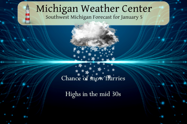
Chance of Snow Showers
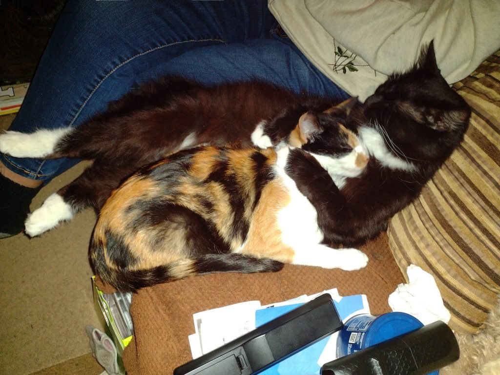
My giant four-year-old cat Monster generally joins me in preparing my daily blog in the morning, though he generally adds nothing pertinent to the post. It seems since he has seen Bill Steffens cats on T.V. he has to prove they aren’t the only ones with an interest in meteorology.
Maizie, ( the calico) is his best friend and was adopted about a year ago are almost inseparable. In all my years of having cats (and dogs), I have never seen such a close attachment between cats.
Yesterday we had a high of 50° at 4:30 am dropping to 34° by late afternoon. There was a quick peek of the sun around 4 pm but it was very short-lived. Light snowfall accumulations (under 1 inch) are possible today, mainly on grassy surfaces.
Temperatures will also turn somewhat colder, and snow showers will persist into Friday. Dry and settled weather will return on Saturday. We have the promise of sunshine for Saturday which may be a shock after this extended period of cloudy weather so far this month.
Grand Rapids Forecast
Setting up fake worker failed: “Cannot load script at: https://michigan-weather-center.org/wp-content/plugins/pdf-embedder/js/pdfjs/pdf-4.6.1.worker.min.js?ver=4.6.1”.
Kalamazoo Forecast
Setting up fake worker failed: “Cannot load script at: https://michigan-weather-center.org/wp-content/plugins/pdf-embedder/js/pdfjs/pdf-4.6.1.worker.min.js?ver=4.6.1”.
Lansing Forecast
Setting up fake worker failed: “Cannot load script at: https://michigan-weather-center.org/wp-content/plugins/pdf-embedder/js/pdfjs/pdf-4.6.1.worker.min.js?ver=4.6.1”.
Forecast Discussion
- Light snow showers today -

Moisture will increase through most of the dgz today as the upper
level low moves overhead. Therefore we expect occasional light
snow showers through the day into tonight. A consensus blend of
our latest short term guidance continues to suggest snow
accumulations will be quite light at under an inch.

Determining pcpn type today is a bit tricky as the HRRR indicates
potential for a rain/snow mix. We agree with the previous shift
that with deep moisture into the dgz and anticipated thermal
profiles/polling of fcst soundings that pcpn type should be snow
today. This notion is supported by the 00z 3km nam and 00Z HREF
for p-type as well.

Few if any impacts to travel are expected though given the light
nature of snow showers and sfc temps in the lower to middle 30s.
Roads should just be wet but a few slick spots may develop where
snow showers are relatively steadiest and most persistent.

As the upper low and the deeper moisture associated with it moves
east of our area tonight the dgz will become unsaturated.
Therefore we will just be left with some snow grains and patchy
drizzle. A few slick spots may develop on roads as sfc temps
slowly fall to below the freezing mark toward daybreak.

- Tranquil weather this weekend into early next week -

Ridging will build in at the sfc and aloft this weekend and result
in fair wx with partly cloudy skies and seasonably mild temps. In
fact dry ne sfc winds should result in quite a bit of clearing
Saturday. Fair and seasonably mild wx will continue early next
week with the sfc ridge remaining in control of our wx pattern.