Warming Trend – Weather History
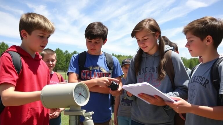
We begin our thaw today, turning our dead-end road into a pothole-filled mud run at the Weather Center. Yesterday was our last below-freezing day for the week with a high of 27° and a low of 17°. Today will be partly sunny with temperatures rising to nearly 40° with breezy conditions, winds coming from the south at about 15 mph with gusts near 30 mph.
Weather History for SW Michigan
December 25
1982: Southerly winds push temperatures into the 60s during the warmest Christmas on record for Lower Michigan. Scattered thunderstorms punctuate the unusual warmth.
1983: Only one year after the warmest Christmas on record, southwest Lower Michigan is setting record lows with temperatures plunging below zero as a long siege of arctic air dominates the last half of the month.
2000: Lansing falls to 17 degrees below zero for their coldest Christmas on record.
December 26
1985: Muskegon sets a daily snowfall record of 14.4 inches during a long stretch of snowy weather. The monthly total for December is 57 inches.
2001: A foot of lake effect snow piles up at Grand Rapids as a week-long snow blitz drops about 4 feet of snow at Grand Rapids.
December 27
1959: Southerly winds bring mild weather with lows in the 40s and highs in the upper 50s.
1993: Temperatures plunge below zero, beginning a long stretch of arctic weather that will continue through much of January.
December 28
1982: Temperatures hit 61 degrees at Lansing, Grand Rapids, and Muskegon as a spell of very mild weather continued during one of the warmest winters on record.
2000: Arctic air and deep snow cover combine to produce record-low temperatures across Lower Michigan. Records include 5 below zero at Muskegon, 9 below zero at Grand Rapids, and 18 below zero at Lansing.
December 29
1880: Arctic air puts Lower Michigan in a deep freeze. Lansing falls to 15 below zero after a low of 17 below zero the day before. The high temperature of 1 above zero on this day is the coldest maximum temperature on record for the month of December at Lansing.
1984: Temperatures reach record highs for the second day in a row at Grand Rapids and Lansing. Amazingly, the record high of 65 degrees at Grand Rapids is set just after midnight. A cold front moves through in the morning and temperatures fall into the 30s during the afternoon.
December 30
1976: Temperatures fall to record lows across Lower Michigan. At Lansing, the thermometer plunges to 17 below zero. It hits 11 below at Grand Rapids and Muskegon. The low at Muskegon sets the record for the month of December, which will be broken the very next day with a low of 15 below.
2000: Lansing picked up another 2.4 inches of snow, bringing the monthly total to over 33 inches and making December 2000 the snowiest December on record.
December 31
1875: The year ends on a remarkably balmy note. At Lansing, the high temperature of 70 degrees is the highest ever recorded in the month of December.
1976: One of the coldest Decembers on record ends with a second consecutive day of record lows across Lower Michigan. The temperature falls to 15 below zero at Muskegon, a record low for the date and for the entire month of December.
Weather History for SE Michigan
December 25
On December 25, 2000, Christmas morning dawned clear and frigid, with a morning low of 13 degrees below zero at Flint, setting an all-time mark for the month of December (the old record was -12 on Dec 23, 1989). Saginaw reached 3 degrees below zero. Three nights later, Flint would give the new record a run for its money, coming up just short with a low of -11 on the 28th (this was still a new record for the day). Saginaw fell to 5 below zero on the 28th. The arctic weather would take a toll on pipes. Both Ypsilanti High School and Chelsea High School had pipes burst over Christmas weekend, damaging classrooms. Several buildings on the University of Michigan campus in Ann Arbor had similar ruptures, including the School of Dentistry and Wolverine Tower. The cold also hampered shipping interests. Ice formation was extremely rapid on the Great Lakes and the connecting waterways. Several freighters got stuck in ice on both the Detroit River and Lake St Clair, blocking the shipping channel and bringing dozens of ships to a halt. Icebreaker assistance was needed to free the freighters. This arctic outbreak helped to seal December 2000 into the records with the 4th coldest December in Detroit, and the second coldest December for both Flint and Saginaw.
Also on December 25, 1982, record daily high temperatures of 64, 65, and 63 degrees were respectively set in Detroit, Flint, and Saginaw. This made for a record-warm Christmas Day in 1982! Curiously enough, the very next year in 1983, the record low for Christmas was set with -10 at Detroit!
December 26
On December 26, 2016, Detroit, Flint, and Saginaw set record highs of 57, 56, and 54 respectively.
Also on December 26, 2012, a large Gulf low lifted northeast along the Appalachian Mountains and clipped southeast Michigan bringing a widespread accumulating snowfall to the area. By the following morning, 4″ to 7″ had accumulated across the southeast half of the area, with higher amounts of 14″ in Lakeport and 11.1″ in Port Huron. Detroit and Flint measured storm total accumulations of 6.2″ and 5″ respectively. Further northwest, Saginaw received a glancing blow and measured only 1.5″.
Also on December 26, 1914, the overnight temperature plummeted to -12 degrees in Saginaw, which is 30 degrees below the average overnight temperature!
December 27
On December 27, 1904, there was a maximum temperature of 56 degrees in Detroit between 3 and 4 pm that fell steadily to a minimum of 18 by midnight.
December 28
On December 28, 2008, a rapidly intensifying storm system moved across Lake Michigan to the Straits area. This storm brought wind gusts up to 60 mph to all of Southeast Michigan, and wind gusts up to over 70 mph to Lakes Huron, Erie, and St. Clair. Numerous trees, limbs, and power lines were down. In all, about 300,000 customers in Southeast Michigan lost power during the height of the winds.
Also on December 28, 1880, the daytime temperature rose to only 4 degrees in Detroit, which is 29 degrees below average!
December 29
On December 29, 1998, 0.1 inch of snow fell in Detroit. While this light snowfall is not usually a significant event at the end of December, this was the first measurable snowfall for the 1998-1999 winter season, making this date the latest first measurable snowfall of any winter season.
Also on December 29, 1880, the daytime temperature rose to only -3 degrees in Detroit. This is the second coldest maximum temperature for any day in Detroit!
December 30
On December 30, 1971, Detroit recorded the greatest amount of precipitation in 24 hours for the year. The recorded measurement was 1.37 inches.
December 31
On December 31, 2015, the high temperature reached 36, 34, and 33 in Detroit, Flint, and Saginaw respectively. Although typical for December, they were chilly compared to the rest of the month. Fueled by a particularly strong el Nino and a northward displacement of the polar jet stream, the monthly average temperature for December 2015 came out to 41.1, 40.0, and 39.1 degrees, making it the warmest December on record for all SE Michigan climate sites.
Also on December 31, 1974, marks the end of the snowiest December on record in Detroit. A total of 34.9″ of snowfall fell during the month, which is 23.8″ above average!
Forecast Discussion
- Thawing Out With Light Rain and Fog Moving In

Low level moisture below 5000 ft will advect in ahead of the western
U.S. upper level trough late tonight into Thursday. Model soundings
show low cloud cover developing region wide during that period.
Light rain or drizzle should develop ahead of the surface cold front
that is forecast to be moving across central Iowa by 00z Friday. As
abundant low level moisture moves overhead Thursday, light fog
should develop but could get locally dense over areas with a sizable
snow pack. This could make for some highly variable visibilities
across the region and some difficult driving conditions at times.

The 00z model suite continues to tone down rain amounts Thursday
into Friday. There is still both deterministic and ensemble guidance
spread in QPF for late Friday into Saturday. The current thinking is
that the cold front should move into SE Lower MI Friday afternoon
and stall out there. That part of the state will be more susceptible
to receiving additional rainfall Friday night into Saturday as
another mid level shortwave pivots through. LLJ orientation does not
look favorable for our area on the 00z ECMWF while the GFS is
further west and wetter. The 00z WPC QPF shows the area at greatest
risk for 0.25" or greater to be near/east of I-69. Sunday is
trending drier region-wide.

There is a risk for mixed precipitation Friday night into Saturday
night across central Lower MI as surface temps drop into the low to
mid 30s. Some light freezing rain and/or snow would be possible.
This is more likely to occur Saturday night based on model soundings.

- Another Surge of Warmth Early Next Week With Rain

Ensemble guidance is narrowing in on a storm system slated to impact
the region late Monday into Tuesday. The upper level pattern looks
more dynamic with this system than the one moving through late this
week. A deep upper low should develop west of the Great Lakes,
placing our area well into the warm sector. This is shown by a
consensus of deterministic and ensemble guidance bringing 850 mb
temperatures into the 7C-10C range. Vigorous LLJ development ahead
of this upper low is forecast with 50-60 kts advecting in Gulf of
Mexico moisture into the Great Lakes. Heavier rainfall is possible
with this system (0.50" or greater). Additionally, depending on warm
frontal placement, some elevated instability may develop and we may
need to include a risk for some thunderstorms if trends continue.

Ensemble mean high temperatures are now inching into the mid 50s on
Tuesday for southern Lower Michigan, with a notable number of
members from the ECE/GEFS/CMC showing 60s reaching areas south of I-
96. These kinds of temperatures would threaten records for January
3. Whatever might be left of our snowpack early next week will be
torched with this system when you factor in both the rainfall and
temperatures.

At this point, snow melt combined with rainfall over the next 7 days
does not appear to rise to the level of any river flooding, but we
will have to monitor ice movement over the next few days for the
potential for ice jams forming. Currently, our river modeling shows
low potential for break-up ice jams to occur even with the rain and
warmer temperatures. Still, something to keep an eye on for our jam-
prone locations.

- Seasonable Winter Temperatures Return Mid to Late Next Week

Ensemble guidance brings in more typical wintertime temperatures
after this warm system departs the region early next week. Highs
should return to the 30s with lows in the 20s. Some light lake
effect snow showers may be possible next Wednesday.