Slim and I have been dropping hints of the winter forecast for this year – I am thinking I will put out my forecast sometime next week. My main concern for early winter is the predicted position of the jet stream through November which is just south of the state (which I will figure into my forecast) which would lead me to believe our winter will be back loaded with the colder air the last half of the season.
The jet seems to be moving just south of the state through the early term which could hold off the coldest air until after Christmas. This is just preliminary as these are just guesses and hints at this time. We could still see below normal temperatures through Christmas but with the rain/snow lines so close we could be seeing chances of freezing rain in the mix through the period in southern Michigan.
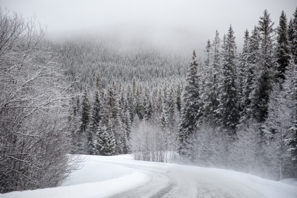
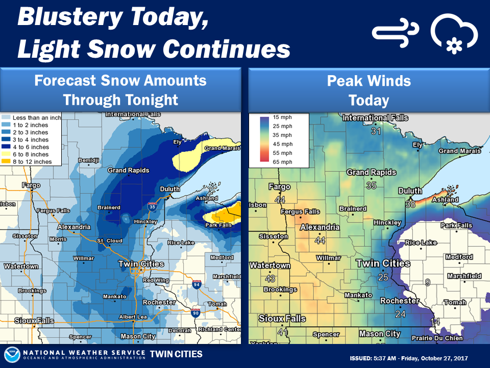
Today we have winter weather advisories and warnings in Minnesota, extreme northern Wisconsin and the western U.P. where 8 to 10 inches of snow may fall so it won’t be long before winter activities will be in full force in the north.
[columns] [span6]
[/span6][span6]
[/span6][/columns]
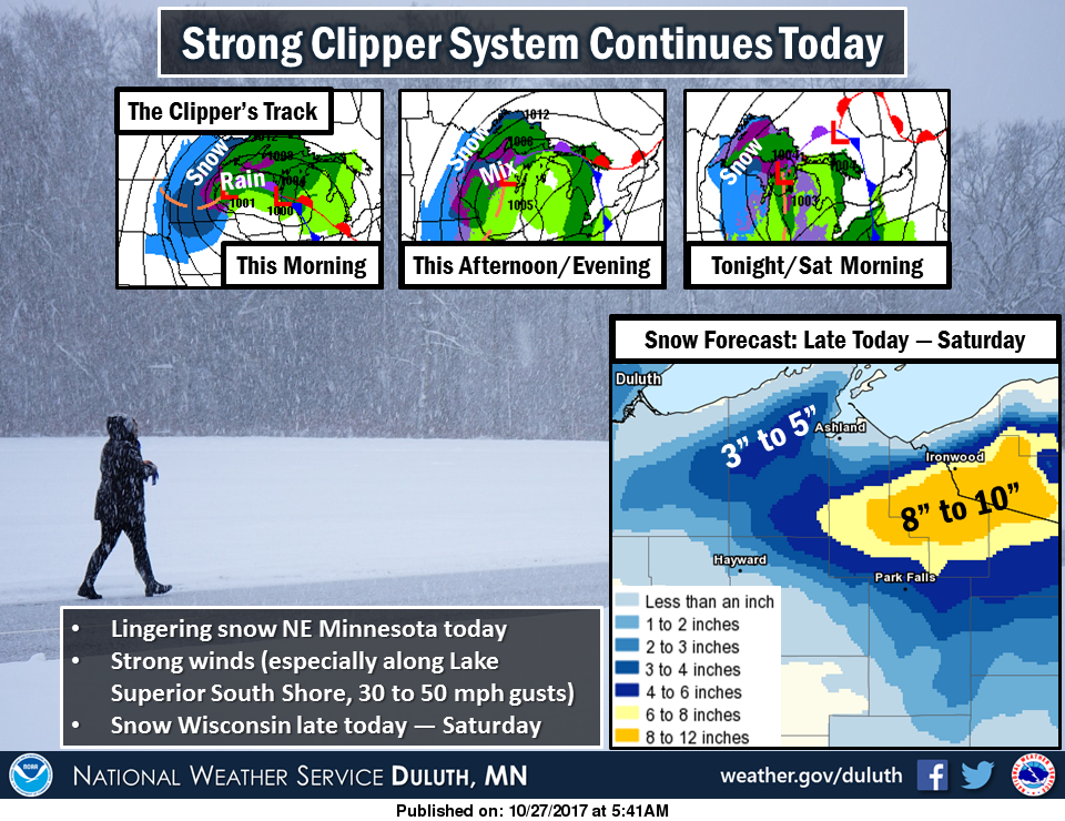
There will be lingering snow and strong winds across northeast MN today as a strong Alberta Clipper moves through Wisconsin. It will mostly be rain in northwest WI today, but with powerful winds affecting coastal areas near Lake Superior (30 to 50 mph gusts!!). This will result in very high surf and piling up of water onto the shore. The rain in WI will switch to snow late today and tonight, bringing the first snow of the season to those areas. The greatest snowfall will be along and near the Gogebic Range because of lingering lake effect snow through Saturday.
Halloween still is appearing to be a wet day with a mix of rain and snow which we could see through the weekend also. A cold front will move through Southwest Lower Michigan this morning, ushering in colder air. Temperatures this afternoon are expected to remain in the 40s. It will be breezy with southwest winds of 15 to 25 mph which will make it feel cooler. Rain showers are expected to move through the area today.
On the upcoming winter ideas that is always a good question and the fact of the matter there is no one who can predict what will happen case in point last month how many forecasts were saying that October 2017 would be the wettest October at many locations? But that said we have been is a warm pattern (and a very warm winter pattern) now for two years and just like the dry pattern we had been in that warm pattern too will change. Will it be this winter? Next spring? Or next summer? That is hard question to answer.… Read more »
NWS forecast high for today in GR is 47 degrees. Current temp in GR is now 50 degrees?
Yeah I wondered that to. When I left for work this morning it was 54 with a forecast high of 46. Swing and a miss on that one.
It is not unusual for temperatures to go up even at night before a cold front goes thru and that is just what happened last night. The temperature at my house went up from 46° to 52° and now have gone back down to 47° At this time it looks like the official high for the day will be 51° at Grand Rapids. As for missing the high for the date that happens sometimes both on the high and low side.
Slim