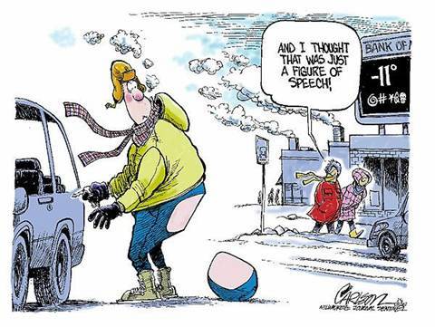
Wind-chill or windchill, (popularly wind chill factor) is the perceived decrease in air temperature felt by the body on exposed skin due to the flow of air.
Wind chill numbers are always lower than the air temperature for values where the formula is valid. When the apparent temperature is higher than the air temperature, the heat index is used instead.
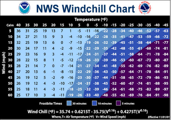
For wind speeds under 5 miles per hour, there is no significant wind chill factor and for wind speeds above 45 miles per hour the wind has no further appreciable effect. For wind speeds between 5 mph and 45 mph, the following formula may be used to calculate the wind chill factor — where “t” is the temperature in degrees and “v” is the wind velocity in miles per hour.
![]()
If the temperature is 30° and the wind speed 20mph the windchill would be 17°.
Lake Superior set a wave height record yesterday at 28 feet! The previous record was October 27, 2010, measured at buoy no. 45136, operated by Environment Canada, in northern Lake Superior recorded a significant wave height of 26.6 feet .
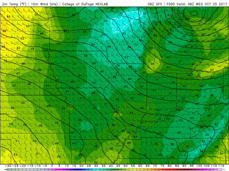
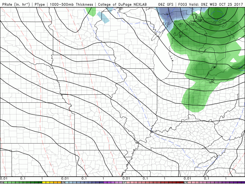
Appears we may see a couple days of dry weather but the unsettled pattern may continue through early November. At this point Halloween may be wet and chilly so you may want to consider a warm costume for the festivities. Below are the GFS temp and precipitation models through November 10. The western portion of the U.P. is expected to see their first accumulating snows this weekend. Here in the lower part of the state we could see our first snows the first of week of November though I don’t see it sticking around.
My main concern for November is the temperatures during the rain/snow events bringing a freezing mix. I am still thinking we will get most of our snow for Christmas through the months of January and February.
[columns] [span6]
[/span6][span6]
[/span6][/columns]
Most of Michigan set rainfall records for the month of October (with more rain to come). Here at the station we have received 12.69 inches!
We had about 4 3/4 inches of rain since Sunday in my unscientific bucket that was left out. Lol.
The latest point forecast show temperature down around freezing for most of the area after 4am until daybreak tonight
I had 3.99 in of rain for this last event. Now how long before we see snow! :))
Hopefully we set yet another record with the latest snowfall ever! Might as well keep shattering records while we are on a roll!
This October is turning out to be a record month! The 2.81” of rain that fell at GRR on the 23rd set a new daily record for Grand Rapids (the old record was 1.92” in 2009. And now with the 9.31” that has fallen so far this month has now set a new record for the month of October breaking the old record of 8.32” set in 1954. If that was not enough Grand Rapids will at least tie the record for the latest in the fall season for reaching 39° or lower. So far the coldest it has officially… Read more »
Yeah, I was thinking yesterday we have been setting a lot of extreme records in the past month. Always fun watching history being written in the record books.