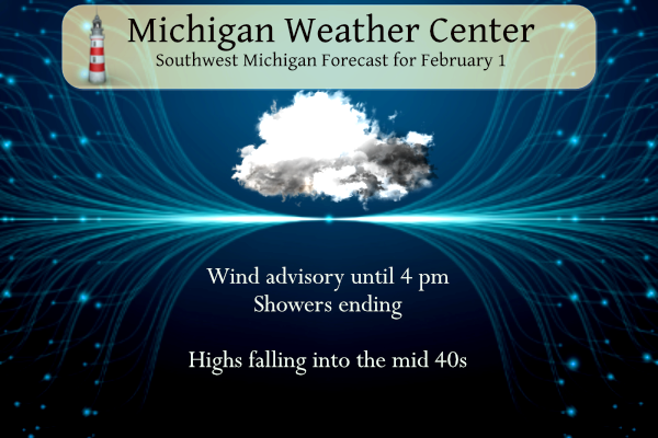
We had a nice spring-like day yesterday, our temperature here at the station was 55°! We still have 53° at 5 am this morning. Today will be windy with diminishing showers. The temperature will fall through the 40’s. Another system will bring accumulating snow and a wintry mix to parts of Lower Michigan on Thursday into Thursday night; areas of slippery travel conditions are expected. I suspect we will see more advisories, watches, and warnings later today
Weather History for SW Michigan
February 12
1967: Temperatures plummet to 24 below zero at Lansing and 16 below at Grand Rapids as arctic high pressure moves across Lower Michigan.
February 13
1938: Heavy rain and warm temperatures prevail for the second day. Lansing records over three inches of rain from the storm and Grand Rapids over two inches and some minor flooding is noted across Lower Michigan.
February 14
1899: The record arctic cold wave begins to abate but not before Grand Rapids sets its all-time record low of 24 below zero.
February 15
1954: A two-day surge of warm air into Lower Michigan peaks with record highs of 61 degrees at Grand Rapids and 60 at Lansing.
February 16
1981: Lower Michigan is in the midst of a long period of thawing weather with lows above freezing and highs mostly in the 50s from the 16th to the 20th.
February 17
1973: Arctic air is in force across Lower Michigan with record lows of 19 below at Grand Rapids. Muskegon falls to 14 below zero, just shy of the record low for the day of 15 below set in 1904.
1979: A long spell of frigid weather during January and February results in Lake Michigan freezing over almost completely for the only time on record.
February 18
1926: A snowstorm drops 5 to 9 inches of snow across southern Lower Michigan. Lansing sets a record snow total for the day of 8.5 inches.
2014: Persistent cold weather and frequent snows during January and February result in a deep snow cover that persists through much of March. At Grand Rapids, the snow depth reaches 24 inches on this date, second only to the record of 25 inches set after the blizzard of late January 1978.
Weather History for SE Michigan
February 12
On February 12, 2019, the Tri-Cities and Thumb regions saw 3 to 6 inches of snow while areas south of Metro Detroit saw persistent freezing rain. Tens of thousands of residents lost power during this storm.
On February 12, 2003, the city of Port Huron received 5 inches of snow due to a passing snowstorm.
February 13
On February 13, 2015, Flint set a daily record low of -8 degrees. This broke the old record of -7 which occurred in both 1970 and 1958.
Also on February 13, 1894, a two-day snowstorm dropped 12.8 inches of snowfall on Detroit.
February 14
On February 14, 1905, a very cold Valentine’s Day night was experienced in Detroit, with the temperature plummeting to -15 degrees!
Also on February 14, 2007, a two-day snowstorm ended leaving most of Metro Detroit with 6 to 8 inches of new snow. There was also considerable blowing and drifting of the snow with drifts reported as high as 2 to 4 feet in some locations.
February 15
On February 15, 2015, Amid an intense cold outbreak during one of the coldest months in the climate record for Southeast Michigan, Detroit, Flint, and Saginaw all recorded daily records for the lowest average temperatures of -1, -7, and -5 degrees respectively. In addition, Flint and Saginaw recorded record low high temperatures of 2 degrees to go along with record lows of -17 and -13 degrees respectively.
Also on February 15, 1954, the daytime temperature soared to 66 degrees in Detroit, which is 32 degrees above average.
February 16
On February 16, 2021, a significant winter storm impacted the region with areas along the lakeshore in Sanilac and St. Clair Counties receiving over a foot of snow. The snow was light and fluffy and with northeast winds gusting to 30 mph, there was significant blowing and drifting of snow.
On February 16, 2015, Detroit tied (1904) a new daily record low of -9 degrees under calm winds and clear skies. The temperature in Flint fell to -21 degrees, which tied for the 5th coldest temperature ever recorded in the Flint Area. The previous record for February 16th was from 1963. The NWS office in White Lake reached -23 degrees, a new all-time record low which would ultimately stand for less than a week before being broken again.
Also on February 16, 1875, marks the thirteenth day in a row of overnight low temperatures of 0 degrees or below in southeast Michigan,
February 17
On February 17, 2014, a low-pressure system brought accumulating snowfall that lasted into the morning of the 18th. 3 to 5 inches were measured across the area. However, locations across the north that saw precipitation remain all snow throughout the event recorded higher totals including 8 inches in Port Austin and 6.5 inches in Bay City.
Also on February 17, 1979, the overnight temperature plummeted to -19 degrees in Flint.
February 18
On February 18, 2019, an overachieving snowfall event occurred. A strong upper-level wave led to convective snow that resulted in a narrow swath of 5 to 7 inches of accumulation across the Ann Arbor to Utica corridor. Most other areas saw 1 to 4 inches of snow.
On February 18, 1976, the daytime temperature rose to 62 degrees in Detroit, which is 27 degrees above average.
Grand Rapids Forecast
215 grrLansing Forecast
2 15 lanKalamazoo Forecast
2 15 kzoForecast Discussion
-- Windy Wednesday --

Other than locally stronger gusts along portions of the lakeshore
(including MKG ASOS) due to the standing breaking wave in the lee of
the marine layer, winds are unsurprisingly not yet at advisory
levels early this morning as weak stability in the low levels is
limiting mixing. A 50 to 70 knot low-level jet core from 925-850 mb
is translating east of the area, to be replaced with 35 to 45 knot
southwesterly winds behind a cold front as day breaks, amid a tight
pressure gradient between the Lake Superior low and the sprawling
Bermuda high, plus an isallobaric contribution as pressure rises
today. With steeper low-level lapse rates in the cold air advection
behind the cold front after daybreak, mixing of 40 to 50 mph winds
to the surface as gusts will become common through mid afternoon.
Latest model guidance suggested an expansion of the advisory to US-
10 starting later in the morning was fair decision.

-- Wintry Thursday --

Have settled into medium confidence of a 4 to 7 inch snow event in 8
to 12 hours for areas near and north of Holland, Grand Rapids,
Greenville, and Alma (toward Ludington, Cadillac, Harrison). South
of Holland-GR-Alma (toward Kalamazoo-Jackson), a melting layer
around 5000 feet lined up roughly with the track of the 850 mb low
will present some precip-type challenges and a reduction in QPF to
snow ratios but still some impacts to road conditions. The depth and
magnitude of the cold air below the melting layer suggests a greater
potential for sleet (ice pellets) rather than freezing rain. Will
have to keep the door open for some late adjustments, of concern
being some model runs like the 06Z HRRR suggesting a farther south
track of the low which may shift expected amounts about one row of
counties southward.

One big talking point for the areas that expect the greater snow
totals should be the sharp difference in travel conditions between
the Thursday morning and afternoon commutes, with no problems
expected during most of the morning, then the possibility for
occasional inch-per-hour snow amounts during the afternoon with
temperatures below freezing.

It`s interesting to see 12-hour QPF around a half inch in the
deformation zone of this low-to-mid-level cyclone, despite a DGZ
around 600 mb that may be unsaturated for part of the event as
moisture at and above this level is directed east of our area by
southwesterly flow amid a positively tilted upper-level trough. Much
of the lift and QPF production is the result of strong mid-level
frontogenesis in the deformation zone which may also result in some
mesoscale banded snow production. Melting layer aside, the bulk of
precip forming in clouds that are -4 to -12 C leads one to wonder if
snow/liquid ratios need to be held near or slightly less than
average for synoptic events. Despite that, 0.5 inches of water
falling as snow in a period of less than 12 hours will create some
challenges for travel.
BAM! Here you go, we are in a WWA and the GR NWS is right in line with the RDB model! Incredible!
https://forecast.weather.gov/showsigwx.php?warnzone=MIZ057&warncounty=MIC081&firewxzone=MIZ057&local_place1=2%20Miles%20E%20Northview%20MI&product1=Winter+Weather+Advisory&lat=43.0501&lon=-85.5568#.Y-1CeS1Oni0
Had a 56MPH gust at GR airport 😮
Hopefully not many power outages?
The YMCA by me is closed due to a power outage
Mid February snowstorm on the way!! Great scotty many schools will be getting the day off Friday wow to the wow ….INDY..
Yes INDY, back to winter weather and the best season! Then after the snowstorm a brief warm up and then bam back to cold and snow! Get ready to ROCK!
Looks like whatever snow we receive tomorrow will be a precursor for at least the next 2 weeks! Wow, just wow!
Wow, a WWA is looking likely for tomorrow and then plenty cold air is showing up in the models for next week! Incredible!
Wow, that was a lot of high temp records broken yesterday! Muskegon almost making 60 degrees?! The 7 week January thaw continues…….
It is incredibly windy here. Seems like 40+ gusts, maybe 50+.
Looks like whatever snow we do receive will be melting come Saturday and Sunday. I love it!
Probably Saturday-Monday most of the snow will melt besides the piles
Michael or others,
Have you heard of the sudeen stratospheric warming? I watched this https://www.youtube.com/watch?v=i-nxUdNaLN0 Just curious what your take is on it??
Oh yes, this could lead to the polar vortex paying us a visits. If a big SSW hits we could have a very cold and snowy March! I love long winters!
Lots of discussion out there about a Winter storm Friday for GR only adding on to what is a already above average snowfall for the Winter season after temps in the 50’s now thats just crazy…..Who Knew?? INDY
Get ready for a WWA and 3 to 6 inches of fresh SNOW! Nothing better!
The RDB still shows GR picking up 3 to 6 inches of snow Thursday! Get ready for a WWA and slippery roads Thursday afternoon/evening! What? Winter is not over! Who knew?
The latest HRRR looks great for Kent County! Bring it on and then another snowstorm shows up on the models for next week! How could it be?
https://www.pivotalweather.com/model.php?m=hrrr&p=snowfall_acc-imp&rh=2023021506&fh=48
I did not post yesterday as I was in bed sleeping most of the day. I did not feel well so I went to an urgent care center and lo and behold I tested positive for Covid. This is the first time that I have tested positive. I can’t take Paxlovid as I am taking Eliquis. I will have to see how this plays out. While I was sleeping record highs were set all around west and central Michigan. The new record highs are 54 at Grand Rapids. 59 at Muskegon, 58 at Lansing and 56 at Holland. The official… Read more »
Get better soon! I assume you are fully vaccinated and have taken the bi-valent booster!
Yes. I am fully vaccinated with all 5 shots.
Slim
Excellent, because the data is overwhelming that the booster shot greatly decreases your chance of a poor outcome!! Hopefully more people will actually get the latest booster shot!
Feel better soon, Slim.
Any idea how and where you picked it up?
no
Slim
Take it easy and get well Slim – I had long covid for several months along with my wife, not fun at all – we were both up to date with all our covid shots. My heart doctor says covid made my heart problems worse, so take care, my friend…
Oh Slim… I will send prayers and good thoughts your way. Rest & stay hydrated!!! Hopefully the vax will do its job of protecting you.
Get Better Slim probably a good time to stay in anyways with the late February snowstorm on the horizon…Thanks for everything you do for the blog drink lots of water ….INDY
Just got over Covid. I’m an old guy and for me it was pretty much a nothing-burger. No fever or sore throat, had a little nasal drip and some fatigue. The fatigue was only noticeable symptom. Got the initial 2 jabs almost 2 years ago (regrettably because of side effects I won’t go into) but none of the boosters. Hope you get well soon.
I hope you feel better soon Slim!!
I hope you feel better soon. Get lots of rest and liquids. I am very glad to hear you have all your vaccines. That will help you.
Breezy and warm this morning. A few flashes of lightning to our north a couple of hours ago.
Looks like my GR area friends are in a better position than me for some accumulating snow out of this upcoming system.
Make someone smile. Have a great day.
Breaking>>>>we will be getting pounded with snow on Thursday and then next week we transition to a colder snowier pattern! Right on schedule per the RDB prediction from Feb 1st! Incredible accuracy!
“ Rocky (Rockford)
Check back with me by the 3rd week of Feb and we will see if the so called experts are correct about the warm up or the trusted RDB model! Stay tuned!”