This is a post to help explain (I hope) what causes weather patterns. Our atmosphere is a complex system that can be hard to explain and predict pattern movement more than a few days out. The system of weather prediction of these currents of the air has a complex mathematical formula that computers try to track. Remember, computers are only as good as the people who program them. This is why meteorology is heavy on math education and atmospheric science.
In the course of writing this blog over the years, I have learned a lot about how all this functions, however, I don’t consider myself a genius on the matter and the math of it all still confuses me to no end. This isn’t one of those topics which are so simple a caveman could do it.
The physics of the weather is fairly well written in stone but the movement of the systems it brings about isn’t. As we well know low-pressure systems moving a bit north or south in the winter can cause consternation to forecasters as to whether a certain area can receive snow or rain as we have seen this winter.
Weather processes such as wind, clouds, and precipitation are all the result of the atmosphere responding to uneven heating of the Earth by the Sun.
The uneven heating causes temperature differences, which in turn cause air currents (wind) to develop, which then move heat from where there is more heat (higher temperatures) to where there is less heat (lower temperatures).
The atmosphere thus becomes a giant “heat engine”, continuously driven by the sun. High and low-pressure areas, wind, clouds, and precipitation systems are all caused, either directly or indirectly, by this uneven heating and the resulting heat redistribution processes.
Generally speaking, there are two main modes of this heat redistribution:
(1) VERTICAL heat transport: Solar heating of the Earth’s surface makes the atmosphere convectively unstable, causing vertical air currents to develop. This is what causes puffy-looking clouds, showers, and thunderstorms to form in warm air masses.
(2) HORIZONTAL heat transport: Because the Earth is a sphere, it receives more sunlight in the tropics and less sunlight toward the North and South Poles. This causes horizontal temperature differences to develop, which in turn causes air pressure differences, leading to wind which transports heat from the tropics to the high latitudes.
Together, this uneven heating in both the horizontal and vertical directions in the atmosphere causes everything that we perceive as “weather”.
CLOUDS & PRECIPITATION
The vertical heat transport is partly accomplished by wind flowing over the Earth’s surface causing evaporation of surface water, which requires heat (thus cooling the surface), then releasing that heat higher up in the atmosphere when the water vapor condenses to form clouds and precipitation. This primary mode of vertical heat transport is called “moist convection”. The following photo from the Space Station shows a large thunderstorm, which represents moist convection transporting heat from the lower to the upper atmosphere:
If there is very little surface water available (for instance, in deserts), the convective overturning of the atmosphere is called “dry convection”, and it does not produce clouds or precipitation.
HIGH AND LOW-PRESSURE AREAS
Temperature differences caused by uneven solar heating between different regions cause high and low-pressure areas to develop. The horizontal transport of heat by the wind from low to high latitudes is strongly influenced by the Earth’s rotation, which prevents the wind from flowing directly from high pressure to low pressure, and instead causes the wind to flow around high and low-pressure centers.
Thermal lows form due to localized heating caused by greater sunshine over deserts and other landmasses. Since localized areas of warm air are less dense than their surroundings, this warmer air rises, which lowers atmospheric pressure near that portion of the Earth’s surface.
Surface low-pressure systems usually have fronts associated with them. A front represents a boundary between two air masses that contain different temperature, wind, and moisture properties. The weather on the surface of the earth is controlled significantly by what occurs in the atmosphere above. Therefore, meteorologists always analyze “upper air charts” for weather disturbances, moisture, temperatures, etc. and their expected changes to determine what weather likely will occur at the surface.
Since surface air pressure is a measure of the weight of the atmosphere above any location, a high-pressure area represents a region where there is somewhat more atmosphere overlying it.
High-pressure areas are usually caused by air masses being cooled, either from below (for instance, the subtropical high-pressure zones that form over relatively cool ocean waters to the west of California, Africa, and South America), or from above as infrared cooling of winter air masses over land exceeds the warming of those airmasses by sunlight.
As the airmass cools, it shrinks, allowing air from the surroundings to fill in above it, thus increasing the total mass of atmosphere above the surface, which then results in higher surface barometric pressures.
The pressure difference between the high-pressure area and its lower-pressure surroundings causes a wind to develop flowing from higher to lower pressure. But because of the rotation of the Earth, the wind is deflected to the right (in the Northern Hemisphere) which then causes the wind to flow in a clockwise direction around the high-pressure zone.
ATMOSPHERIC CIRCULATION CELLS
All of these horizontal and vertical heat transport processes produce complete atmospheric circulation “cells”. This is a consequence of the fact that for all of the air transporting heat from higher to lower temperatures, there must also be a return flow of air in the opposite direction.
For instance, for all of the air rapidly rising within a thunderstorm, there must be an equal amount of air sinking elsewhere. This sinking occurs over a much broader area than the strong updrafts in the thunderstorm, and the rate of sinking is slower. This is why you feel turbulence when flying through clouds, but not so much in the clear areas around the clouds. The distances involved in the circulation cells are typically tens of miles.
In the winter, and at high latitudes, the circulation cells cover much much larger regions. The slowly ascending air within cloud and precipitation systems associated with low-pressure areas covering areas hundreds of miles across forces an equal amount of air elsewhere to sink, which usually occurs in the high-pressure zones.
So, when you experience a clear day without a cloud in the sky, you are in the descending branch of an atmospheric circulation cell. That descending air is being forced downward by rising air in precipitation systems hundreds or even thousands of miles away. Then, because these circulation cells tend to travel, in a day or two you find yourself in the ascending branch of a circulation cell, with clouds and rain (or snow).
If all this sounds complicated, that’s because it is. But remember, all of this complexity we experience as “weather” is ultimately the result of uneven heating of the Earth by the sun, and the atmosphere continuously ‘trying’ to reduce the resulting differences in temperature. I hope this post helps you to better understand what causes the weather.
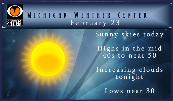
Today will be the end of our rare sunny and warmer February pattern as we close out meteorological winter. This week will feature a more active pattern as clouds increase tonight bringing in rain or mix Monday night and Tuesday. The second half of the week the colder air returns with the possibility of snow. I am not overly excited about this because the temps aren’t overly Arctic in nature, just another visit from our friend from Canada.
I am not putting much stock in the CPC forecast – I guess we will just have to wait and see how it plays out as we transition from winter into spring this month.
It sure was a beautiful day today. We got out and took the dog for a nice walk. I had no idea what was brewing
across the lake till my daughter told me about it and you know it is headed this way. Wood tv 8 is saying 4 to 12″ of snow and possible school closing Wednesday and Thursday. I think I heard Bill say put the plows back on your trucks. LOL!! Sounds like winter isn’t over just yet.
What do we have here? You mean it won’t be a warm spring week coming up?
It reached 50 here and without the cold wind of the past few days, it was perfect out today. Lots of people outside enjoying the warm sun.
Winter storm watches across the lk here we go …INDY
A storm is coming even though the warm weather fanatics keep talking about winter being over and nice warm spring temps right around the corner! Delusional?
The latest NAM!
http://wxcaster.com/gis-snow-overlays2.php?STATIONID=GRR
Good snow track!
What a glorious weekend of skiing up in snow country! Absolutely gorgeous! Now we can focus on all the cold and snow for next week! A major snowstorm is brewing! Get prepared and stay tuned for later updates!
Currently 44* degrees out at thee YARDOFBRICKS Planfiled Township so much for all that 50* degree talk lately …. Bring on the snowstorm ..INDY
50 here, 53 in Kalamazoo, 48 in GR. Just a beautiful day again today with 100% sun.
Keep the facts coming Indy! Snowstorm is brewing! Bring it!
I believe the last time it was 50* degrees here was February 3rd longg time ago all the talk all month one would think it was 50’s everyday with no snow NOT…..INDY
Amazing we have a snow storm coming at the end of February hopefully more in March …..Love it !!!! INDY
Question for Slim……I was surprised to see February precipitation is actually currently below average for the month. That will change with the coming rain, but when was the last month we finished below average in precipitation? The only dry month I can think of recently would be last July, but even then GR had much more rain than our area because of the pop up thunderstorms from the lake breeze.
Sorry it took me so long to back on this but I will post this again tomorrow. August 2019 was the last month of below average precipitation at Grand Rapids. In August GR reported 3.41″ of precipitation with 3.59 being average. The only other month of below average precipitation was last March with 2.23″ falling and 2.37 being average. As for February at this time GR is at 1.08″ and for a 28 day month the average is 1.79″ and it looks like 0.07″ falls daily so that would put 1.86″ as a 29 day average for February.
Slim
Thanks! We could use a string of dry months to get water levels down.
What a great week of sunshine we’ve had! The snow pack has again been obliterated down to nothing, and the ground which has never really froze deep all Winter is soaking up the suns heat which it will retain to help melt any snow that might fall in the coming days. Watch for increased posts this week from the delusional cold and snow people as this crazy mild Winter transitions into Spring.
Great Scott already winter storm watches going up to our Southwest here it comes BIG DADDY time …INDY
The snow is gone, almost 50, sunny, and another horrible weekend for winter sports. I love short winters!
Lol….OK….INDY
I still have a 2 solid inches of snow on the ground!
Time to get the grill out and get it ready for this afternoon! Love these early spring days!
Looks like another short couple day cool down coming this week and then right back above normal for temps! We could use some rain to wash all the salt of the pavement and get the ground kickstarted for spring!
https://weather.com/weather/tenday/l/7f39432f98eef2d300f773cf914253d5f248e7131cb69cb63b087ebda662f574
Wow amazing warmth!
Thanks Michael, this explains a lot as to what is going on with our weather. Very informative! I have learned so much from this blog over the years!
There is also something brewing for next month! Get prepared for a wild ride!
http://wxcaster4.com/cfs/NORTH-AMERICA_CFS-NODE1_SFC_45DAY-ACCUM-PRECIP_180HR.gif
Some MODLES showing 20+ inches along the lake shore that’s impressive!! Winter storm Watches on the horizon stay tuned …INDY
Check out the latest form the NAM! There is something brewing for this week so stay tuned to later updates!
http://wxcaster.com/gis-snow-overlays.php?STATIONID=GRR
It is another great ski day up in snow country! Conditions are excellent and the sun is out! What an incredible ski season up here! Keep it coming!
With the sun we had yesterday and mild temperatures took a big bite out of the snow cover here. There now is a lot of bare ground showing. Of course the snow piles are still there and there is still snow on the north side of building and in the woods yet. As shown in my post from yesterday it is not unusual to have no snow on the ground in late February. In the 30 leap years of records here at Grand Rapids 15 had either no snow on the ground or just a reported trace. At this time… Read more »
Some great information MV
Slim
Excellent and easy to read post MV! I’ve sent a link to today’s posts to all my kids for them to read, should help answer some of the questions they’re always bombarding me with in regards to what causes this or that with the weather. I always tell them it all starts with the sun.
Thanks Michael, for that information! It really clarifies in my head what is happening on the larger scale, with respects to air masses, their formation, and how they interrelate to one another. I have found this website one of my daily “go to” sites to get my weather fix, forecasts, and useful info. Have a restful, sunny Sunday.
Great post!