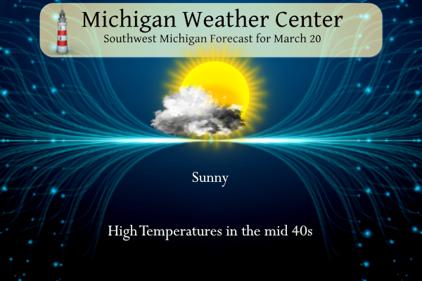
Spring begins at 5:24 pm today and we welcome the day with plenty of sunshine and temperatures in the mid-40s. Now is the time we wistfully look at the seed catalogs wanting to begin planning for planting spring gardens, which are still several weeks away. Temperatures start to warm, spring showers bring the earth back to life. Today appears to be our best day of the week for outdoor activities before a more active weather pattern comes into play. Temperatures will be trending milder this week, but with frequent clouds and precipitation especially Wednesday onward. In the meantime, a dusting of new snow is possible Monday night in central to northern Michigan.
U.S.A and Global Events for March 20th:
1948: The city of Juneau received 31 inches of snow in 24 hours, a record for the Alaska Capitol. (20th – 21st)
Also, on this day, an F3 tornado tracked through Tinker Air Force Base in Oklahoma City, OK just before 10 pm destroying 54 aircraft, including 17 transport planes valued at $500,000 apiece. The total damage amounted to more than $10 million, a record for the state that stood until the massive tornado outbreak of 5/3/1999. Major Ernest W. Fawbush and Captain Robert C. Miller were ordered to see if operationally forecasting tornadoes were possible. The tornado prompted the first attempt at tornado forecasting. Forecasters at Tinker believed conditions were again favorable for tornadoes and issued the first recorded tornado forecast. Five days later, on 3/25 at 6 pm, a forecasted tornado occurred, crossing the prepared base, and the damage was minimized. The successful, albeit somewhat lucky forecast, paved the way for tornado forecasts to be issued by the U.S. Weather Bureau after a lengthy ban. Click HERE for more information from NOAA.
1986: Great Britain recorded its highest wind gust ever as the summit of Scotland’s Cairngorm Mountains, at 4,085 feet, had a gust of 172 mph.
1998: A deadly tornado outbreak occurred over portions of the southeastern United States on this day. Particularly hard hit were rural areas outside of Gainesville, Georgia, where at least 12 people were killed during the early morning hours. The entire outbreak killed 14 people and produced 12 tornadoes across three states. The town of Stoneville, North Carolina, was hard hit by the storms.
Forecast for Grand Rapids
3 20 grrForecast for Lansing
3 20 lanForecast for Kalamazoo
3 20 kzoForecast Discussion
-- Dry today; slight chance rain/snow this evening/tonight --

Dry weather will continue today, although wind gusts to around 35
mph are expected. Mid/high clouds will likely thicken/increase late
in the day in advance of a midlevel shortwave trough / vort max,
currently evident in water-vapor imagery over SD. Meanwhile, a west-
east-oriented cold front will slowly progress southward into the
forecast area this evening, then likely stall across Lower MI
tonight. Weak/shallow frontogenesis along the sloping frontal zone,
in conjunction with midlevel ascent accompanying the aforementioned
shortwave impulse, may be sufficient for spotty light precip this
evening/tonight, mainly north of I-94. HRRR time-height sections
show fairly limited moisture and a persistent dry layer below the
DGZ, suggesting that precip coverage/amounts will be quite
limited. Where light precip occurs, thermal profiles support rain,
snow, or a mix thereof.

-- Light rain likely Tue evening into Wed --

Models continue to indicate that another shortwave impulse will
emerge into the Northern Plains on Tue night. A modest surface low
will develop in advance of this feature, likely reaching the
vicinity of DLH by 12z Wed. Across the forecast area, forcing for
ascent in tandem with increasing PW (around 0.6") should support
light precip, with EPS-median precip amounts ranging from 0.1-0.3"
across the area. Thermal profiles favor mainly rain, but a
rain/snow mix is possible on Tue night across northern counties.

-- Additional rain Wed night into Thu --

A relative lull in precip coverage is possible on Wed afternoon/
evening. Meanwhile, models suggest that a surface low will develop
across the CO plains on Wed, then propagate northeastward toward the
region on Wed night along a pronounced baroclinic zone. The
deterministic ECMWF and EPS mean are relatively fast with the
progression of this system and its associated precip, and yield a
surface low over Lower MI at 12z Thu. In contrast, the GFS and GEFS
mean are markedly slower, while also featuring a more subdued/non-
deepening frontal wave along the baroclinic zone. These notable
differences aside, renewed precip is likely to arrive sometime
between Wed evening and Thu morning, with thermal profiles
favoring rain. EPS median 24-h precip through Thu afternoon ranges
from around 0.3-0.5" across the forecast area. Across southern
counties, forecast profiles exhibit MUCAPE of 200-600 J/kg for
parcels rooted near 850 mb, suggesting that thunder is possible in
these areas.

-- Possible system Fri night or Sat --

Farther ahead, ensemble guidance suggests that surface cyclogenesis
will occur over the Southern Plains on Thu or Thu night in response
to the approach of a mid/upper trough, with the surface low then
continuing northeastward. The GEFS mean has recently trended toward
the EPS mean in depicting pronounced surface-low development, as
opposed to a benign frontal wave along the baroclinic zone. By 00z
Sat, the EPS and GEFS both exhibit a mean surface low over the Lower
Mississippi Valley, but members are loosely clustered around their
means. Thereafter, the surface low in the EPS mean follows a more
northwestward track than in the GEFS mean. Given the positional
differences between these ensemble means, as well as positional
spread within the respective ensembles, considerable forecast
uncertainty still exists in this timeframe, with implications for
precip probabilities, amounts, and types.
Facts are facts people! This has been a long, hard, snowy winter! Wow, wow, WOW!
What a winter ? Let it snow, let it snow, let it snow! Let’s see a couple more snowstorms to cap off this long hard snowy winter! Wow to the wow, WOW!!!!!!
Lots of money this winter being spent from all the winter storm damage one for the record books …INDY
Yes a ton of bad roads, power outages, white outs etc, etc! Definitely was a hard long winter despite the warm weather hype on here!
HAPPY 1ST DAY OF SPRING EVERYBODY!!
To you as well!!!
Looks like the final tally was 150 cars involved in the I-96 Portland pileup. Looks like it began right on the bridge over the grand River just before the Kent Street exit which is a common accident location in the winter.
Beautiful sun halo this afternoon around lunch time. Took some pix
Some may say if it wasn’t for all the snow GR got it would be a weak/easy winter. But at the same time one can argue if it wasn’t for the warmer temps this winter would have been one of the strongest/most brutal winters in a while.
+1000 yes Kyle, mookie always uses “what if” or if this would have happened, etc, when he spouts the warm weather nonsense! Nonsensical indeed!
The GR area has seen a near record breaking winter! Multiple daily snowfall records, multiple WWA, WSW, and blizzard warnings and now a long winter with multiple snow events in mid March! A wild above normal snowfall winter! Incredible winter with a lot of bad roads! What a winter! Keep it rocking!
Snowfall is only one measurement of winter severity I’m afraid
Personally I don’t recall a winter within the last 10 years that had Ice Storm Warnings and Blizzard Warnings in the same winter. Very fun winter! I think we covered all the winter headlines this winter!
Too funny! Wow just wow!
Outside of GR, the winter has been very weak. Lansing and Detroit are once again approaching top 10% weakest winters recorded. For GR, the winter is on the border between below average and weak. If GR didn’t receive so much snow that quickly melted, this might have been the weakest winter in a long, long time.
Here’s another snow fact. Not only is this the 3rd snowiest winter for GR, this is also the 5th snowiest March for GR as well.
Nice catch, I did not even realized that fact.
Slim
Interesting stat from Bill- we have not had a day reach 55 degrees since November 10th. So a mild winter, but no really warm days that stood out
Temps in the extended don’t look all that warm. Pretty close to average honestly. True “spring” air doesn’t look to be in within the next week at least. As a matter of fact depending how the weekend system plays out there could be some more snow accumulations again especially if the Euro is correct.
NUMBER 3 all time most snowfall for GR!! Its been snowing since around November 23rd or so thats a long Winter Folks …. Great balls of Fire!! INDY
According to the AWSSI for Grand Rapids we now have a point amount for GR of 574. That gives our area very near the border of mild and moderate winter season. And the winter season is now at 126 days long. So bottom line a mild but rather long winter season and of course a lot of snow fall.
Slim
The EURO is still looking good for snow! No, winter is not dead and yes we will be seeing more snow this month! Get ready! I love long winters especially after people told me winter was dead 6 weeks ago! Wow just wow, WOW!
https://www.pivotalweather.com/model.php?m=ecmwf_full&p=sn10_acc-imp&rh=2023032000&fh=240
More model runs are trending deeper with the system for the weekend. The Euro has been very consistent the GFS so far has not. No doubt a system to watch.
45-52 degrees the next 8 days. I’ll take that! Lots of birds this morning, and I think I heard my first few peepers too!
Good morning and welcome to the spring equinox that happens at 5:24PM today. Yesterday was a sunny but cool day here in Grand Rapids with the official H/L of 34/17 there was no rain or snow fall and 100% of possible sunshine. The day started with officially 2” of snow on the ground. The overnight low here in MBY this morning so far is 28 with clear skies. There is just a trace of snow on the ground now and of course the snow piles. For today the average H/L is 46/28 the record high of 83 was set in… Read more »