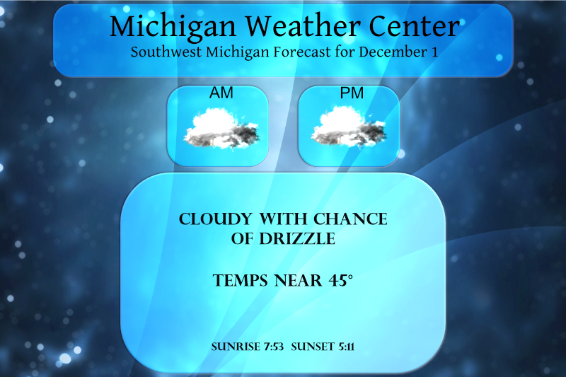
Now we have put fall behind us it is time to look forward to met winter. Our total liquid precip (rain and melted snow) was 10.25 inches and snowfall was 7.9 inches for Met fall. Yesterday we reached 43° with a low of 25° with a couple of peeks of the sun. Today will feature much of the same with temps in the 40s under mostly cloudy skies. We may see a few sprinkles or light rain however it will not amount to much.
Forecast Discussion
- Warming up and little meaningful precipitation into Thursday

Our polar jet will shift to southern Canada into Sunday. However
what is driving this warm up is the lead shortwave in our current
set of wave trains from the North Pacific. Since this lead shortwave
and associate jet core track through northern Lower Michigan and
southern Ontario during the day time hours of Thursday, the
cold air will be pushed out of our area into southern Canada.

There is an active warm front with this shortwave and jet core.
and it does have some showers with it currently. These are rain
showers from MSP south and snow showers north of that. Since we
will be in the right exit region of that jet core today, that is
not an area favorable for precipitation. Still there is lift and
mid level moisture so a few light rain showers are possible from
late morning into mid afternoon. Most of these may not even
totally wet the ground. Still they will be around.

Once the warm front is through those showers will come to an end
but then we will be in the warm air. During the night tonight do
not expect the temperature to fall much. There is 30 to 40 knots
of wind in the boundary layer and that will keep the air well
mixed, not letting the temperature fall much below the mid 30s,
even in our northern counties.

- Then the cold front follows Thursday

The cold front does come through during the day but it should come
through dry (not precipitation expected). We do not get into the
really cold air behind this cold front since the polar jet core
stays near the Canadian board into Sunday.

It would not be out of the question to see a few sprinkles or
flurries late Thursday night into early Friday as the cold air
settles in.

Even so we do have a decent shortwave tracking along the polar
jet. It will move through, just north of Michigan, with a 160 to
170 knot jet core later Friday into early Saturday. With most of
the dynamic energy well north of us, so that is were the
precipitation is expected. We should see little or none here
Friday or Saturday. This shortwave does push colder air this way.
Saturday will be colder than Friday but nothing more than near
normal temperatures for this time of year are expected even so.

- Stormy period Sunday into the middle of next week

The third shortwave that comes out of the latest Pacific wave
train, heads into southern British Columbia Friday. That is last
jet core in this series. It will try to dig an upper trough over
the northern Plains by Sunday. That results in a coupled jet
feature. That in turn results in decent surface low developing.
The question is how much does that jet core dig as this is
happening. The model solutions have been constant that this will
happen but inconsistent on just how it happens. Or, where the
surface low actually tracks once it develops. One way or the
other expect precipitation at some point on Sunday into Monday.
The latest spin on this is a rain to snow shower event.

One of the key questions is how deep does this upper wave get? The
latest GFS closes off an upper low with this system and that
brings done some very cold air, colder than we have seen so far by
Monday. This would cause highs in the 20s on Monday (much colder
than our current forecast suggests). That would result in a
meaningful lake effect event on Monday. If the ECMWF is correct we
would get some snow showers but it would not be much. It is that
set up that gives us highs in the 30s Monday.

Once that system exits the area, yet another digging jet streak
creates yet another storm that would come through this area in the
Wednesday time frame. Both the GFS and ECMWF are giving us a
snowstorm from this system. However they were doing that with the
Sunday system several runs ago. So hard to say how much to believe
that yet.

Another aspect to weather over Michigan next week is that the MJO
goes into phase 6 next week. That is a warm phase for the eastern
CONUS. That would favor the ECMWF more so than the colder GFS.
Time will tell on this but it is worth noting.

At this point I would plan on two meaningful precipitation events
with this set up, one Sunday into Monday and the next one later
Tuesday into Wednesday. Likely we will see some accumulating snow
at some point from all of this.
Weather History for SW Michigan
November 28
1955: Bitterly cold arctic air is firmly entrenched across Lower Michigan. The high temperature at Lansing is only 15 degrees, after a morning low of 6. Meanwhile, a foot of lake effect snow piles up at Muskegon.
November 29
1929: A month after the great stock market crash, it is the temperature that crashes in Lower Michigan. Record morning cold in the single digits is followed by afternoon highs only in the 10 to 15-degree range.
1960: A strong cold front moves through dropping temperatures dramatically and setting off lake effect snow showers. The temperature stays in the 20s during the day at Muskegon, after a high of 61 degrees the day before. The freighter Francisco Morazan runs aground off South Manitou Island in northern Lake Michigan during a heavy lake effect snow squall. All aboard are rescued by the Coast Guard in near white-out conditions.
1998: Balmy weather prevails during the final days of November, with lows in the 50s and highs in the 60s. Record highs today include 65 degrees at Muskegon, Lansing and Grand Rapids.
November 30
1958: November ends on a frigid note with lows in the single numbers and highs only in the lower 20s. From 6 to 10 inches of lake effect snow piled up near Lake Michigan.
1976: One of the coldest Novembers on record ends with a blast of arctic air that drops low temperatures near zero and keeps highs only in the teens. Big Rapids falls to one degree below zero and Grand Haven measures three inches of lake effect snow.
December 1
2006: A snow and ice storm strikes southwest Lower Michigan. From 6 to 12 inches of snow falls from Muskegon to Ludington, while an ice storm causes power outages and treacherous travel conditions from Kalamazoo to Lansing.
December 2
1976: One of the coldest winters of the 20th century gets off to an early start, continuing the persistently cold pattern that began during the autumn. Temperatures plunge to record lows of 11 degrees below zero at Grand Rapids and 2 below zero at Muskegon.
1982: Low temperatures on this day are only in the mid-50s across southwest Lower Michigan, the warmest on record for December. The afternoon temperatures are in the mid and upper 60s. Muskegon hits 64 degrees, a record high for the month of December there.
December 3
1998: An extended spell of warm weather occurs in early December with highs in the 50s and 60s the first six days of the month. Record highs are set on this date with 64 degrees at Grand Rapids and 66 degrees at Lansing.
2002: Arctic air and fresh snow cover combine to drop the temperature to 18 below zero at Lansing, setting a record for early season cold.
December 4
1886: A record cold snap continues across Lower Michigan. Lansing falls to 13 degrees below zero, as the temperature hits zero or below on first five days of the month there.
1941: Three days before the attack on Pearl Harbor, Lower Michigan is basking in record warm early December weather. Record highs include 60 degrees at Muskegon, 63 degrees at Grand Rapids and 64 degrees at Lansing.
2009: A narrow band of heavy snow across central Ottawa and Kent Counties drops over a foot of snow from Allendale to Comstock Park. Up to 15 inches fall in northern sections of Grand Rapids.
Weather History for SE Michigan
November 28
On November 28, 1991, a winter storm moving through the Great Lakes brought snow, sleet and freezing rain across the Flint area, leaving 4.4″ of snow by the 28th.
November 29
On November 29, 2011, heavy rain fell across much of Southeast Michigan. The rain changed to snow during the evening and early morning hours of November 30. Between 1 and 3.5 inches of precipitation fell which help make November 2011 and Autumn 2011 the wettest on record in Detroit. This was just another round of heavy rain in 2011 which was the wettest in Detroit history and the 4th wettest in Flint history.
Also on November 29, 1998, Flint and Saginaw had a two-day period of record highs of the same temperature with the 29th and 30th both having a temperature of 64 degrees.
November 30
On November 30th, 2011, a low pressure system tracked northeast into the Eastern Great Lakes allowing rain to change to snow, with total accumulations of 4 to 8 inches occurring over the Tri-Cities region, Shiawassee, and Livingston Counties. Elsewhere, generally, 1 to 4 inches of wet snow fell. Some of the higher snowfall accumulations that were reported included Auburn and Perry with 8 inches, Midland 6.6 inches, Howell 6.2 inches and Bridgeport with 6.1 inches.
On November 30, 2008, a snowstorm hit Southeast Michigan and continue into December 1. The storm mainly affected the Flint, Saginaw, and Thumb regions. The heavy, wet snow piled to 5 to 8 inches, downed trees and power lines, and left about 25,000 customers without power. Some of the higher snowfall totals included 8.6 inches in Marlette, 7.0 inches near Chesaning and 6.0 inches in Perry.
On November 30, 1999, cold air poured into the Great Lakes, as high pressure moved southeast from central Canada, producing several bands of lake effect snow over Lake Huron. One of the bands to move onto the eastern shore of Michigan Thumb. Measurable snow fell from Huron City, south to Marine City. Heavy snow fell from Port Sanilac to Port Huron, 7 inches accumulated during the morning.
On November 30, 1940, a snowstorm left Saginaw with 11.9 inches of snow, Flint with 7.8 inches of snow, and Detroit with 3.8 inches of snow.
December 1
On December 1, 1974, 19.3 inches of snow fell in Detroit. This was the second-highest snowfall ever recorded in the city. For more information about this storm see: Detroit snow
December 2
On December 2, 1976, there were record lows in Detroit on the 2nd with -2 degrees and the 3rd with -3 degrees, in Flint on the 2nd with -5 degrees and in Saginaw on the 2nd with 3 degrees.
December 3
On December 3, 2002, Flint had a record low of -8 degrees. The next day, Flint had another record low of -4 degrees.
Also on December 3, 1982, Detroit reached 68 degrees, Flint was 67 degrees and Saginaw reached 63 degrees. All are records for the date. This was the second day in a row that all three sites had record highs. This was a start to a very warm December. December 1982 was the warmest on record for Flint, the second warmest for Saginaw and the 6th warmest for Detroit.
December 4
On December 4, 1998, the overnight temperature did not drop below a balmy 51 degrees in Detroit.
At Grand Rapids November came in with a mean of 38.5 that is -1.5° below the new 30 year average. There was a total of 9.7” of snow fall that is above the new 60 year average of 7.1. A total of 2.22” of rain and melted snow fall. That is below the average of 3.10. The high for the month was 65 on the 7th and the low was 18 on the 23. November was the 1st month of below average temperatures since July and the coldest compared to average since May.
Slim
I see that Lansing was below average for precip for the month of November. 5.7” of snow fell which seems like a lot for so early in the season. What is the avg snowfall for Lansing in November?
The new 30 year average snow fall at Lansing is 3.9″ The record snow fall at Lansing for November is 21.8″ in 1921. In more recent times there was 16.8″ in 1966 and in 2018 11.9″ was reported. That was the last time over 10″ of snow was reported at Lansing in November.
Slim
👍
Breaking>>>>>>yesterday was just another of many below normal temp days and it is official, November was colder and snowier than normal! How is that possible? Get ready for a wild winter!
Don’t know how it will play out but there are some long range indications that there could be a major warm up in mid December. We shall see.
Slim
Any warm ups in December will be short lived! Get ready to rock!