In an extraordinary engineering feat, the 2,260-pound Perseverance rover touched down gently in a dried-out crater lake on Mars yesterday. I have been following the space program since Gemini (a long, long time ago) and am amazed at the engineering feats NASA and JPL have come up with over the decades. Landing a rover on Mars is no simple task to be sure. There have been five successful robotically operated Mars rovers, all managed by the Jet Propulsion Laboratory: Sojourner, Opportunity, Spirit, Curiosity, and Perseverance. No other country can claim this amount of success.
The Curiosity Rover sends out daily weather reports at Gale Crater in the southern hemisphere of Mars, near the equator. At this location, it’s currently early autumn. Mars is an extremely cold planet with an average temperature of around minus-80 degrees. Temperatures can dip to minus 225 degrees around the poles. Periods of warmth are brief — highs can reach 70 degrees for a brief time around Noon at the equator in the summer.
| Date | Sol |
Air Temperature (°F)
|
Pressure (Pa) | Sunrise | Sunset | |
|---|---|---|---|---|---|---|
| Max. | Min. | |||||
| Feb. 16, 2021 | 3033 | 3°F | -99°F | 823 | 06:39 | 18:37 |
| Feb. 15, 2021 | 3032 | 19°F | -101°F | 822 | 06:39 | 18:38 |
| Feb. 14, 2021 | 3031 | 9°F | -101°F | 821 | 06:39 | 18:38 |
| Feb. 13, 2021 | 3030 | -4°F | -101°F | 821 | 06:39 | 18:39 |
| Feb. 12, 2021 | 3029 | -2°F | -99°F | 821 | 06:40 | 18:39 |
| Feb. 11, 2021 | 3028 | 0°F | -99°F | 821 | 06:40 | 18:39 |
| Feb. 10, 2021 | 3027 | 1°F | -101°F | 820 | 06:40 | 18:40 |
Keep in mind the atmosphere is thinner and most of the heat from the sun radiates into space at night.
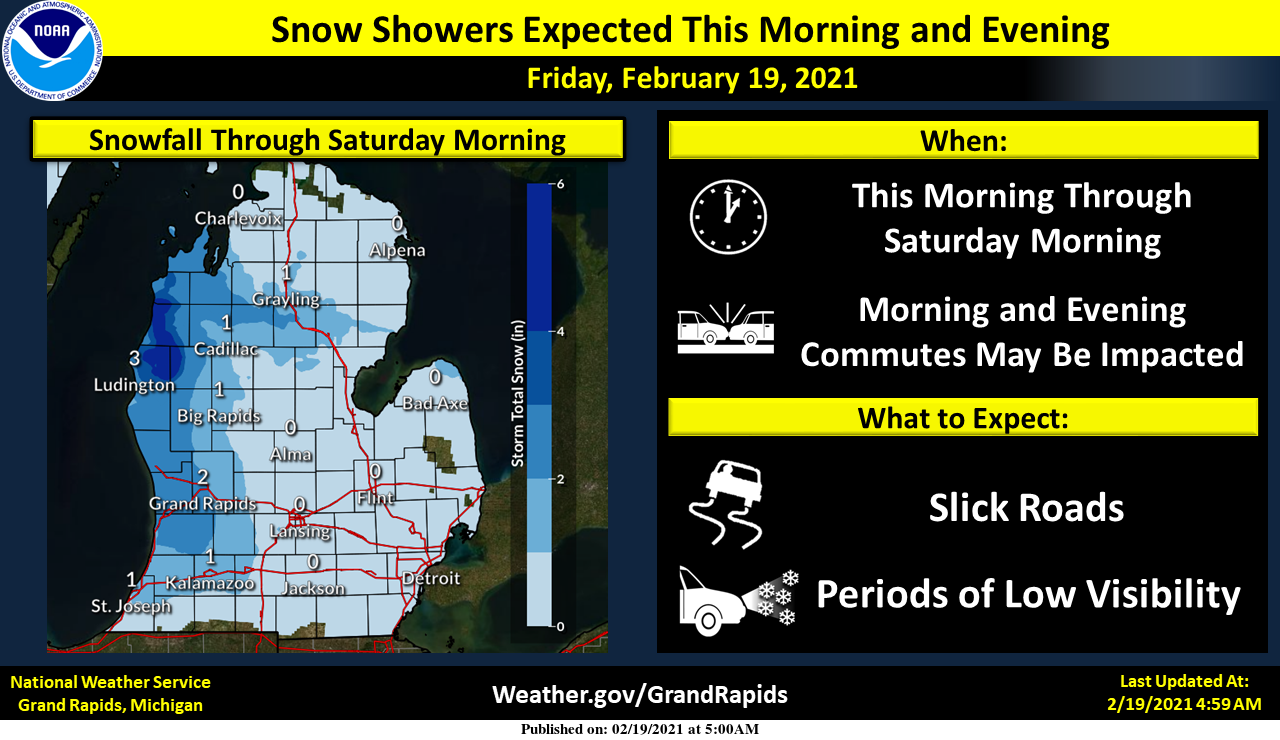
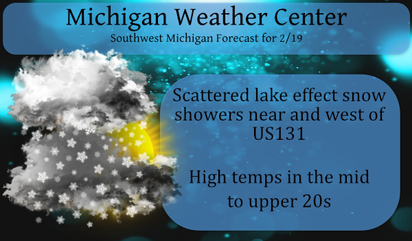
Lake effect snow will begin this morning and last into this evening. Snow showers may come in bursts, resulting in quick drops in visibility with accumulations on roads. Overall accumulations will not be too high, with generally around 2 inches or less expected for lakeshore counties with higher amounts expected further north near Ludington.
Snow showers will spread in off Lake Michigan Friday, first affecting areas near the lake in the morning, then spreading east toward places like Lansing by afternoon. These snow showers may cause fast and significant drops to visibility and a fast coating of snow on roads. Much of the weekend then will be quiet. Then, snow will arrive over the entire area Sunday night.
Forecast Discussion
- Lake Effect Snow Showers Today -

Lake effect snow showers will start back up this morning around
daybreak and will last into Saturday morning. These snow showers may
consist of 2 main bursts, the first around daybreak as winds turn
from easterly to westerly which could push snow bands as far east as
Lansing. The second burst will be during the afternoon and evening
as a quick moving shortwave moves through the state, mainly
bringing locally heavier snow showers for lakeshore areas.

Snowfall amounts on the order of 1 to 2 inches look possible with
some locally higher amounts up to 4 inches in Lake and Mason
Counties. Meanwhile the lowest amounts will spread further east
as far as US-127. Snowfall rates up to 1 inch per hour will be
possible in the stronger bands, particularly during the evening
burst of snow. A slower evening commute should be anticipated for
lakeshore areas, especially as far north as US-10.

- Snowy System Sunday Night into Monday, Then Warmer -

Our next snow producing system is expected for Sunday night into
Monday as a low travels from the Central Plains up into Lower
Michigan. Snowfall amounts up to 2 to 4 inches look possible for
areas along and south of I-96, while areas further north of I-96 may
see snow amounts up to 5 inches.

While this system will drop some additional snow on us, it will
also help to finally boot out the cold air thanks to deep
southerly flow. Following the passage of this system, flow will
turn more zonal which will help facilitate a warming trend
through mid week.

- Weak Front Tuesday -

A weak front will move through the area Tuesday morning as a clipper
slides east through southern Canada giving us a chance for some
precip. While daytime temperatures will break into the mid to upper
30s, morning temps will still be low enough for some snow with this
front. Snow amounts look low with nothing of much consequence.
Let it snow, let it snow, let it snow!
And it’s snowing again in my area the winter that wasn’t supposed to be is back loaded and fun who knew?? Lol…INDY
Major back loaded winter! I absolutely love it!
Great news! Still 29 days of winter left! Get ready for accumulating snow this weekend and after a brief warm up it is right back to more SNOW! Incredible pattern!
Lol the brief warm up may approach 40* degrees for one day with 18 inches of snow on the ground we will see it to believe it! Big deal ..Let me know when mid 50’s and 60’s start thank you until then let it snow let it snow let it snow…INDY
Rock on Indy!
Less than 10 days until meteorological spring. I love it! CPC says get ready for some warmth the next 2+ weeks.
A dusting of new snow fall here overnight. The snow depth is now at 12.5″ There is some light snow falling here with a current temperature of 15.
Slim
14* degrees this morning in my area another cold start for February the beat goes onnnnn who knew ?? INDY
Incredible!
The snow just keeps coming! What a month! Incredible!
http://wxcaster.com/gis-snow-overlays2.php?STATIONID=GRR