We close out the month of July today meaning met summer will be two-thirds over. Sunrise today was at 6:35 am and it sets at 9:05 pm. In Otsego, the rainfall for July is 5.40 inches which is more than an inch above normal. Our summer total is at 8.02 inches.
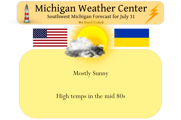
The mostly sunny and warm conditions will continue today. Tonight clouds will increase as a cold front approaches from the west. Showers and thunderstorms will arrive around daybreak for the lakeshore communities. These showers will then move inland through Monday morning. The front will exit the area during the afternoon. Uncomfortable heat and humidity will build in on Wednesday with temps in the 90s.
We are starting to eat fresh tomatoes, green onions, and peppers from our garden. The cucumbers are coming along nicely. There is nothing tastier than fresh tomatoes. I have had gardens for over 40 years, my mom always had a garden and my grandfather planted nearly two acres of every vegetable you can think of.
Forecast Discussion
-- Showers and embedded storms late tonight and Monday --

We are looking at one more nice summer day today, before clouds and
rain come in for much of Monday. We are seeing a little bit of
moisture working in from the SW this morning in the form of some
clouds coming in around 5k ft. We do not expect a lot of clouds
today, but the current clouds and some diurnal cumulus development
will justify a partly sunny forecast.

We may see clouds diminish a bit temporarily this evening as diurnal
clouds dissipate. Clouds will increase then again overnight, and
areas North and West of GR will see some rain move in by 12z Mon.
These rain showers will be out ahead of a fairly organized short
wave, and associated low level jet moving in. The rain will then
spread to the South and East through early afternoon.

Thunder remains possible, but we are not expecting a lot of
excitement with these storms at this time. The timing of the short
wave through the area a bit before peak heating will be one of the
strongest limiting factors. Instability is progged to increase to
over 1,000 J/kg ML CAPEs with the warm and moist air ahead of the
system, combined with falling heights aloft. Wind shear is a bit
limited to 25 to 30 knots, and more favorable to the SE where the
short wave will be closer to peak heating. We like the SPC Marginal
risk just clipping our far SE counties at this time. Some downbursts
of wind are most likely at this time with dry mid levels/DCAPEs
1,000+, and unidirectional wind profiles. Most of the rain should
move out Monday afternoon as the short wave passes East of the area
mostly by 18z.

-- Increasing chance for heavy rain Wednesday-Thursday --

The models are hinting at some possible convection on Tuesday Night
now. This convection would be associated with a developing warm
front and the nose of a low level jet moving in. This looks to be
short lived as it would end once the warm front presses through.
Once the front moves through, Wednesday is still looking like a
mostly hot day for most of the area. 850 mb temps are still forecast
to warm into the lower 20s C with strong SW flow advecting in the
hot air aloft.

The factor that could temper temps a bit would be if showers and
storms are able to fire ahead of the front and affect the northern
portions of our area early enough. The further North areas will see
better chances of more clouds and some rain that would keep them
cool, compared to the South where it is likely they see more sun
longer and they are deeper into the hot air.

The best chance of showers and storms would be late Wednesday
afternoon through Wednesday night. The models are holding on to
plenty of instability ahead of the front with plentiful heat and
moisture in place, combined with falling heights and a short wave
timed closely with the front. Some of the storms could have gusty
winds on the leading edge, as forecast soundings show an inverted V
sounding that would support microbursts.

The concern will then shift to heavy rainfall as the front looks
slow to move through. Ahead of the front, pwats are quite high with
values over 2.00". The slow front, and some waves possibly riding
along it could cause some training of heavy downpours resulting in
locally heavy rainfall amounts. The front will slowly drift south
into Thursday. There are even some indications that southern areas
near the state border may see additional waves and rain move along
the front into Friday.

-- Cooler end of the week with additional chances for rain --

The trend over the last 24 hours has been for relatively cooler
temperatures for the end of the week and next weekend. The models
still reestablish the upper ridge over the area once the Wed-Thu
front is able to clear. The difference however is that the low level
flow is not conducive to advect hot air back into the area very
quickly.

There is a lot of uncertainty as far as rain chances are concerned
for Friday and beyond. It all depends on how bottled up the features
end up, and where the area ends up under it.
Michael,
We have been enjoying some veggies from our garden too. Green beans, tomatoes, and peas. Our honey rock melons and white pumpkins are coming along. You are right there is nothing like veggies from the garden.
My gparents had huge garden growing up too. My Gpa always planted sweet corn and sole it by the roadside. I miss comparing my garden to my dad this summer. He passed earlier this year. It was always our “thing”.
Such a beautiful Summer sofar as Slim says pretty average no real heat issues I agree we just had a cool late Fall like week in Boyne only hit the pool once and I believe that was way back on Monday before the cool air really set in!! Temp in the low 70’s and some nights in the mid 40’s low 50’s just a perfect late July week!! Now I have been noticing the NWS is coming down on the temperatures this week looks like its not going to get as hot as some predicted typical for August around here… Read more »
Who would have thought?
Next weeks forecast is looking better. Temps have been lowered and rain chances look a little better. There are parts of our area that still desperately need rain despite the heavy rain event on the 23rd.
Yet another great summer day yesterday with the official H/L at Grand Rapids of 83/57. There was no rain fall and the sun was out 81% of the time. The overnight low here at my house so far has been 60 and at the current time with clear skies it is still that 60. For today the average H/L is 83/63 the sun rise today is at 6:32AM and the sun sets today at 9:04PM The record high for today is 98 set in 1917 and the record low is 46 in 1971. The next week now looks a little… Read more »
With July coming to a close it can be said that the first two months of summer have been almost average. June came in with a mean of 69.2 that is a departure of +0.3 and with just today to go July has a mean of 72.8 and that is the 30 year average. So all in all a very average summer so far here at Grand Rapids.
Slim
And how many seemingly perfect weekends? I’m sitting out back enjoying my coffee and it is picture perfect.
Almost all of them!
Who knew?