Yesterday we had clearing skies and a good period of sunshine after a period of morning drizzle which amounted to a trace. Our high temp was 72° and the low was 56°. At 7 am this morning we have 66° which is near normal for daytime highs.

Prior to yesterday’s cooler temperatures, October 2021 was off to a warm beginning. In fact, the average overnight low temperatures between Oct 1 and Oct 11 were the warmest on record for many locations in our area. These locations were about 15 degrees warmer than their normal lows. Remarkably, the low temperatures we recently experienced in October are typically observed during the last week of August.
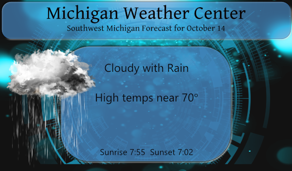
Don’t expect much sunshine for today – we expect showers and a few thunderstorms in most areas. However, our northwestern counties (nearest Ludington) can expect a chance of showers today, followed by some clearing. With the passage of a cold front, temps will cool back into the 60s for tomorrow and mid-50s for Saturday.
Forecast Discussion
- Shower/isolated thunderstorm potential today and tonight

A cold front will move across Southwest Lower Michigan today and
move southeast of the area tonight. Instability will be rather
limited during both forecast periods. Expecting showers to
increase along the front today, especially with the area of
precipitation lifting our direction from Illinois. We have likely
pops in the forecast today 60-70 percent in some areas. Despite
very high and anomalous precipitable water values (1.8 inches) we
are not expecting heavy rain due to the weakening front and lack
of upper forcing (the wave associated with the front is lifting
into Northwest Ontario). The most widespread rain will occur this
morning as the Illinois precipitation works in. Tonight the
front moves just southeast of the forecast area with precipitation
lingering through the night towards Jackson.

- More widespread precipitation Friday into Friday night

A wave of low pressure will work up the frontal boundary from the
plains moving towards Detroit Friday evening. Widespread
precipitation can be expected Friday into Friday night in a post
frontal regime. Any severe threat that was possible on Friday
looks gone now as the warm sector of the system will be off to the
south and east of the GRR forecast area. Rainfall amounts during
the Friday/Friday night time frame will range from light amounts
in the northwest CWA towards Ludington (less than tenth of an
inch potentially) to near an inch towards Jackson.

- Lake effect rain showers Saturday into Saturday night

The lake surface water temperature right now is around 66F or
+19C. With a delta T around 13 needed for precipitation production
both Saturday and Saturday night look to be opportune times for
lake effect rain showers. Deeper moisture associated with the
upper trough will be in place during both periods. We are
expecting a bit more in the way of showers than what most of the
models are showing at this point.

- Dry early next week then turning wetter into mid week

Any chance for lake effect rain showers will likely come to an end
Saturday night although we stay cool into Sunday. The deeper
moisture pulls away though on Sunday and this should keep things
dry from Sunday through Tuesday. Some model disparity as we get
into mid next week, but it appears there will be a low or trough
moving in on Wednesday. Expecting the chance for rain once again
on Wednesday as this low/trough moves in.
Surprise! More clouds and rain is on the way for tomorrow! Very cloudy and wet October! Who would have thought?
The sun just came out here. I wonder if it will clear up?
More of the same on into November?
Sun came out for a bit and boy is it humid. 72 degrees with a 71 dew point in mid October? The record breaking streak marches on……
Still raining outside….Who Knew???? INDY
Wet and cloudy month of October so far! Wait till winter hits with a vengeance! Could be a record breaking winter this year! Get prepared now!
I am ready ….snow shovels out new snow blower is tuned up bring it onnnn….INDY
The leaf change is certainly going to be late this year. Peak is normally right around now… and nearly all trees in my area are 90%+ green.
Same here, almost no color at all. Though I have noticed there are a lot of pine needles on the ground, but that might be because it was so dry through September.
Fun facts. It is now October 14th and so far this fall season the coldest it has been is 47. This is the latest it has gone without reaching 46, 45 and 44 (October 8, 2016) 43, 42 (October 11, 1931) and 41 (October 13, 1934) the next milestone would be 40 the latest for that is October 24th 1914.The latest first 39 low is October 24th 2017. The average 1st 32 low is October 13th the latest is November 14th 1918. and for the latest hard freeze (28) is November 29th 1948.
Slim
Thanks Slim. Interesting for sure. I don’t think we’ll be having any frost in the near future.
Wow we’re smashing the record books again after a warm and sunny summer. I love it!
Warmest start ever for October. That’s a lot of years of data to be beating out! We might be mowing well into December again this year.
Let it rain let it rain let it rain ….Such a wet Fall I am ready for 60’s and 40’s at night looking good next for next week good old bomb fire weather here we come if we can dry out …..INDY
Humid out, but no A/C, no furnace, and windows open. Can’t complain about this weather.
Grass is still lush and green. I am still having to mow every three days. My lawn looks the best as it has all season.
Yeah ours is finally turning green now to after being brown for a long time. Still have our AC on though, way to damp and humid to sleep without it. Been on for 6 months now.
No AC or heat on here. The AC did kick on a few time this month and that is the only time I have ever had the AC on in October here in Michigan. I had it on a few times in the fall and winter down is south Florida but it can get very warm and humid down there even in the winter. As for the grass I cut the grass yesterday and it was very tall and I just cut it a week ago so it is still growing fast. Not sure how much longer we will be… Read more »