We had .28 of an inch of rain yesterday bringing our total for the month to 2.99 inches and 11.18 for the season. Our high for yesterday was 58° after a morning low of 46°.
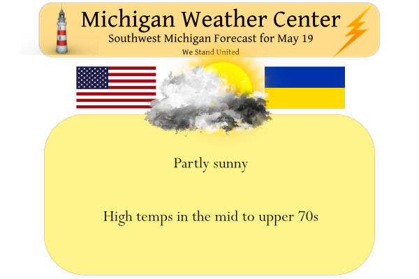
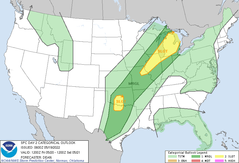
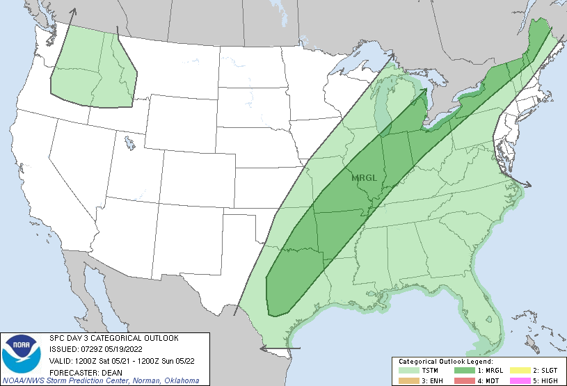
We will be entering a more active weather pattern with chances of rain and storms through Sunday morning. Skies will become partly sunny today. An isolated shower or thunderstorm is possible. It will be warming up with high temperatures in the 70s closing in on 80° along and south of the I94 corridor. Below are the SPC guesses for Friday/Saturday.
[columns] [span6]
[/span6][span6]
[/span6][/columns]
SPC Forecast Discussion
 ...THERE IS A SLIGHT RISK OF SEVERE THUNDERSTORMS FROM LOWER
   MICHIGAN INTO THE MID MS VALLEY...PARTS OF THE SOUTHERN PLAINS...

   ...SUMMARY...
   Severe thunderstorms will be possible Friday afternoon and evening
   across lower Michigan, perhaps extending into parts of the Midwest.
   Severe thunderstorms will also be possible across parts of the
   southern Plains during the afternoon and evening. Large hail and
   damaging wind gusts are expected to be the primary threats.

   ...Synopsis...
   A positively tilted upper trough is forecast to move eastward from
   the central/northern Great Plains toward the Great Lakes region on
   Friday. A deep surface low will move from the upper Great Lakes
   toward the southern part of Hudson Bay, while an attendant cold
   front will move across parts of the Midwest, Ozark Plateau, and
   southern Plains. Further southwest, a low-amplitude upper-level
   trough will move toward southwest/central TX by Friday evening. A
   surface low may develop along the front across southwest
   OK/northwest TX, with a dryline extending southward across parts of
   west/central TX.

   ...Parts of the Great Lakes into the Mid MS Valley...
   Considerable uncertainty remains regarding the severe potential
   associated with the cold front from parts of the Great Lakes into
   the mid MS Valley. Deep-layer shear will be more than sufficient for
   organized convection. A rather strong and extensive EML will support
   moderate to locally strong buoyancy by late afternoon along/ahead of
   the front, but may also tend to suppress convection in the absence
   of favorable large-scale ascent across the warm sector. There is
   also some uncertainty regarding the influence of early-day
   convection potentially spreading eastward out of the upper Midwest.

   The most favorable area for surface-based development may be across
   lower MI, in closer proximity to the departing shortwave trough and
   surface low. A couple of organized cells/clusters will be possible
   in that area during the late afternoon/evening, with a threat of
   hail and damaging wind gusts. Reintensification of morning
   convection, or development along any remnant outflow, also appears
   most likely to occur over lower MI, if any of those scenarios
   materialize.

   Further southwest over parts of IL/IN/MO, surface-based development
   cannot be ruled out, but appears increasingly unlikely due to strong
   capping. Elevated convection will likely develop north of the front
   across this region Friday night, which could pose an isolated hail
   risk, given the steep midlevel lapse rates and rather strong
   midlevel flow that will be in place.
NWS Forecast Discussion
...Warmer today...

Today will start off with some fog and overcast skies. However,
drying in the wake of a departing short wave should erode the clouds
by late morning leading to some sun during the afternoon and warmer
temperatures. Weak height rises will help temperatures climb into the
mid 70s across the cwa.

...Could be a stormy Friday...

A well defined short wave over the northern Plains will produce a
sfc low over Minnesota tonight. A cold front will trail southwest of
the low across the Missouri Valley. The ECMWF/GFS move the low
toward James Bay by Friday night. Ahead of the low, a warm front
will pass over the cwa tonight. We expect it to move through.
However, the HRRR does hint at the possibility of a shower
developing near the front around 00z. Once the front moves through,
we`ll be solidly in the warm sector and highs on Friday will climb
into the 80s. More importantly, we`ll be in a very juicy environment
with sfc dewpoints in the 60s and a cold front to the west. Strong
instability reflected by MUCAPE around 2500 j/kg and a 50 kt low
level jet aimed at the northern cwa may be the focal point for
convection Friday afternoon, especially as a wave rides northeast
along the front toward northern Lake Michigan. Forecast soundings
are mostly unidirectional with height which would suggest that
straight line winds would be the main threat. Bulk shear values 35-
40 kts points toward some organizational potential too and thus hail
is a concern too.

HREF max reflectivity and updraft helicity point toward areas north
of M-46 Friday afternoon for the strongest storms, which would also
be closer to the track of the wave riding up the front.

Models also show a secondary area of stronger low level winds across
the I-94 corridor, but upper dynamics aren`t as strong here. However
outflows from earlier convection to the north may be a focus for
renewed convection later in the afternoon.

Both the GFS and ECMWF don`t exactly push the cold front through the
cwa Friday night, likely due to the lack of an upper level push.
Thus we`ll be looking at showers and thunderstorms through Saturday
night as another shortwave rides up the front. Once that passes
through, the front should make progress east and high pressure to
the west will move in Sunday leading to dry weather through Tuesday.
So much on cutting the grass Saturday its supposed to rain now …Such a wet pattern we are in. …INDY
Hughs in the 50″s next week??? Great Scotty..great fire weather yeahhh INDY
Just more below normal temps! The pattern continues!
Get ready for the big chill! Incredible!
The Slight Risk area seems to keep shrinking on about every update. The biggest change was the addition of the 5% tornado risk for our northern and northeastern counties up into the northern lower.
From SPC: “If thunderstorms can form, they would pose a threat for all severe hazards across this region, as both instability and deep-layer shear appear favorable for supercells.”
Get ready for the big cool down! It starts Saturday and lasts many days! Wow!
LOL You said the same thing for our tiny 2 day cool down. Enjoy the huge warm up the next few days!
Thanks for pointing out that I was 100% correct about the cool down and the next one will last more than 2 days! Incredible!
Rocky there are hints that it could warm up by the end of May and into the start of June. It looks like it could stay on the wet side so it could also become rather humid.
Slim
A little warmth is good, but the high dew points is horrendous! Give me sun and low 70’s and low humidity!
After 8 warm days in a row, our two day cool down is over. 77 degrees today and 85 tomorrow!
Average high is only 71 degrees today.
Well well more rain coming tomorrow I better wait for Saturday to cut the grass even know its sky hi right now such a wet pattern we are in …InDy
The official H/L at Grand Rapids yesterday was 54/44 the mean of 49 was -11 below average for the date. That high of 54 was the 7 coldest for any May 18 at GR. The average H/L at Grand Rapids is now 71/50. At Lansing the average H/L is now 70/48, at Muskegon it is 69/48 and at Holland it’s 69/49. There was 0.26″ of rain here at my house and the official rain fall for GRR was 0.23″ At Muskegon there was only 0.11″ at Lansing there was 0.23 and at Holland 0.27″ so not a lot of rain… Read more »
So it appears that cool temps forecasted for next week will only be a few degrees below average. I am enjoying this spring. We’ve had a little bit of everything, weather-wise. My lawn looks as good as ever.
Well by Sunday the new 15 year average H/L is up to 73 and by Tuesday it is up to 74 so the start of next week the highs could be up to 10 degrees below average. At Lansing the new 15 year average for Sunday is 72.6 and for Tuesday it is 73.2. By June 1st the new 15 year average at Lansing is 75.6/54.0. At Grand Rapids by June 1st the new 15 year average is 76.2/55.0. As you stated the grass has that nice May look to it and as long as it stay cool and wet… Read more »
The average high/low this coming Tuesday for Lansing is 71/49. The average high doesn’t hit 74 until the 1st of June.
Mark I updated the post as I was looking at the new 15 year average and not the longer 30 year average. The 30 year average for Sunday at GR is 72 for Sunday and 73 for Tuesday and 75 for June 1st. At Lansing the average 30 year is 71.5 for Sunday 72.2 for Tuesday and 74.8 for June 1st And yes it is 71/49 for today and Friday.
Slim
Yes I have noticed that the end of May has been getting warmer. Makes sense that the most recent 15 years have trended upward.