I was looking at past posts here and found Slim and I have passed four years here at the Weather Center beginning in June of 2017. Time has flown by as we close in on 1500 posts on this blog. Thanks for stopping by! You can look through past posts by checking out the blog archives at the bottom of the Weather Center pages.
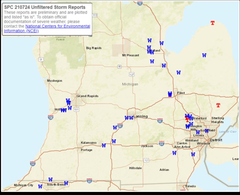
July 24 storm reports
Above are the storm reports for July 24 showing mainly wind damage and three tornadoes on the eastern side of the state.
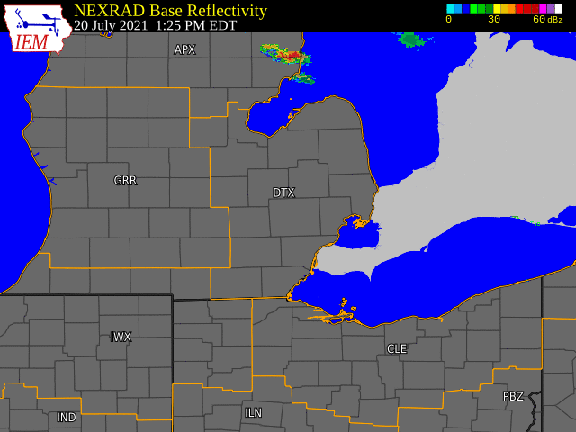
July 20th – Scattered thunderstorms initially developed over Saginaw Bay and tracked through the Thumb region, becoming locally strong to severe before becoming a line of strong to severe thunderstorms as they tracked through the northern Detroit metro and I-69 corridor during the evening hours. These thunderstorms formed along and ahead of a cold front, with moist and relatively unstable air out ahead of the front. The thunderstorms produced reports of wind damage along with reports of power outages in addition to heavy rainfall and numerous lightning strikes.
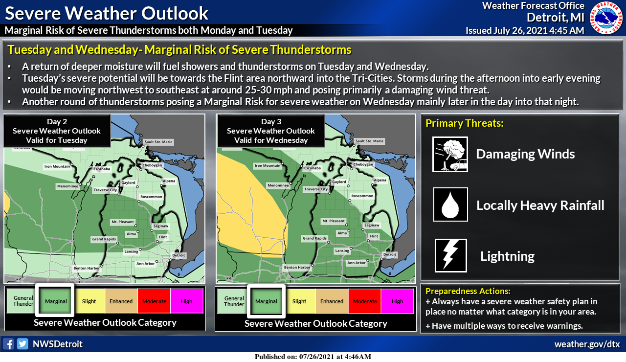
A Marginal Risk for severe weather is in the forecast for Tuesday across the Saginaw Valley and Flint mainly during the late afternoon and early evening. Damaging winds would be the primary threat. Another round of severe weather posing primarily a damaging wind threat will be possible on Wednesday. This time for most of southeast Michigan and towards the latter part of the day into Wednesday night.
Forecast Discussion
- Increased risk of storms early Tuesday

It would appear the storms tonight (early Tuesday morning)  may
be stronger than we were thinking earlier. Currently we have a
shortwave with an associated surface frontal wave near James Bay,
early this morning. However there is a trailing speed max north of
Lake Winnepeg. That dives into the eastern trough merges with the
frontal wave jet energy and strengthens. By tonight we are in the
jet entrance region of that jet core. That leads to 40 knots of
deep layer shear (Nrn WI / Upper Michigan) with MU capes over
1200 j/kg and a with a 30 to 40 knot low level jet aimed at it.
Clearly strong convection will develop this evening over Nrn MN
and NW WI due to all of this happening. That convection will then
dive southeast (as per the HRRR/ARW/NAMNEST). The NAM and HRRR
show very strong coupling of the upper divergence and surface
convergence in that area early tonight. Overnight this couplet of
surface convergence and upper divergence sinks nearly due south
of Lake Michigan. It does weaken through. The associated
convection will likely do the same.

My spin on this is the strong storms will stay over WI and
northern Michigan early tonight. As the storms move southward late
tonight they will weaken considerably as they move south into
much lower cape in the GRR CWA. Still this will have to be
watched.

Seems too, the shortwave will be moving out of our area on Tuesday
during the day light hours, so we will have to much mid-level
suppression for significant storms during the day on Tuesday
(between shortwaves). This is shown by the HRRR, NSSL, ARW, FV3
and NAMNEST. Storms may refire over the thumb area late in the
day. Of course we would still have to see how the outflow from the
overnight convection leaves boundary and there is always the
front stalled over central Lower Michigan. A storm would still be
possible near the front during the day but they would be isolated.

- Frontal wave convection Wednesday night

The main wave that changes our weather pattern into the middle of
next week comes through now during the early morning hours of
Thursday. Seems too the models are farther west with the frontal
wave. There would be good deep layer shear through due jet
dynamics even at night. There will still be some decent cape too,
near 1000 j/kg. So storms would still be possible, even after
midnight. However they would not be surface based. That would
decrease the risk of severe storms significantly.

The cold front will be coming through by mid morning Thursday, so
there is not much chance of convection here during the afternoon.
It will get breezing and turn cooler though. Friday should be
notably cooler, as will Saturday.

- Significant cooling trend Friday into next week

Our Polar Vortex event is looking better as now the Canadian, the
GFS and the ECMWF and the ensembles of all 3 are going with this
event. The upper low that normally is near the north pole gets
split and part of it heads into Siberia (850 temps there are
forecast below -10c early next week there). The other part of it
heads south to Hudson Bay. This is where we get the cold air. The
front ahead this comes through Sunday. More than likely you will
see our risk for convection increase significantly for Sunday
over the next few days. The ECMWF ensembles keep our high
temperature below 80 from Friday through Wednesday. For that
matter the GFS and Canadian are similar to that. So expect a
significant cool down by this coming weekend that will last
through at least the first half of next week.
Great Scott look at all them 70’s we see as far as the eye will be coming up …ahhhhh!! Nothing hot as I been saying since May …INDY
Awe… Bill stepping back a bit. I didn’t think Ellen would be named the Chief. I thought it would be Matt.
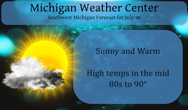
The air temperature is very warm 89 but the with the dew point only being reported at 55 the heat index is 87. There is a chance that the temperature may reach 90 today. While very warm and it can get “hot” in the sun this is not unusual for a summer day in southwest Michigan.
Slim
Phew, 3rd hot day in a row around here. Looks like two more upcoming too.
Lol…..hot ….Could you imagine if we had temps in the mid to upper 90’s this summer that would be a scorcher then right?? INDY
Currently 88* degrees dew point 53* and heat index 87* degrees in my area I’m don’t consider this hot weather but….INDY
“Significant cooling event” into the 70s… This is probably the best time of the year to have a cool down. Looking forward to it!
Great Scott don’t say that to loud on here lol.. Bring on more below average temperatures Who Knew?? INDY
To Nathan. And the best time for “much warmer then average is January”
Slim
Amen Slim!!
Polar Vortex activity in August?…oh well, we had a couple of “Summer” days. Standard existence in the Southern Arctic.
This Summer has not been hot at all and just think Fall is right around the corner!!! INDY
Indy, The mean for the summer of 2021 at Grand Rapids is now at 71.6 that is a departure of +0.8 above the 30 year average. The new 15 year average is 71.3 so this year is very near the new 30 year average (+0.3)
Slim
As of July 25th the warmest official high at Grand Rapids has been 90 and that has happened on two days on June 11th and 12th. So far this summer at Grand Rapids there have been just 2 days of 90, 5 days of 89, 3 days of 88 and 3 days of 87. At Muskegon the high so far this summer has been 89 on June 11th there have only been 5 days with highs in the upper 80’s there. The warmest day at Holland is also 89. To the east there have been more warm to hot days… Read more »
Nothing hot let’s keep it going through August! Thanks Slim INDY
With only 6 more days to go in July lets keep this summer cooler brezze a going into August still to this date only one 90* degree day out in area easy peasy in the heat department!! Love it!! INDY ….
.
Easy peasy are far from the words to describe last weekend. Friday and Saturday had dew points in the mid 70’s and the heat index was in the mid 90’s. Doesn’t get much worse than that around here.
Temps flirting with 90 degrees for the third consecutive day!
As I have stated at times in the past I have two temperature sensors that are placed in my yard. One is placed in what I like to call the “cold” spot of the yard and the other in the “warm” spot. The over night low at the cold spot last night was 61.0 and and the warm spot the low was 63.1. Note in my reports I round up or down to the whole number. At this time the current readings are 68.4 (68) at the cold spot and 68.9 (69) at the warm spot. And yes I have… Read more »