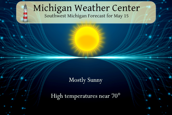
Sunny skies are expected today, although there will be a slight increase in high clouds this afternoon. Highs will be right near normal around 70 degrees today. Dry weather is forecast for the bulk of the work week. Rain does not return to the forecast until Friday. CPC products continue to show temps to be near to slightly below normal through the end of the month with below normal precipitation.
U.S.A and Global Events for May 15th:
1896: An estimated F5 tornado struck Sherman, Texas, killing 73 people; 60 of them downtown. Tornado victims were found as far as 400 yards away from their original location. A trunk lid was carried 35 miles by the twister.
1957: An F4 tornado killed 20 people in Silverton, Texas. A 5,000-pound gasoline storage tank was reportedly carried 1.5 miles and dropped into a lake. Residents said the tornado “looked like red sand, boiling and rumbling.”
1968: Also, an F5 tornado moved through Butler, Chickasaw, Floyd, Franklin, and Howard Counties in northeast Iowa. The tornado touched down northeast from north of Hansell, passing east of Aredale and Marble Rock, before devastating Charles City. The tornado grew more massive and intense as it approached Charles City. The huge funnel passed directly through town, destroying 337 homes, and causing about $30 million in damage. The tornado continued to the northeast hitting Elma. From there the tornado turned to the north and dissipated south of Chester, 4 miles south of the Minnesota border. Nearly 2000 homes were damaged or destroyed. All 13 deaths occurred in Floyd County. 450 injuries were reported in Floyd County and 12 injuries in Howard County. Another F5 tornado moved north-northeast from southwest of Oelwein to Maynard and east of Randalia in Fayette County, IA. Homes were leveled and swept away in both Oelwein and Maynard. The warning sirens had sounded for only 15 seconds before the power failed in Oelwein. Nearly 1000 homes were damaged or destroyed along the path, and 34 people had to be hospitalized. Almost 1,000 families were affected. In addition to these F5 tornadoes, an F2 tornado touched down 6 miles south of Cresco, IA and two weak F1 tornadoes touched down in Dodge County, MN. Also, baseball size hail fell in Fayette County, IA.
1972: The worst ice jam flooding of memory for long-time residents took place along the Kuskokwim River and Yukon River in Alaska. It was the first time since 1890 that the two rivers “flowed as one.” The towns of Oscarville and Napaskiak have been entirely inundated.
...RED FLAG WARNING IN EFFECT FROM 10 AM THIS MORNING TO 9 PM EDT
THIS EVENING... Across the northern lower penninsula

The National Weather Service in Grand Rapids has issued a Red
Flag Warning, which is in effect from 10 AM this morning to 9 PM
EDT this evening. The Fire Weather Watch is no longer in effect.

* Winds...West 5 to 10 mph.

* Relative Humidity...As low as 17 percent.

* Temperatures...In the lower 70s.

* Impacts...burn restrictions are likely in effect. for more
  information on burn restrictions...visit the michigan dnr
  website at www.michigan.gov/burnpermit or call 866-922-2876.
Grand Rapids Forecast
Forecast Discussion
--Cold temperatures this morning--

As per the previous forecast the overnight temperatures remain on
track to be at and below freezing along the US 10 corridor and in
the low 30s through much of central Michigan. The calm winds,
mostly clear skies, and dry air will allow for temperatures to
continue to drop to and just after sunrise. The freeze warning and
frost advisory will remain through that time.

-- Mild weather and dry through most of the week --

The early week will be dominated by a large upper level low
situated over Eastern Canada. This low will propagate southward
sweeping a band of dry air and warmer temperatures today into
tomorrow. Temperatures will surge into the 70s. However, following
this warmer and drier air will be a moisture starved cold front.
Tuesday evening. This front will drop temperatures Wednesday but
it should have little precipitation associated with it, though
light rain along the US 127 corridor remains possible. High
pressure ahead of an approaching low will bring sunny, dry and
warm temperatures for Thursday.

-- Next chance for significant precipitation late this week --

The biggest forecast question on the horizon remains the timing
of a frontal system Friday into the weekend. The mid to long range
models vary in solutions. All have a large upper level low with a
deepening trough, decent mid level moisture and cold frontal
passage. The difference is placement of the low and thus the
timing of its passage. The GFS brings the front and rain through
Friday, The EC currently deepens and stalls the low through the
upper mid west and brings the front through Saturday. So given
this disparity, have chance pops through this timeframe.
No heat in sight just beautiful weatherr for May standards YES!! INDY
Red on the CPC in the summer = horrible!!
CPC looking red again! Let the long summer continue!
Yep, looking at another April thru October summer again! BRING IT!!
We are definitely getting spoiled. The weather the next 3 weeks looks incredible. As I said during last year’s long sunny and dry stretch, Michigan sure seems to be getting lots of sun anymore.
Flying out to see my sister later this week in Arizona. Going be a hot one with upper 90s low 100s. Looking forward to it we plan on doing some desert mountain hiking.
It will be very hot there. It should be cooler in the mountains. Enjoy!
Slim
Was just out there. Loved the hiking in Phoenix and Sedona!
Have a great trip!
Thanks It should be a fun time!
Ridiculous heat!
The next 10 days looks very typical for mid-May. Nothing crazy warm or cold in sight. I’m certainly enjoying it!
It’s been very nice. I look forward to the return of the 80s however.
Looks like around May 25th and after we *might* start seeing 80s again
I hope so!
Nice temps and humidity outside right now! As far as I am concerned it never has to get above 70 degrees all summer long! 60’s rock in the summer!
if you like it that cold in the summer than Alaska would be a place for you. Summer to me is is highs in the 80’s and lows in the 60’s
Slim
I know Rocky should just move here…
https://www.latimes.com/environment/story/2023-04-09/mammoth-lakes-recent-weather-brings-record-snow-to-ski-resort-town
https://gizmodo.com/california-snow-photos-mammoth-lakes-ski-resort-1850298121
Looks great! Skiing till June!!!
That’s all you!
I have been to AK in the summer and it is AWESOME! Lots of cool temps, great scenery, lots of wildlife and some fantastic fishing!!!!
You’re not going to like the next 5+ months LOL
Temps were in the 30’s this morning! Keep your furnace ready for more 30’s this week! Now that is cold!
Here are some current mean May temperatures around the Great Lakes area between the 43rd 42nd parallel. Milwaukee 54.9. Grand Rapids 56.7. Flint 55.4. Buffalo 53.5. Detroit 57..4 Saginaw 55.0 Lansing 57.1.
Slim
Interesting GR is about the same as Lansing! Incredible!
The GR NWS rocks and I appreciate all the accurate info they post! Get ready for a week of below normal temps as our overall cool pattern continues to rock n roll! I love it!
Yesterday was almost perfectly average. Lansing is currently +1.6 degrees above average in May and going for its 13th warm month in a row!
I no longer rely on GR’s averages due to their ongoing issues.
Good for Lansing. In the past Lansing has had cooler averages so it now their daily and monthly means are warmer than in the past.
Slim
And Detroit was actually warmer than average yesterday. GR remains the “cold” one.
Flint and Saginaw were also cooler than average yesterday. Here in Grand Rapids the clouds moved in and while the temperature was in the mid 60’s with the clouds and wind it felt much colder. Today with full sun and light winds it feels much warmer.
Slim
There was not any frost here in the Grand Rapids area but that was not the case just to the north of here. The low here in MBY was 39. There will be a chance of frost to the north this week but not here in southern lower Michigan. While the highs yesterday were in the mid 60’s there were a lot of clouds and with a cool north wind it felt rather cool. The next 5 days look to be rather typical mid to late May in the temperature department.
Slim
The official H/L at Grand Rapids yesterday was 65/48 there was no rain fall and 10% of possible sunshine. For the day there were 8 HDD’s and 0 CDD’s The official overnight low at GRR looks to be 40 here in MBY the low was 39. For today the average H/L is now up to 70/48. The record high of 91 was set in 1991 and the record low of 34 was set in 1920. This is the 1st this is the earliest day that has not yet reached 32 or lower. The rain fall record of 4.15” was set… Read more »
Wow WOOD has mainly sunny and 70’s the next 8 days! This stretch of weather has been wonderful.