I was walking around the woods in the back of my property yesterday morning and it felt like spring. A lot of the spring birds are returning and the woods were filled with their music, it made me feel happy. This is one of the simple pleasures of life which can make one smile and feel good about the day. Today should be another one of those days with the sun poking through the clouds and temperatures rising back into the 40s.
U.S.A and Global Events for March 27th:
1890: The middle Mississippi Valley saw a significant tornado outbreak on this day with 24, estimated F2 or stronger tornadoes impacting the area. Tornadoes killed at least 146 people. The most notable of the tornadoes was an estimated F4 that carved a path from the Parkland neighborhood to Crescent Hill in Louisville, Kentucky. This tornado destroyed 766 buildings and killed an estimated 76 to 120 people. Most of the deaths occurred when the Falls City Hall collapsed. Click HERE for more information from The Filson Historical Society.
1931: A blizzard struck western Kansas and adjoining states was called the “worst since January 1888”. Twenty children, ages seven to fourteen, were stranded in a makeshift school bus for 33 hours during this blizzard. Click HERE for more information about the Pleasant Hill School Bus Tragedy.
1946: Winnipeg, Manitoba Canada thawed out as the mercury soared to 74 degrees, their warmest March temperature on record.
1964: Great Alaskan earthquake left at least 100 dead in Anchorage, Alaska. The magnitude 9.2 quake is the largest in US history and the second strongest worldwide. Waves reached 103 feet above the low-tide mark. Click HERE for more information from USGS.
1994: The Southeastern Palm Sunday Tornado Outbreak occurred on this date. What began as a peaceful Palm Sunday quickly changed to a historic day in weather history when a powerful tornado ripped through southern Alabama and Georgia. By the time the storm was over, 22 people were dead, and 92 were injured. The F4 tornado cut a 50-mile path from Ragland in St. Clair, County Alabama to the Georgia line. The storm touched down near Ragland at 10:51 am. The storm struck Ohatchee then roared across northeastern Calhoun County, passing near Piedmont and hitting Goshen in Cherokee County. The most disastrous damage occurred at Goshen, where the twister struck the Goshen United Methodist Church at 11:37 am. 20 people were killed at the church, which did not hear the tornado warning issued 10 minutes earlier by the National Weather Service in Birmingham. A tornado watch had been released at 9:30 am. Following the tornadoes, Vice President Al Gore pledged to extend NOAA Weatheradio coverage into the areas affected by the twisters, which had previously been unable to receive the alarm signals. Click HERE for more information about the Palm Sunday tornado outbreak.
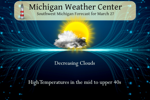
Grand Rapids Forecast
3 27 grrLansing Forecast
3 27 lanKalamazoo Forecast
3 27 kzoForecast Discussion
...Clearing today, chance of snow Wednesday, Rain late week...

A compact vort max continues to move east across the cwa early this
morning. There has been some snow and sleet along with rain across
the cwa. The back edge of the precipitation is moving through Grand
Rapids attm and will exit the cwa by mid morning. IR imagery shows
clear skies from northwest Lower west across Wisconsin and as high
pressure moves east, we`ll see skies clear later this morning and
afternoon. Highs will be in the mid to upper 40s today.

A weak low over southern Ontario will push a cold front across the
cwa Wednesday. Models show the precipitation behind the surface
front...more in line with the h8 front and soundings indicate this
will be snow. However, there is a small warm wedge near the surface
that could cause some of the snow to melt during the afternoon and
fall as rain. Thus, mixed rain and snow is the way to go Wednesday.
Any accums will be limited to an inch or less, mainly on lawns and
fields.

A much more intense low typical of Spring will develop late in the
week in the lee of the Rockies and track northeast across Wisconsin.
We`ll be on the warm side, which means rain.

Showers are progd to develop over the southwest cwa after 18z
Thursday along the warm front as it pushes northeast. Behind the
warm front, a 50 kt LLJ develop Thursday night into Friday that will
bring a steady stream of moisture northward from the Gulf. It will
also bring much warmer air; highs Friday will be around 60. Elevated
instability exists across much of the cwa Thursday night and Friday
and we`ll include a thunder mention in the grids. This is a fairly
large low and so we`ll be dealing with rain through Friday night
before colder air advects in behind the low Saturday, at which point
we`ll see the precipitation mix with some snow.

Both the ECMWF and GFS ensembles suggest mean QPF around an inch for
this event with a few members closer to two inches which would
result in rises on area rivers.
More snow and cold is coming! Get ready for wind chills around 20 degrees with snow on Wednesday! What a winter!
Areas from near Holland to Kalamazoo to Coldwater are already in the slight risk area for severe weather on Day 5. There is also a 30% enhanced risk from west of Chicago down to Arkansas. We are certainly in an active severe weather pattern across the US. There also is a chance for more storms in Michigan around Wednesday the 5th of April but to early to know if severe weather will be possible.
The main roads through Rolling Fork, MS are open. Now I will just have to find an area I can deliver some supplies. I love the state of Mississippi and seeing the damage is heartbreaking.
Thanks for heading down there Kyle! I’m sure everyone will be really appreciative of you
Yes it is!! When I was at Fort Myers beach a couple weeks ago I had to turn around and leave the damage from the hurricane many months ago is still terrible I started getting a headache seeing it all it will take years to rebuild very hard to see it on tv but to be there is real time os horrible…. Be safe and thank you for yoir services you are making Michigan and MV’s blog proud…..INDY
Rock on Kyle!
GR has seen 22 inches of snow in just 26 days of March! Wow the wow, WOW!
Looks beautiful outside but yet another cool one for March 27th currently 40 degrees out in my hood well below average today … Seeing more snow chances coming for Wednesday at this rate we are seeing this much snow in March im thinking April will have snow to probably is a good bet ….INDY
GR has only measured 0.2″ of snowfall the past 9 days.
Seeing snow fall in April in a very good bet. You have to go all the way back to 1998 to see a April where there was no snow fall in April.
Slim
You know it Indy! This has been a snowy, long winter! One for the record books, despite the warm weather hype on here! Rock n roll baby!
GR is well over 200% for March snowfall! What a month and what a snowy winter! Facts are facts people!
It’s been such a crazy snowy long term pattern it is hard to remember that the big snow events started back in November and are still happening! What a long snowy winter! Wow, just wow, WOW!
It’s been such a crazy warm long-term pattern. The last below average temp month in Lansing (I no longer follow GR for temp avg departures) was all the way back in April 2022.
Breaking News>>>>>the latest CPC shows below normal temps at least through the first week of April! Wow, what a cold and snowy pattern! Incredible!
It looks like a continuation of cold in the west/north, and warm in the south east. Which is probably not good news for more tornadoes in the south east…
All of this warm weather hype and it just keep snowing and we can barely hit 50 degrees! The cool pattern continues! Incredible snowy winter! The roads were snow and slush covered in Northern Kent county and very dangerous on Saturday morning! Just the facts baby!
LOL The question is are you going to apologize for your garbage models you kept posting all last week that were 100% wrong about 7-15″ of snow for GR?
Apologies cone onnn…This is public weather blog not the NWS service the RDB is pretty accurate especially this Winter…INDY
I have explained to the warm weather nuts many times, that the long range snow models only give you the trends and are not a snowfall prediction! It is like talking to wall, because there is no comprehension!
Wow by the looks of it is that more snow on the ground this morning I believe I am pusing a 120 inches of snow in my hood now thats real hype if you ask me!! Talking 60’s and 70’s coming this March was a funny thought DDDDDD… Currently its 33 degrees outside….INDY
Thanks Indy, I had not looked outside but reading your post I did and sure enough there is a trace of snow on the ground here. As for the total snow fall amount Grand Rapids is now at 109.4″ for the season. There will not be any 70’s this March as for 60 we will see how Friday goes.
Slim
I was shocked to as I was driving home last night I swear I saw a flash of lightning but it was definitely pouring rain at the time I didn’t think I would wake up to snow on the ground crazzy Slim….INDY
We got a rumble of thunder and a flash of lightning as well last night.
Yesterday was exactly average with a HL of 49/30 there was 0.16” of rain fall and no snowfall. The overnight low here in MBY and current temperature is 34. For today the average H/L remains at 49/30 the record high of 81 was set in 1945 and the record low of 0 was set in 1965. The record snow fall of 6.9” fell in 1948. Last year it was cold with a H/L of 29/20 that high of 29 was the 4th coldest for this date. The next 5 days look to be near average with a one day warm… Read more »
All this snow hype on here by a few and we received basically zero over the weekend and now NWS says very little if any accumulations this week. I love it!
I seen several cars on Saturday that had at least 2″ on them. Not sure where the cars came from but there was some wet snow fall not too far away.
Slim
Montcalm county! Quite a storm!
We had about 1.5-2” snow fall on Saturday morning in a hurry. But then it transitioned to freezing rain and ice. All of it was melted by the afternoon with the afternoon warmth and rain.
Get ready for the snow and wind chills around 20 degrees this Wednesday! Incredible snowfall totals this winter! Is winter dead yet? Wow to the wow, WOW!