We have a very comfortable 55° at 5:30 this morning.
Yesterday we reached 89° with comfortable humidity, the morning low was 60°.
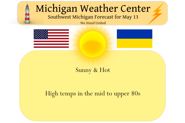
This will be our last significantly hotter than normal day for next week or so. Normal high temps this time of year are in the upper 60s to around 70. Highs away from the lakeshore will reach the upper 80s. Winds will be from the south at around 10 mph. Dewpoints will be in the low to mid-50s. We have gone seven straight days without precipitation.
At this point, it appears Saturday will be our best chance of rain with a 50/50% chance here in SW Michigan. Chances increase to 70% on the east side of the state and 60% north of Grand Rapids.
Forecast Discussion
- Dry Today, Rain Chances Return Mainly on Saturday

No changes to our dry and warm forecast for today. Yet another day
of record or near-record high temperatures is forecast with most
locations reaching the 85 to 90 degree range to finish off a pretty
remarkable week of early to mid May warmth across Lower Michigan.

Skies will gradually become mostly cloudy on Saturday as a cold
front moves into the region. 00z HREF guidance is indicating SBCAPE
building into the 1000-1500 J/kg range near and east of US 131
Saturday afternoon. Hourly QPF probabilities for measurable rainfall
(0.01" or greater) are highest east of US 131 from midday on. The
850 mb and surface winds turn westerly off the lake during the
morning which will help push a more stable airmass into the
lakeshore region. As a result, we have adjusted POPs down across the
lakeshore for Saturday as the greatest odds for showers and a few
storms will be inland, especially after 16z. Any thunderstorms that
develop are not expected to reach severe levels. Could be some small
hail and locally gusty winds where storms are strongest, but given a
dearth of any shear to speak of, storm organization will be sorely
lacking and they will not be moving very fast. So, isolated
instances of 0.50"-1.00" or more of rain is possible.

For Sunday, the left exit region of the upper level jet will afford
upper divergence across northern IL, northern IN, and far
southern/SE Lower MI. Also, the upper trough axis will be moving
through. Given low (or zero) instability present, mainly showers
would be generated and the greatest odds look to be near and south
of I-94. The most likely region for thunderstorms would be east of
I-69 where some MUCAPE is present.

Isolated or widely scattered showers are possible mainly east of
US 131 on Monday but many areas should stay dry.

- Likely Dry Tuesday and Possibly Wednesday, But Will Rain Return?

The upper level pattern will go through an adjustment with falling
mid level heights and much colder 850 mb temperatures moving in
early next week. However, medium range and ensemble guidance is in
pretty good agreement that moderating temperatures will commence
mid to late week. It is looking like 70s and possibly 80s could
return toward the latter half of next week. We`re looking at a lot
of variation in ensemble and deterministic guidance that far out,
but the potential is there for a warm and wet pattern to set up.
What a great day it was today. I spent the day at the Tulip Time Festival in Holland. Walked around got some pictures, did some shopping, got some lunch and an elephant ear (love them). Then drove the back roads home through Allegan, Barry, Eaton Counties then north to home. Hope everyone else had a great day!
Lunar eclipse coming Sunday night. At this point, it looks to be cloudy for us, but NASA will livestream the event.
https://moon.nasa.gov/news/172/what-you-need-to-know-about-the-lunar-eclipse/
So far in this May warm period there have been several locations that have gotten very hot and have reached highs in the low to mid 90’s with even a 96 reported at Traverses City. It has also reached 90 or better officially at Muskegon and Holland. Most other major locations have not been has “hot” as Traverse City and most locations on the east side of the state only had highs in the 85 to 89 range. I am sure many had readings in the low to even mid 90’s in their home and on their car thermometers. While… Read more »
Since Monday, it’s been 69 – 76 degree high temps for Las Vegas. Go figure.
CPC keeps getting darker and darker red for the next two weeks! I love it!
It is sunny and 86 here at my house. With the lower dew points it is not that bad in the shade. A little warm in the sun. The current reading of 91 is a new record high for Traverse City. I have to say like this warm weather, I much rather have it very warm over it being cold.
Slim
It got much hotter this week than what you were saying a few days ago!
Humm, I do not recall making a temperature forecast for this week because I do not make a forecast but I see on May 5th you had this post
“Wow NWS talking about 5 straight days in the low to mid 80’s in early May and possible record temps!” it looks like the NWS was also off on their temperature guess. I also do not recall anyone making a forecast guess of 90’s at Traverse City.
Slim
Slim wrote:
It will nice and warm. But I would not call it a “blowtorch” While there will be some 80’s I don’t see any upper 80’s or low 90’s thus no “blowtorch”. While the highs next week will be well above average at this time it looks like they will be below record levels.
All turned out to be inaccurate. We’ve seen plenty of upper 80’s and low 90’s and many records.
I mean Grand Rapids has not reached 90 (you keep talking about Traverse City), and we reached the record in GR by 1 degree… not a bad forecast for a week out IMO. It is called weather, not always perfectly accurate. And again, all info Slim posted regarding the post you mentioned came from NWS data last week
One reason could be that Mookie may not live in the Grand Rapids area.
Slim
Woah Traverse City is 86 degrees before noon!
90 degrees at 1pm Wow!
Hey everyone! Been a rough couple of weeks but we’re slowly moving forward. The weather has been great for working outside up until this week. Give me temps in the 50’s any day over this mid July 90 degree weather. Hard to believe we’re not even halfway through May and already adding up 90 degree days.
Good to hear from you! I agree this 90 degree temps is hard to take. I hate to say it but it’s too hot.
Hey Barry! Nice to see you here again. Hang in there, bro.
Hope everything is going well! I have the flu (or COVID, not sure) and these hot days are really uncomfortable. Looking forward to next week when we return to our cool weather pattern
NWS GRR says 70’s and 80’s next week now!
Hope you feel better soon!!
Welcome back Barry. Glad your getting some of your business back together.
Slim
Is this the start of a long hot summer? It’s pretty early for all the 90’s around Lower Michigan.
In Traverse City, hitting 92 and then 96 in early May is going to be remembered for years to come. And could be back in the 90’s again today. Muskegon hitting 91 already is pretty unreal as well.
That would be like wondering if it was cold in November that would lead to a cold winter. At Traverse City that 96 is a new record high for May. It has reached 90 or better at Traverse City on 4 days in May in 2018,1977, 1975 and 1962. It has reached 90 or better there in May in 26 years. At Grand Rapids the most 90 days in May is 6 in 1977 and it has reached 90 or better in May in 21 years. So far it has not officially reached 90 at Grand Rapids this year.
Slim
Forget temps around 90 degrees and bring on the 60’s and 70’s! Who in their right mind would want temps in the 90’s? Incredible!
I don’t mind heat, but I despise humidity. Yesterday was fantastic with DPs in the low 40s.
Here is a short recap of the record temperatures set yesterday. Grand Rapids 87 new record. Muskegon 91 new record. Holland 88 tied with 1993 for the record. Kalamazoo 87 tied 2011 for the record. For today the record high are Grand Rapids and Holland 86. Kalamazoo 88. Lansing 91 and Muskegon 84. So there is a good chance that most records could be tied or broken today. With low dew points the temperature fell to 59 here at my house and it looks like the overnight low at GRR was 61. At the current time it is clear and… Read more »
I believe Traverse City hit 97 – 10 degrees warmer than the old record.
Another day of record temps… but it wasn’t a blowtorch says a few on here. Hmmm LOL
Well there is no such terminology of blowtorch in the weather world. Of course we could also use the term “deep Freezer” in the winter time.
Slim
Another one of those lake breezes kicked in yesterday this time at Huron Beach in Presque Isle County. Went from 95 degrees to 56 in 10 minutes.
That’s amazing.
It’s been a warm May and so much for the cool down! “It is looking like 70s and possibly 80s could return toward the latter half of next week.”