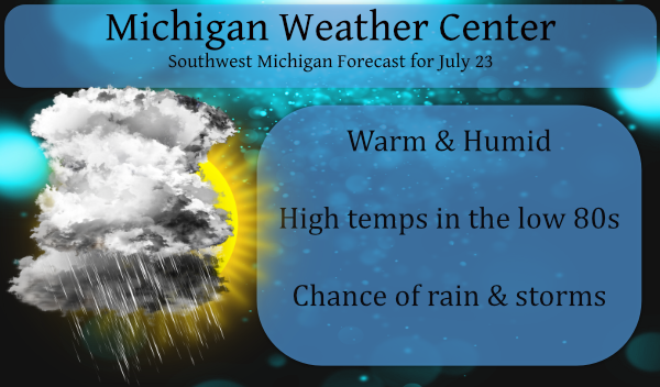
We have a few showers around the area this morning mainly from Pentwater to the south and east (as of 5:30). So keep your umbrella handy for your early morning commute. Warm and humid air will build in today which will be the trigger for showers and storms today and tomorrow. Our current temp is 69° with a 67° dew point.
Yesterday’s high/low was 80/56°.
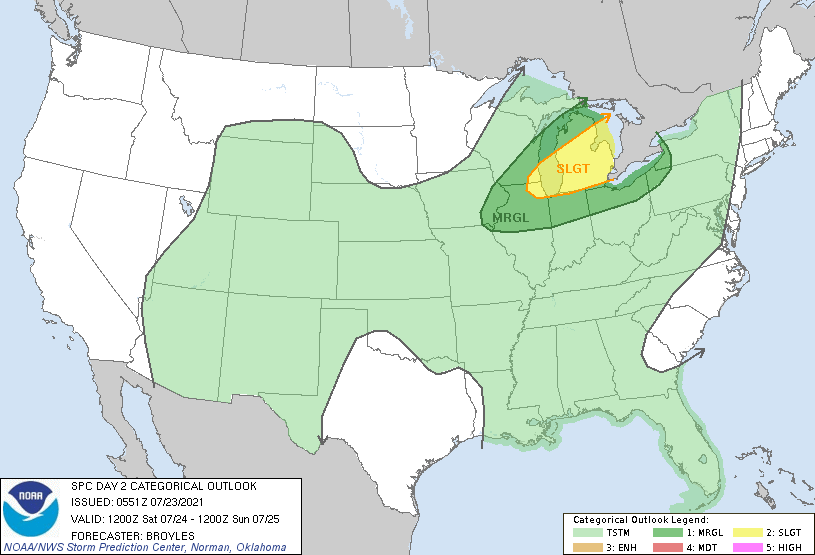
Tomorrow will be our best chance for severe weather mainly in the afternoon and evening, the main hazard being wind and hail:
Forecast Discussion
- Thunderstorms with locally heavy rain to start the day today

Warm and moist air advection was leading to building CAPE along the
lakeshore...especially around Muskegon. Showers and thunderstorms
were on the increase in that region. The showers and thunderstorms
will build inland though the early morning hours leading to locally
heavy downpours and occasional cloud to ground lightning strikes. We
will continue to feature high POPs for the passage of this area of
storms. Later in the day...a few diurnally driven showers/storms
could reform inland. The coverage is expected to be
isolated/scattered.

- Risk for severe weather Saturday

The 0 to 6 km bulk shear increases as a mid level jet builds into
the Upper Plains and Great Lakes region Saturday. An initial line
of showers and storms will likely be weakening as it moves into
the CWA around daybreak from the northwest. Gusty winds would be
the main risk at that time.
A cold front pushes through later in
the afternoon into the evening. Ahead of this front there is some
uncertainty exist as far as how much we destabilize. ML CAPE
values are progged to top 2000 J/kg on some models...but several
models keep it under 1000 J/kg. The lower CAPE values suggests
debris clouds from the morning convective system may limit the
overall severe weather risk. It is too early to say which way this
will go...but the overall pattern is supportive of organized
convection. If we do see the stronger instability in the afternoon
and evening...further convective develop will likely organize
into a line with damaging winds...large hail and frequent
lightning becoming possible. The severe weather risk will continue
into the evening.

- Additional storms possible for the middle of next week

Another cold front pushes through the region around Wednesday.
There is a risk for strong to severe storms with this front as well.
How much if any occurs will largely depend on the timing of the
front. Mid to upper levels winds are shown to be supportive of
organized convection. Most 00z models actually show a stronger
upper and lower level jets with the Wednesday system as compared
to this Saturdays system.
That is some thick air out there today! Dew points in the mid 70’s, heat index right back to the 90’s. You can see the moisture in the air like a fog. Visibility’s down to 6 or 7 miles. No cool breeze today.
Days are getting shorter avarage temperatures are dropping and only 1 90* degree day sofar this Summer and with August right around the corner such a cool breeze sofar I will take it!! INDY
The official rain fall from this mornings rain event at Grand Rapids was 2.39″ Here at my house I had a total of 1.86″ It looks like the most rain fell is SE Grand Rapids were there were several reports of over 2″ and one even up to 3.42. At this time it is cloudy here and very humid. The current temperature here at my house is 79 with a DP of 77
Slim
ADA – 1.75 inches over night. Surprise!…we’ll take it.
Well, we had a warm spring and a warm June so far. Is the upcoming heat wave enough to give us a warm July too? Stay tuned.
I had 1.31 inches of rain here. Nice soaker.
.33 here in Otsego
Heard a loud boom at around 4:30 this morning. Looks like we are entering the airmass from last month where the rain has a hard time dissipating (normally when we get storms in the summer they always seem to dissipate around Grand Rapids… the bubble). So my hopes for severe weather, just like the tornado event last month, are much higher than usual based on this fact. The main threat looks to be wind damage this time.
While it looks to be kind of warm and on the humid side here the next week it is nothing like what is expected to the west of here. Just a few hundred miles to the west a true heat wave looks to set up. While our forecasted highs are in the 80’s to our west they are in the 90’s with upper 90’s in that forecast.
Slim
Wow, I just took a rain fall measurement and I recorded 1.78″ of rain fall here overnight. GRR reported a thunderstorm at 5AM. While that may be true I did not see any lightning or heard and thunder but I do sleep good. There are some thunderstorms to the south west of GR down west of Kalamazoo at this time. most of the night was in the lower 70’s but during the rain it fell to 67 at GRR and it fell to 68 here. At this time it is 68 with light rain falling.
Slim
1.25” here and it came fast and hard. Driving into work at 5am I could hardly see the road it was pouring so hard and quite a bit of lightening and thunder as well.