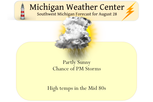
Yesterday we reached 80° after a morning low of 55° under partly cloudy to mostly sunny skies. Today we will see the humidity increase as well as our chances of storms late this afternoon and overnight. The potential for thunderstorms will persist through Monday with a few severe storms with heavy rain possible. A cold front pushes through Monday night so conditions will dry out for Tuesday.
Sunrise today was 7:05 and sunset will be at 8:26 pm.
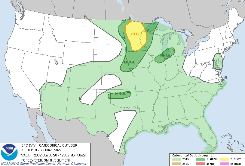
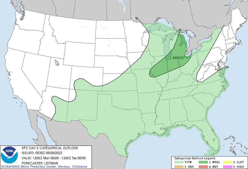
This is the SPC Outlook for Today and Tomorrow:
[columns] [span6]
[/span6][span6]
[/span6][/columns]
Forecast Discussion
The weather will become muggy today as moisture surges northward
through the cwa. Dewpoints, currently in the upper 50s, will rise to
around 70 this afternoon.  At the same time, a short wave to the
west will move across Lake Michigan late in the day. CAMs suggest
scattered convection will develop, though the scope may be limited
as SBCAPE isn`t much more than 500 j/kg. However, bulk shear
increases to 35 knots, especially over the southwest cwa, so storms
that develop may become strong in that area. Heavy rain will remain
a threat through Monday night as precipitable water values rise to
over 2 inches. HREF local probability matched mean shows a stripe of
enhanced qpf from Alma southwest to Kalamazoo by 12z Monday.

A deep upper trough will move east and push a cold front across the
cwa Monday night. ECMWF/GFS show this trough taking on a bit of a
negative tilt with time and would imply an increased heavy rain
threat. WPC continues to keep the cwa in a marginal risk for
excessive rain during this time. Given the moisture, lift from both
the short wave and approaching cold front, and instability, Monday
afternoon and evening will be a favored time for storms. Higher
shear values arrive late in the period at a time that we normally
see instability decrease, so it`s questionable as to how strong
these storms will be be. There`s likely a window during the evening
when the shear is beginning to increase and the instability hasn`t
totally faded when a few stronger storms may develop.

The cold front will move though late Monday night and take the
precipitation with it. Tuesday will be cooler and less humid and
that trend will continue through mid week. Temperatures will begin
to warm again by the end of the week as the high over the Great
Lakes moves east and south flow strengthens.
Up to nearly 3 inches of rain so far! Wow just wow!
And…a miss to the NW, with a dry slot chaser 🙁
Get ready for ANOTHER week with below normal temps! Incredible weather!
Too funny, I have picked up .4 inches of rain already! What a summer, no heat waves, normal temps, enough rainfall that I have not needed to water the lawn, plenty of sun, hardly any mosquitoes! Wow, just wow! Rock n roll will never die!
The near to below normal temp pattern contains to Rock! I love it!
We haven’t had a cold month since April. And the CPC is looking hot!
One above normal temp day and then bam, right back to our long term
pattern of below normal temps! Incredible and what a summer!
The official H/L at Grand Rapids yesterday was 80/57 for yet another great late summer day. There was no rain fall and the sun was out 54% of the time. The official overnight low at GRR was 59 here in MBY I had a overnight low of 62. For today the average H/L is now down to 79/59. The record high for today is 94 set in 1952 and again in 1953. The record low is 41 set in 1986. It was hot last year on this date as the high/low was 92/73. Today looks to be very warm and… Read more »