Congrats to the Wolverines (my favorite) on their win yesterday over Ohio – if you didn’t watch it you missed a great game. They now move on to the Big 10 championship game against Iowa.
We gained another inch of snow yesterday which mixed with some freezing rain towards sunset. Our total is now 5.4 inches for the season. The high yesterday was 34° and the overnight low was 23°. We currently have 32° at 6:30 am.
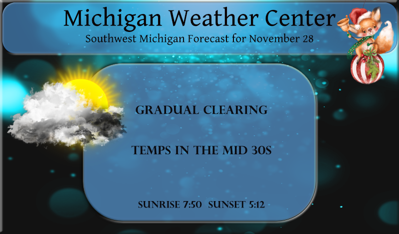
We will see the precipitation ending today with gradual clearing late. Winds will be on the increase and temps will rise into the mid-30s today. Our next system moves in for tomorrow with another rain-snow mix. Temps will be on the increase throughout the week topping out in the mid to upper 40s before falling back into the 30s by the weekend.
- Slick Roads, Possible Freezing Drizzle Early This Morning -

Roads will be slick to start the day following widespread snow that
accumulated late into last evening. Many roads across West Michigan
are still covered in snow, while others appear shiny on webcams.
Those shiny roads are either treated and wet, or could be icy as
once-melted snow refroze overnight as temperatures dropped into the
mid/upper 20s or as freezing drizzle created icy spots for areas
near/south of the I-96 corridor.

Surface low pressure continues to track east across Lake Erie this
morning, dragging a weak frontal boundary behind it through Southern
Michigan. Weak lift along this feature, moist low levels, and an
unsaturated DGZ are generating patches of drizzle/freezing drizzle
and light fog/freezing fog along the I-94 corridor and up through
the Lansing area early this morning. This should all become more
patchy as the low pulls further away, with the drizzle and fog
sliding east through the morning (clearing Lansing/Jackson by 9 AM).
Temperatures are also starting level off in the low 30s, or even
warm above freezing, over far southwest portions of the State. This
will obviously begin to help travel conditions and road treatment
strategies as well. For the remainder of the area, temperatures are
expected to rise above freezing this morning.

- Light Snow/Rain Showers Today For Some Areas -

Strong upper shortwave will dive through the Central Great Lakes
today, pushing surface low pressure across Northwest Lower Michigan.
This will provide a modest increase in moisture depth and a chance
for snow showers, mainly for areas near and north of US 10.
Northwest flow may also allow a few bands of lake-enhanced snow to
spread inland from Lake Michigan by midday, but not expecting a high
coverage of these and potential will drop off the further south you
head in West Michigan. Additional snow amounts today will stay
light, but locations near/north of US 10 may see about an inch. High
temperatures today will warm into the mid and upper 30s, allowing
snow to mix with rain at times. Lower dewpoints will favor snow as
the predominant precipitation type, however. Winds will also be
gusty out of the northwest today (25-30 mph), keeping wind chills in
the 20s.

- Light Snow Possible Monday -

Another clipper system will dive through the area late Monday into
Tuesday. POPs were boosted to likely for areas along/north of I-96
Monday afternoon and evening as models now look much more impressive
with moisture depth along the warm front as it lifts through the
area. Forecast soundings support mostly snow as precipitation type,
and could see another 1-2 inches again for areas north of US 10 and
a dusting to one inch south of there. Travel impacts should be more
limited with this system as surface temperatures remain in 30s while
most of the snow is falling, and then only slowly fall into the
upper 20s overnight.
Definitely a snowier start to the season than last year (not saying much, but clearly not a repeat of last season so far). Still no really cold air through the first week of December, but it will be interesting to see if any of the cold air over Alaska heads this direction towards the middle of the month. The lake is plenty warm enough for lake effect snow!
A nice lake effect band just rolled through! The snow just keeps coming and coming! Incredible!
Great Nov weekend! A snowstorm and U of M annihilated Ohio State! Incredible! Also plenty of long range signals for tons of snow in December! Bring it!
Here at my house 2.8″ of snow fell yesterday. The official snow fall at GRR was 2.7″ around the area Muskegon just 1.1″ at Lansing they recorded 2.4″ of snow fall. Detroit metro reported 4.2″ Flint 2.6″ Saginaw just 0.4″ At Grand Rapids it was the 6th snowiest November 27th at Lansing it was the 11th snowiest (records go back to 1863 at Lansing) At Detroit it was the 5th snowiest November 27th at Flint it was the 4th snowiest Muskegon and Saginaw it was not in the top 20. But over all a very snowy November 27th. At this… Read more »
Over 3 inches of new snow on the ground out on hood thats 7 inches for the season brims my total down to 83 more inches togo for the young Winter season…Who Knew??? InDY
I had 2.8″ the official amount at GRR was 2.7″ Holland don’t keep snow fall amounts so we do not know how much fell there. I was at the Rivertown mall area yesterday and there was less snow there then here at my house.
Slim
We are above normal for November snowfall! Great start to winter! Wait till mid December – by then a major Rock n Roll snow party will be taking place! Get prepared now! Buy your ski passes, tune up your snowblower, make sure your car is ready, etc!
We ended up with approx 2.5″ total. Nice forecasting by the mets. It was an exciting day of football. It’s nice that Harbaugh finally got that monkey of his back. Now let’s hope they can beat Iowa so the B1G can be represented in the Playoffs.
Iowa is toast!