We have a temp 0f 46° at 6 am this morning. Yesterday’s high was a nice 64° and the low was 38°. I generally close up my fish pond the first week of November as the water temps cool into the low 50s. I clean the water filters and pond then cover it all with a tarp. The fish go dormant over the winter months and don’t need food. I have been doing this for 20 years and have never lost a fish. It is a long winter’s nap…
We have been fairly dry so far this month having only a couple of days with trace amounts of rain.
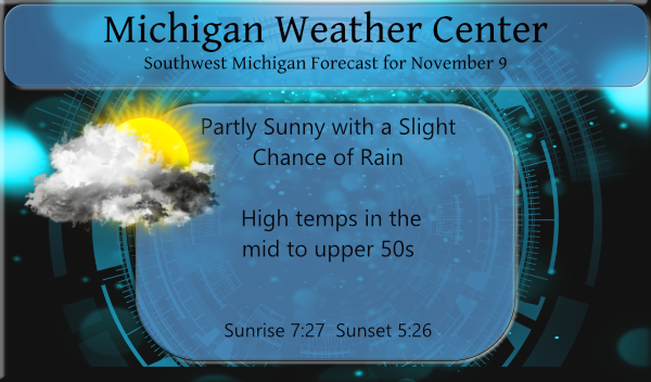
A weak cold front will bring a chance of rain showers to southern Lower Michigan today, with the best chance of rain will be generally along and south of I-96. A seasonably strong area of low pressure will approach for later in the week, bringing widespread rain on Thu. Gusty winds to 40 mph are also expected on Thursday. Much cooler air arrives for Thu night and beyond.
Forecast Discussion
- Very small chances for rain this afternoon and evening

Very small chances for rain remain in the forecast for this
afternoon and evening. A cold front continues to slip south
through the area this morning. It will stall off to our south this
afternoon. Low pressure riding up the front (more prominent in the
ECMWF) will touch off some frontogenesis aloft resulting in the
potential for some light rain near and south of I-96. We have
continued 20-40 percent pops in these areas to account for the
chance. The HREF probability matched mean precipitation is almost
nil, so not expecting much.

- Fall storm to bring rain and wind on Thursday

The focus of the forecast remains on the fall storm that will move
through the Great Lakes Thursday and Friday. We may see some light
rain in a warm air advection wind on Wednesday night, but the bulk
of the precipitation on or near the warm side of the system will
occur on Thursday. The cold front will move through on Thursday
and the precipitation will largely occur near or just behind the
front. Rainfall will not be heavy given the speed of the front.
Quarter to half inch or so amounts should be common. Instability
is rather small, MUCAPE < 200 j/kg and 850mb LI`s around +3, so
not thinking we have much of if any thunder threat.

The winds may be the biggest impact with the passage of the cold
front. At this point, looking at wind gust swaths from both the
ECMWF and the GFS it appears 30-40 mph will be the common peak
gusts. This is just below wind advisory criteria. If there is a
place a wind advisory would be possible it would be along the Lake
Michigan shoreline on Thursday as the wind shifts to an onshore
component behind the front. Some isolated/scattered power outages
in the lakeshore counties will be possible Thursday.

The trend in the models tonight is steady and consistent with last
night. The low stays off to our west and bottoms out in the low
990s mb. So, a fall storm for sure, but nothing off the charts.

- Prolonged period of lake effect precipitation Friday-Monday

A persistent westerly flow (SW through NW) occurs off of Lake
Michigan from Friday through Monday. We will be cold enough for
lake generated precipitation the entire time with Delta Ts in the
15C to 20C range. This is more than enough instability to get
precipitation going. RH values through a deep depth (1000-700mb)
is in place as well, with all forecast periods seeing 70% or
greater RH. The final item we usually look at is the presence of
upper troughing and shortwaves working through the flow to provide
a synoptic scale boost. This factor is there as well the entire
time, all 4 days. So, we will see lake effect rain and snow
through this period. Wet bulb zero heights crash below 1500ft on
Friday and remain low through Monday. 1500ft is where rain usually
starts to change over to snow. Most of the time is near zero, so
we are certainly going to see snow. We are likely looking at mixed
rain and snow showers through this period given a warmer Lake
Michigan (water temps around 54F). Away from the lake it will
trend more towards snow and especially during the night time
periods. That said, even during the day we are going to see snow.
Not thinking snow accumulations will get too out of hand but we
are going to see the ground turn white in spots across Western and
Central Lower Michigan. 2 and 4 inch soil temperatures were around
44F yesterday morning, so the ground continues to cool. Bottom
line its going to feel a bit more like winter towards the end of
the week and through the weekend.
Accumulating snow chances are looking great! Bring it!
We put up our Christmas lights yesterday probably the earliest I can remember beats putting them up in the cold and snow this is probably the best time to do that after Thursday it all goes down hill folks big time pattern change with a big time cold front blows in who knew ??? InDY
The snow pack will be growing big time! Rock n roll will never die!
https://www.instantweathermaps.com/GFS-php/conussfc.php?run=2021110906&time=PER&var=ASNOWI&hour=384
Im thinking winter weather advisorys coming this weekend middle of November and talking about winter weather advisorys who knew?? InDY
The first few snow events in the late fall/early winter can be very dangerous times on the roads as most people have forgotten how to drive on snow and ice. And for some reason people have been driving much faster the last few years (could it be the higher freeway speed limits?) And way if you are out on the first few snow events remember to take care.
Slim
It is interesting how the criteria changes throughout the season for advisories. The NWS usually issues an advisory for the first accumulation (even just a couple inches) but later in the season they dont even issue an advisory for 3 inches unless it falls during rush hour or in a short time period. Although I think in 2014 we were basically under an advisory for 5 months straight.
We had two warm days in a row with highs in the 60’s In the last 30 years there have only been 4 years with OUT highs in the 60’s or 70’s in November. And in the last 70 years there have only been 6 Novembers when it has not gotten into the 60’s and highs of 70 or better is actually rather common. The overnight low both here at my house and at the airport was 41 at this time it is cloudy and 48 here the last reading at GRR was 45.
Slim
Check out Thanksgiving week slim Nathan and rocky long range looks verry wintery around here nothing like Fall I will take it start adding on to my 90 inches of snow I predicted this year woo wooo ….InDY ….
🙂
Yep definitely looking cool for the second half of November! Lake Michigan is warm so any cold days could have plenty of lake effect. I’m sure fixxer is excited 😀
Back to the 50’s next week? I love it! Looks like only a short cool down.
As usual you are 100% wrong!