A side note to begin the post today we shout out “we are debt-free!” having paid off our mortgage yesterday. This is a great feeling after living fairly frugally since all the kids have moved away and have had children of their own. We have 12 grandkids the oldest being 18 and the youngest two years old. We have only bought used cars which we could pay off quickly and pay off the credit card monthly. So, for you younger people out there make sure you contribute to a 401k or other retirement investment so you can have a comfortable retirement. I took an early retirement three years ago so I can enjoy it.
We have a warm 74° this morning (at 6 am). We had no rain overnight here in Otsego. This is the convective outlook summary from the SPC for today:
Isolated strong to severe storms may impact a corridor from the
   lower Great Lakes region into the mid Mississippi Valley and parts
   of the central/southern Plains today. Damaging wind gusts should be
   the main threat.
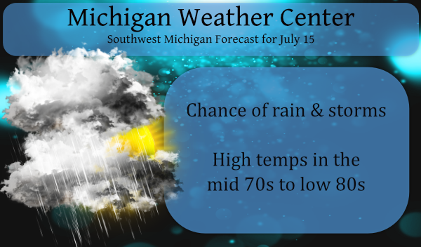
Showers and thunderstorms are likely today, mainly before 3 pm. Mostly cloudy and breezy, with a west wind of 10 to 20 mph, with gusts as high as 30 mph. The chance of precipitation is 70%. New rainfall amounts of less than a tenth of an inch, except higher amounts possible in thunderstorms.
Forecast Discussion
-- Thunderstorm potential today --

Elevated storms this morning in Central Michigan are forming off
925-850 mb moisture transport convergence and closer proximity to
the upper level trough, and repeating batches of heavy downpours
could cause minor flooding this morning, particularly in Mason and
Lake counties where soil moisture is relatively high. The QLCS in
northern Illinois is trending less impressive as it encounters
less dynamic support. The longer into the morning it persists in
southern Iowa through northwest Indiana may hinder development of
more surface-based convection in southern Michigan this afternoon.
If diurnal convection matures before exiting our eastern CWA, 0-3
km shear around 30 knots could support multicell segments and a
moderate amount of DCAPE (depends on if any mid-level dry layers
are present) may allow for localized wind gusts capable of tree
limb damage. The orientation of the cold front or mid-level focus
for storm development relative to the 0-3 km shear vector is
closer to parallel than it is perpendicular, so this would also
limit the potential for a stronger QLCS to develop.

-- Chance of Southern Michigan heavy rain Friday night --

Models remain in quite a bit of disagreement regarding the extent
to which a weak upper level wave along the front from Missouri on
Friday augments with convection / possible MCV in Illinois, which
underneath the right-entrance region of the upper jet may develop
a more robust low through a good depth of the troposphere in
northern Indiana by Friday night. The ECMWF, GFS, and many of
their ensemble members provide southern Michigan with a swath of
heavy rain Friday night north of the surface low, though they may
be suffering from convective feedback and overdeveloping the low.
The majority of the HREF members keep the Friday night convection
south of Michigan.
Hey Slim is this supposed to be the hottest times of the year In west Michigan?? INDY
Another well below average July day who knew ??? Currently 69* only in my area under more clouds boy this summer has been a cloudy one lot cloudyer then last summer at this point …Keep it coming …INDY
Below average high temps but above average overnight lows. Bigger story as MV and others have pointed out has been the humidity this Summer. Dew points have a lot more to do with how the air feels than temps do. Current dew point once again over 70 making it feel thick and gross yet again.
Currently 75* degrees outside I believe that’s below average for the middle of July ..Well below average for west Michigan standards sorry maybe next week?? …INDY
And the low for the day was 70 degrees, well above the average low. Sorry. Maybe next month?
Good thing I have strong security on this site – there have been almost 1500 attacks this week…
wow, is that getting worse???
Slim
Why would someone want to hack a weather site? Seems there’s bigger fish to go after with other sites. Odd.
Wow look what lake Michigan did to our storms yesterday and overnight killed them I’m giving up on Thunderstorms bring on winter storms way more fun to track loving these low 80’s coming up for next week as we get to the end of July as of now no heat waves to even speak of such a easy Summer on going in the heat department who would of thought??? INDY
MV or Slim care to comment on how our NWS can be soooo precise in forecasting tomorrow’s weather, where we appear to have a 1 hour window where a thunderstorm will NOT be possible?
Friday:
A chance of showers and thunderstorms before noon, then a chance of showers between noon and 1pm, then a chance of showers and thunderstorms after 1pm. Mostly cloudy, with a high near 77. Calm wind becoming east 5 to 7 mph in the morning. Chance of precipitation is 40%.
I have noticed that in the NWS forecast as well. I am not sure how accurate that forecast will be in the long run. It must come off the computer models that they are using. I know that the TV and private weather services have had hourly forecast for some time but they miss the mark many times. On a side note I will give a hats off to the NWS on yesterdays forecast. As the rains to our west did indeed dissipate before getting here last night. In looking at the radar yesterday I was concerned if that would… Read more »
Thanks for the info. 🙂
I emailed them yesterday, but I don’t expect a response.
Bernie
Yesterday was one of those kind of rare days when the mean for the day was “average” The overnight low here at my house was a warm 75 it must have been cloudy all night long but there was no rain here. There was some lightning to the north and northeast last night but it was off in the distance. As I have stated before there has not been much thunderstorm activity here in the NW side of GR. At this time it is cloudy and 76 here.
Slim
Congrats on have your mortgage paid off. I have had my paid off now for several years.
Slim
Congrats MV, that’s fantastic! Our kids are in high school and we have a long way to go, but I can’t wait for that day.