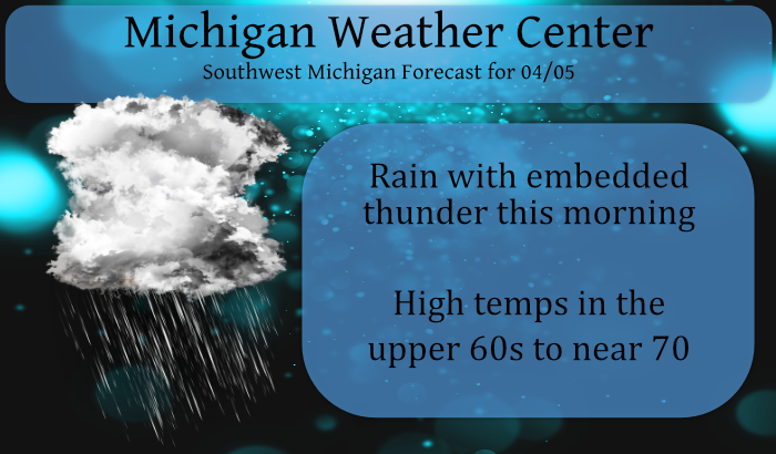
We reached 73.2° yesterday with mostly sunny skies. Our low at 5:30 this morning is 51.8° with clouds overhead. We have rain moving into Muskegon and I see from my radar (Radarscope) there is some lightning embedded. There are showers and storms across the lake from Janesville Wisconsin down to Chicago. Still waiting to see if there is more development to come.
The showers and storms may become fairly widespread towards daybreak today and at least continue through the morning in SW Michigan. Locally heavy rainfall over an inch is possible in spots where training may set up. Severe weather is not expected, but a few rumbles of thunder are.
Forecast Discussion
-- Scattered showers and storms today --

An EML plume is established over the region this morning,
featuring 700-500 mb lapse rates modeled around 7.5 to 8 degrees
C/km, and 8.9 C/km observed in the 00Z KGRB sounding between
750-550 mb. This will provide instability for moist air advecting
in from a 25-30 knot southwesterly low-level jet around 850-800
mb. Scattered convective clusters have already developed in
northern Illinois (not well modeled) and near Green Bay (what most
members of the HREF have been depicting). It remains to be seen
how the northern Illinois convection affects the evolution of
storms this morning, but models have been pretty consistent with
showing scattered convection developing over Lake Michigan and
moving through a good portion of southwest Lower Michigan.

The dry air and somewhat steep lapse rates below the clouds down
to about 1,000 feet may allow downdrafts to impinge the surface,
though the temperature inversion below 1,000 feet would resist
this during the morning.

Lightning would be the main threat with
storms today. HREF ensemble-localized probability-matched mean
rainfall the last couple runs has shown a narrow swath of 1 to 1.5
inches of rain possible today if a train of convection sets up,
which is generally beneficial (given the dry spring so far) and
not likely to cause flooding.

-- Pretty warm the next few days and an unsettled wet pattern --

Under an amplifying upper level ridge on Tue into Wed, the warm
front and most of the precipitation will be north of us, and there
is good ensemble support for temperatures well into the 70s. The
trend of temperatures may go down and precipitation may go up
on/after Thursday as an upper level low approaches.
A couple of flashes, a bit of distant thunder, and just enough rain to wet the road. A week or more of rain on the way…yay?
Now that we are well into Spring I can finally say our thunderstorm drought is over I believe the last time we had a good. Thunderstorm.was over 6 months ago crazy …INDY
So far today I have recorded 0.33″ of rain fall and the grass has sure became green and it looks like grass cutting time will soon start. At this time it is cloudy and 52 here.
Slim
Here is a fun fact. At Grand Rapids While there have been only 3 April’s where the high did not reach 70 (1950, 1961 and 1907) there have been 14 years where the warmest temperature in April was 85 or better (the record high for the month is 90) there have been 25 years when the months high has been 85 or better 30 years where the high has been 83 or better and 58 years where the high has been 80 or better. So having a warm day or two in April is not that unusual.
Slim
In April 2020 and April 2018, we saw no back to back 70+ degree days. In April 2019, it took to the end of the month to see that. If the forecast holds, we could see 4 days or more at 70+ in early April. That’s fairly unusual.
If the forecast plays out that would be rather unusual and it could set up the issue of fruit crop damage if it gets cold later in the month. In 2000 there were highs of 78 on March 31 and then 82 and 83 on April 1st and 2nd then highs in the upper 60’s and low 70’s for the next 5 days. Then there was a low of 29 on April 10th then in May there were lows of 31 on two nights. Not sure if that caused any crop damage.
Slim
Not too worried. Farmers will get bailed out by the government if any significant crop is lost. But I wouldn’t go planting any super sensitive plants quite yet.
This is probably great weather for the plants. It will be interesting to watch the “green up” this week. I believe last year it took until at least mid-May for things to really green up.
You’re right. Grass, air temperatures, and water temperatures all seem to be almost a month ahead of average.
There are now flashes of lightning and rumbles of thunder here. So far just 0.03″ of rain and the current temperature is 51 and that is the overnight low so far. Yesterdays official high of 71 at Grand Rapids was the 7th warmest for any April 4th there was a new record set at Muskegon with a high of 73 the old high was 72 set in 1942. The high of 72 at Kalamazoo was the 4th warmest for the date and the high of 74 at Holland was the 3rd warmest for the date. The record for today at… Read more »
Some pretty heavy thunderstorms with hail came through my area in northern Kent around 7:30 this morning! Been a fun morning!
Some lightning and thunder here but no hail and not real heavy rain either.
Slim
Middle to upper 70’s this week with thunderstorms? Is it summer already? I love it!
Warm but NOT summer just yet. One thing it keep a eye on is that plants get too far ahead of where they should be and then have a frost in late April or early to mid May.
Slim
20 degrees above average?? You don’t see that very often.