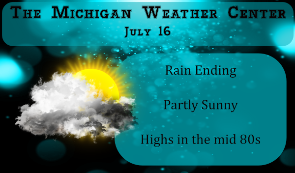
The rain has ended in the Otsego/Plainwell area. We had .34 of an inch overnight bringing our total for the month to 1.48 inches. Last year at this time we had .96 of an inch through the 16th of July.
NOAA has issued a La Niña Watch, which means conditions in the tropical Pacific Ocean are favorable for the development of the cool phase of the climate pattern known as ENSO later this year during the fall and winter. However, the probability is not a strong one. There’s a 50-55% chance of La Niña, a 40-45% chance of neutral conditions, and still a 5-10% chance of El Niño.
El Niño and La Niña are the warm and cool phases of a recurring climate pattern across the tropical Pacific—the El Niño-Southern Oscillation, or “ENSO” for short.
The pattern can shift back and forth irregularly every two to seven years, and each phase triggers predictable disruptions of temperature, precipitation, and winds.
These changes disrupt the large-scale air movements in the tropics, triggering a cascade of global side effects.
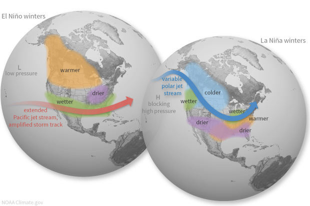
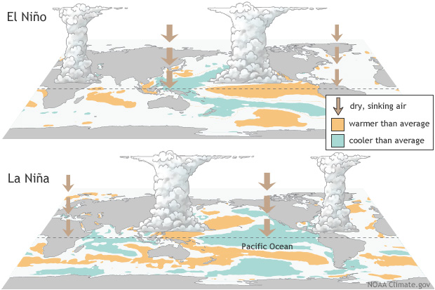
- El Niño: A warming of the ocean surface, or above-average sea surface temperatures (SST), in the central and eastern tropical Pacific Ocean. Over Indonesia, rainfall tends to become reduced while rainfall increases over the tropical Pacific Ocean. The low-level surface winds, which normally blow from east to west along the equator (“easterly winds”), instead weaken or, in some cases, start blowing the other direction (from west to east or “westerly winds”).
- La Niña: A cooling of the ocean surface, or below-average sea surface temperatures (SST), in the central and eastern tropical Pacific Ocean. Over Indonesia, rainfall tends to increase while rainfall decreases over the central tropical Pacific Ocean. The normal easterly winds along the equator become even stronger.
- Neutral: Neither El Niño or La Niña. Often tropical Pacific SSTs are generally close to average. However, there are some instances when the ocean can look like it is in an El Niño or La Niña state, but the atmosphere is not playing along (or vice versa).
6pm out at thee YARDofBRICKS NE of GR 80* degrees currently and it was supposed to be hot this week lol….Have a super night …INDY
Ended up with 0.33” of rain here. We missed a lot of the heavy rains last week, so every drop is welcome! Sky’s are clearing from the West now, and it looks to be clear this evening to view the comet. I highly suggest you give it a look if possible, and if you don’t have a dark or clear view of the NNW, drive somewhere that does. Ones like this are about once or twice a lifetime!
Tonight’s position:
Thanks Barry we are planning on it. I charged batteries for a different camera to try. It is so cool!!!
I recorded 0.27″ of rain overnight here. At this time there is a light mist falling with a temperature of 66. At this time it is looking less hot over the next week or so.
Slim