There seems to be no end to this parade of dry sunny days and of course, the smoke from Canadian wildfires drifting overhead. The combination of warm temperatures, low humidity, and occasionally gusty winds will maintain elevated fire danger in the days ahead. Red Flag Warnings continue in the upper lower peninsula of the state. Hazardous swimming conditions are also likely at some Lake Michigan beaches today and Thursday afternoon/evening. Chances for rainfall are in the forecast this weekend into early next week.
Weather History for SW Michigan
June 4
1925: An early June heat wave began and lasted through the 6th with record highs in the mid and upper 90s.
1860: Powerful thunderstorms moved across Lake Michigan in the evening. Sailors reported seeing a very large waterspout moving across southern portions of the lake. The storms eventually reached West Michigan, causing damage in the Grand Haven area.
June 5
1905: Torrential rains soaked much of the region. Four to six inches of rain on June 5th and 6th caused widespread flooding. Both Lansing and Grand Rapids set records for daily rainfall in the month of June with 5.47 and 4.22 inches, respectively.
1930: A tornado moved across southern Clinton County from near Eagle to seven miles north of Lansing. One farm home was torn to splinters and scattered.
June 6
1869: It was the second frosty morning in a row as temperatures dropped to near or below freezing. Lansing recorded a low of 31 degrees, after a low of 27 degrees on the 5th which is the coldest ever recorded there in the month of June.
1917: A violent tornado struck the town of Springport in Jackson County, killing two people. About 35 homes were destroyed.
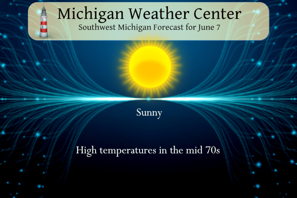
June 7
1958: One of the coolest Junes on record saw scattered frost across the region as the temperature fell to the mid-30s.
1996: A weak, short-lived tornado moved through open country east of Lake Lansing in rural Ingham County. Two other small, weak tornadoes struck near Novi and Flint.
June 8
1933: An early season heat wave peaked as temperatures hit 97 degrees at Grand Rapids and 92 at Lansing.
2008: Severe weather and flash flooding occur on June 7th and 8th, with four drownings in southwest Lower Michigan. Two people drowned when their car plunged into a fifty-foot ravine created by a washed-out road in Castle Park, Allegan County. Tornadoes struck in Osceola County near Hersey and in Eaton County near Needmore, downing hundreds of trees and destroying several outbuildings.
2003: Tornadoes strike Lower Michigan, with damage mostly confined to near Fenton in Genesee County and Leonard in Oakland County. A weak tornado hit near Rose Lake in Osceola County but did no damage.
June 9
1963: Severe thunderstorms caused millions of dollars in damage across the region as winds gusted over 70 mph. There were also reports of funnel clouds and a possible tornado in Belmont where several trailers were destroyed and homes were damaged. A tornado near Dorr heavily damaged a house.
1966: A large storm system that had produced the F5 Topeka, Kansas tornado the previous day moved into the Great Lakes region and brought severe weather to Lower Michigan with high winds and large hail. A tornado struck Wall Lake, near Delton in Barry County, and damaged a boat and cottage.
1974: Ferris State University in Big Rapids is hit by a tornado. Two people are injured. Several houses and two schools also had damage to roofs and walls.
2004: Severe thunderstorms produced at least one tornado and some very large hail. Hailstones over 4 inches in diameter fell in Jackson County and a tornado briefly touched down near Alma, producing only some tree damage.
June 10
1939: Tornadoes struck across southern Lower Michigan, including one that hit Kalamazoo County from near Schoolcraft to Austin Lake. A farmhouse lost its second floor and a mattress from the home was found over a mile away.
Weather History for SE Michigan
June 4
On June 4, 2010, a severe thunderstorm developed over southwest Oakland County. The storm produced hail up to 2 inches in diameter and downed numerous trees in Novi and Northville.
Also on June 4, 1998, the latest record low for Flint for the month of June occurred on this day. The temperature dropped to 33 degrees, which ties a record previously set on June 1, 1966.
June 5
On June 5, 2005, widespread severe weather hit Southeast Michigan. Thirty-four warnings were issued with 52 distinct severe weather events reported including one F0 tornado near Hemlock. Hail was up to golf ball size, and wind gusts up to 80 mph were estimated in Bay City, Hemlock, New Hudson, and Monroe.
On June 5, 1998, the high temperature only rose to 53 degrees in Detroit. Scattered showers during the afternoon forced temperatures into the 40s, and spotters reported sleet with some of them.
In 1953, tornadoes hit both Wayne and Saginaw Counties. An F0 tornado hit Wayne County at 5:05 PM and an F2 tornado hit Saginaw County at 7:00 PM and caused $25,000 in damage
Also on June 5, 1905, an estimated F5 tornado moved through Tuscola and Sanilac counties in the middle of the afternoon. The tornado moved from Colling to McGregor. The worst of the damage was near Shabbona in Sanilac County where at least three farms were destroyed. Five deaths and 40 injuries resulted from this tornado.
June 6
On June 6, 1903, the record for the greatest amount of precipitation for the month of June in Detroit was reached, with a rainfall estimate of 3.07 inches. The normal monthly precipitation amount for the month of June is 3.55 inches. In just one day, the monthly average was almost reached!
On June 6, 2008, widespread severe weather was reported across the Tri-Cities, Thumb, and Flint areas. There were 24 reports of hail and wind damage from the storms with a measured 71 mph wind gust from a spotter in Howell.
Also on June 6, 2010, a strong low-pressure system tracked through the Detroit Metro area during the early morning hours, spawning three tornadoes south of I-94, with flash flooding occurring over Washtenaw and Wayne counties as 2 to 4 inches of rain was recorded. The two tornadoes which occurred over Monroe County damaged a total of 311 buildings. Five single-family homes were destroyed. Major damage occurred at 34 structures. Minor damage was observed at 74 structures, with 198 other homes affected needing mostly cosmetic repairs. The village of Dundee was hardest hit by the EF2 tornado.
June 7
On June 7, 1930, the temperature rose to only 54 degrees in Detroit.
June 8
On June 8, 1953, the deadliest tornado in Michigan history struck the northern Flint community of Beecher at 8:30 PM, killing 116 and injuring 844 along its path. The F5 tornado touched down about 2 miles north of Flushing and from there, created a path averaging about a half mile wide as it moved across Flint, at an approximate speed of 35mph, to about 2 miles north of Lapeer. A 23-mile-long path of death and destruction was left in its wake with over a hundred lives lost, including as many as 20 families reporting multiple deaths. Damage was estimated at $19 million (1953 dollars). On this day in 2003 (the 50th anniversary of the Beecher/Flint Tornado), three tornadoes touched down in the area. Ironically, one tornado hit the southern portion of Genesee County while commemoration ceremonies were underway.
Also on June 8, 2008, a derecho, a significant squall line, raced through Southeast Lower Michigan. Winds were estimated to be 80 to 90 mph across portions of Tuscola, Oakland and Macomb Counties. In Southeast Michigan, nearly 300,000 homes and businesses lost power in the storm and total damage was nearly $100 million.
June 9
On June 9, 2011, a cold front moved through Southeast Michigan around midnight and it produced numerous severe thunderstorms across southeast Michigan during the early morning hours. Winds were estimated to be near 85 mph around Sebewaing with dozens of downed trees and extensive damage at the airport. A measured wind gust of 76 mph was recorded in Flint.
Also on June 9, 1933, the overnight low temperature dropped to only 76 degrees in Detroit. Considering that the normal high temperature for June 9 is 78 degrees, this would have been a very warm overnight temperature.
June 10
On June 10, 2020, a warm and very moist air mass was in place as the remnants of Tropical Storm Cristobal had moved through the Great Lakes the prior evening. This provided the fuel for widespread severe storms not only for Lower Michigan but also northeast Indiana and all of Ohio as a strong trough moved in overhead. Numerous trees fell on homes in Flushing, Mount Morris, and Grosse Ile, and one person was injured in Saginaw when a large tree fell on their car.
On June 10, 1941, the overnight low dropped to a “freezing” 33 degrees in the city of Saginaw. This is the record low temperature for the month of June in Saginaw and is tied by the low temperature recorded on June 8, 1949.
U.S.A and Global Events for June 7th:
1692: A massive earthquake strikes Port Royal in Jamaica, killing some 3,000 people. Click HERE for more information from the History Channel.
1816: The following is found on page 31, of the book, “History of the American Clock Business for the Past Sixty Years, and Life of Chauncey Jerome,” written by Chauncey Jerome. The book was published in 1860. “The next summer was a cold one of 1816, which none of the old people will ever forget, and which many of the young have heard a great deal about. There was ice and snow in every month of the year. I well remember on the seventh of June, while on my way to work, about a mile from home, dressed throughout with thick woolen clothes and an overcoat on, my hands got so cold that I was obliged to lay down my tools and put on a pair of mittens which I had in my pocket. It snowed about an hour that day.” This bitter cold event occurred in Plymouth, Connecticut. Click HERE to read his book.
Grand Rapids Forecast
6 7 grrForecast Discussion
.SHORT TERM...(Today through Thursday)
Issued at 335 AM EDT Wed Jun 7 2023

Primary forecast issues pertain to marine and fire weather
headlines and those are addressed in sections below. As it stands
for sensible weather in the short term, there isn`t much to speak
of given ridging set up across the Great Lakes region. BUFKIT
overviews have very little moisture through the depth of the
column. We are expecting dry weather with mainly clear skies from
today through Thursday. Highs will top out near normals for this
time of year in the 70s.

The RAP smoke model continues to show a fair amount of smoke in
place above Lower Michigan today when looking at the Vertically
Integrated Smoke product. So, hazy skies will continue once again
today.

.LONG TERM...(Thursday night through Tuesday)
Issued at 335 AM EDT Wed Jun 7 2023

- Fair wx through Friday -

Sfc high pressure and dry northerly winds will result in fair wx
through Friday. An elevated fire risk will continue given the very
dry airmass in place and antecedent very dry conditions across our
area.

- Chance for showers this weekend into early next week -

A cold front and upper shortwave will combine to bring a small chc
for showers late Saturday. The wx pattern looks to become cooler and
unsettled Sunday through Tuesday as an upper low closes off over our
region. A better chance of rain will come Sunday due the the closed
low over our region and stalled sfc boundary.

The closed upper low and several vort maxes rotating around the
upper low will continue to bring a chc of showers Mon and Tue.
Instability looks quite limited (sb/ml cape values < 500 j/kg) but
isolated convection is possible as a result of the weak instability
and omegas along with diurnal heating.

GEFS/ECMWF ensembles support potential for at least a half an inch
of rainfall this weekend into early next week. A trend upward a bit
in qpf has been noted and this seems reasonable given the
anticipated evolution of the upper level pattern featuring a closed
low over our region for several days.
Looks foggy out. Stepped out back and immediately smelled it. It’s smoke at the ground level, not fog.
Just got about a 5 minute “rain shower” if you could call it that. Not enough to get the sidewalk or deck wet. Just barely spitting rain. Better than nothing though.
Looks like the US is deploying 600 personnel to help with the Canadian wildfires. Hopefully we can get them contained soon… if we think it is bad here, just imagine NYC and Canada.
Just mowed the lawn. First time in nearly two weeks. It wasn’t that long ago when I needed to mow every three days. Anyways, my throat is kinda sore. Wonder if that has anything to do with the air quality?
All the New York Public Libraries closed at 3:30 due to the air quality concerns… that is something you don’t see very often.
I feel this is the most smoke I have ever seen fill the skies not only here but across the US. Just seems endless.
Yes, it seems to be pretty intense. Was just looking at live pix from NYC. Crazy!!!
It’s unbelievable there. Almost apocalyptic looking.
Temps leaning above average and near normal rainfall in the latest 8-14 day outlook. What could be better?
https://www.cpc.ncep.noaa.gov/products/predictions/814day/
Better would be a little cooler with a couple
Inches of rain!
We do need rain. At least we are heading in the right direction with rain chances in the forecast!
LATEST UPDATE… Short Term/Marine/FireWeather .SHORT TERM…(This evening through Thursday night) Issued at 216 PM EDT Wed Jun 7 2023 Latest vis loop shows another plume of smoke moving southwestward from northeast Lower. Latest RAP Vertically Integrated Smoke data suggests that this plume will move mostly south with time and thin out this evening. Another dense plume of smoke aloft is progd to move SSWward across eastern Lower Thursday, but this may miss our cwa. High pressure over Ontario will continue to produce a northeast wind flow across southwest Lower through tomorrow night. Thus mostly clear skies and low dewpoints can… Read more »
Im thinking campfires are still a loud in campgrounds that dosent band burning The nation weather service says use caution if burning…. INDY
There are burn bans here in the city and townships.
Remember Smokey the bear “Only you can prevent wildfires”
Be smart and don’t burn. It’s really that simple. The fire in Crawford County was 100% avoidable. We had a small grass fire likely from a cigarette here at the Portland exit. Once again, that is 100% avoidable by proper disposal.
Looks like yet another “cloudy” sky with the smoke. This is the most smoke I ever remember, especially for late spring
I see June is starting off with near normal temps and it could end up being GR’s 3rd out of the last four months with below normal temps! I love cool summers!
Only if it counts lol… Yes loving this below average pattern we are in beautiful as is ..INDY
The first three days of June were in the 90s.
46 degrees this morning out in my hood pretty cool for the first week of June great bonb fire weather yeahhhh INDY
I would hope you are not actually having any outdoor fires right now. Anyone having open fires outside should be heavily fined if not arrested.
Don’t forget the smokers they should be heavily funed or arrested for throwing a hot cigarette butt out the window!!! INDY
Agreed. I have seen quite a few burned areas along side of highways and roadways.
Rock on and the overall cool pattern rocks!
Just got back from beautiful Bozeman, Montana.
I see June is starting off really warm. Should probably be our 15th warm month in a row!
There was once again a lot of high-level smoke over the area yesterday. The official H/L was 78/53 there was no rain fall. In the last 29 days Grand Rapids has only had 0.04” of rain fall. There was a reported 45% of filtered sunshine yesterday. There was 0 HDD’s and 1 CDD’s
Slim
The overnight low here in MBY and the official overnight low so far has been 48 this is the coldest low in 10 days. For today the average H/L is 77/56 the record high of 94 was set in 1911 and the record low of 38 was set in 1958 the record rain fall amount of 1.87” fell in 1939.
Slim
The rest of this week looks to be dry until Saturday when there is a chance of some rain. There is at least a 50% chance of rain on Sunday. Temperatures look to be around average until Sunday and then fall to below average for the start of next week along with several chances of some much-needed rain.
Slim