The Omega block continues to bring warm dry weather to the area, I wonder if we are in the desert southwest with continuous sun and low dewpoints. this has made it hard for mets to create any excitement in the endless reruns of their forecasts. Dry weather will continue through Friday, with the next chance of measurable rainfall not until the weekend. Wildfire smoke (mostly from Quebec) will occasionally drift over the region. Smoke may reach the ground at times, reducing air quality. Weather conditions will also contribute to increased fire danger across the area throughout the week. The CPC is trying to entice us with outlooks of normal precipitation beginning next week through the rest of the month.
U.S.A and Global Events for June 6th:
1816: The temperature reached 92 degrees at Salem, Massachusetts during an early heat wave, but then plunged 49 degrees in 24 hours to commence the famous “year without a summer.” Snow fell near Quebec City, Quebec Canada from the 6th through the 10th and accumulated up to a foot with “drifts reaching the axle trees of carriages.”
1894: One of the greatest floods in U.S. history occurred as the Willamette River overflowed to inundate half of the business district of Portland, Oregon. The river crested at 33.5 feet, the worst flood ever recorded in the city. Click HERE for more information.
Grand Rapids Forecast
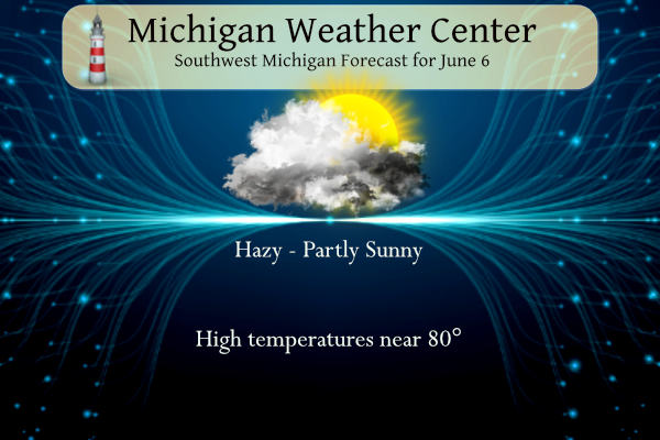
6 6 grrForecast Discussion
.SHORT TERM...(Today through Wednesday)
Issued at 340 AM EDT Tue Jun 6 2023

Outside of the Beach Hazards and Fire Weather threats described
below, very little weather to talk about in the short term period
which stretches from today through tomorrow.

Dry weather is expected to prevail through the short term with a
very dry air mass remaining in place. BUFKIT overviews have very
little moisture noted. Clear to partly cloudy skies are expected
with some high clouds moving through the area today. Highs will be
in the upper 70s to around 80 today, cooling slightly to the
middle to upper 70s on Wednesday.

.LONG TERM...(Wednesday night through Monday)
Issued at 340 AM EDT Tue Jun 6 2023

- Fair wx with seasonable temperatures through Friday -

A sfc high pressure ridge will continue to bring fair wx with temps
that will return to close to normal for this time of year mid to
late week. High temps will reach the 70s daily with mins mainly in
the 40s to lower 50s.

- Chance for showers this weekend -

A low pressure system and cold front will combine to bring a chc for
showers Saturday and Saturday night. The wx pattern looks to become
cooler and a little unsettled Sunday and Monday as a closed upper
level low parks itself over our region. Instability looks quite
limited (sb/ml cape values < 500 j/kg) but we do expect occasional
showers and isolated convection as a result of weak instability and
increased moisture and weak omegas.

As such it looks like a fairly significant wx pattern change will
finally take place late this weekend into early next week. High
temps may struggle to reach the lower to perhaps middle 70s
depending on the extent of cloud cover and pcpn daily.

Having said this a consensus blend of latest medium range guidance
does not suggest that this rainfall will be very significant or
significant enough to substantially alleviate the very dry
conditions across our area. In fact GEFS/ECMWF ensembles support
potential for only around a quarter of an inch of rainfall or less
from Saturday through Monday. Perhaps these values will gradually
trend upwards a bit given medium range guidance trends in terms of a
closed upper low potentially being over our region from Sun-Tue.
I love cool summers! Let’s keep this cool pattern rocking baby!
We need to start charging Canada for polluting our air with smoke haha! It’s a thick smoke today. This is some of the most smoke I feel I’ve ever seen in a given year. Hopefully we don’t add any more from our state as long as boneheads do what they are supposed to
There is so much smoke high in the air you can not tell if it is cloudy or not. The sun is shining thru so it should be smoke. Any way I just took a step outside and with low DP and the wind we do have it feel rather cool out there. At the current time there is filtered sun and 72 here in MBY. On the east side of the state there are a lot of low 60’s and in the up near Lake Superior 50’s are the rule.
Slim
It seems like this is one of the smokiest days we’ve had so far. The smoke odor is strong this morning.
I was thinking the same thing. Wow I can really smell the smoke today. It has been a weird day for sure…
We have an AQI of 132 currently. Which is quite high for west Michigan standards
It sure gets light out early. I think we are 1 minute from the earliest sunrise of the year. Definitely enjoying it!
Another (once again) beautiful day yesterday. It got up to 86 at my house yesterday. I have thoroughly enjoyed the very warm/hot pattern we were in. Looks like there could be a flip with cooler air and some rain showers. Just how much rain will fall is the question. Regardless we will take anything the farmers realllllllyyyyy need it.
There’s really not much to talk about weatherwise. If I had to come up with something, it’s nice to be able to have the windows open again.
The moon has been quite something to watch rise…
We opened the windows for a few mins at night…but since it is so dry the allergens are a bother.
We look to have a rather long period of “don’t have to” weather. The top weather events are 1. the lack of rain fall. 2. the smoke 3. and a lot of NE winds. Even thought it is the start of summer and in summer El Nino usually has very little effect we are in a pattern that would be more like a mid winter pattern with El Nino. Have to wonder how the winter will play out.
Slim
Like a broken record there was no rain fall yesterday. With a hazy but sunny day the H/L was 85/55. There was 79% of hazy sunshine. There were 0 HDD’s and 5 CDD’s The overnight low here in MBY so far has been 59 at the current time it is either cloudy or very hazy. For today the average H/L is 77/56 the record high of 95 was set in 1925 and the record low of 37 was set in 1958. The record rain fall amount of 1.82” fell in 1928.
Slim
Until Saturday it looks to stay dry with highs in the upper 70’s to around 80 and lows in the low 50’s to upper 40’s so it should average just a little below average. There looks to be a pattern change starting Saturday with a better chance of rain and that could hold into the start of next week and it looks to turn cooler as well with highs in the low to mid 70’s and lows in the upper 40’s to low 50’s.
Slim