Old man 2020 is gimping towards the finish line of a year which will remain in the minds of all as eerie and scary, to say the least. This is one we quickly want to put behind us, wipe the slate clean and do a do-over if that was at all possible.
On the positive side, the events of the past year have given us the strength and courage to face whatever may come our way in the new year. I am not one to face a new day with trepidation but rather the shock and awe of laughter and happiness as I dig into the depths of sorrow and heartache to gain a foothold on positivity in dire circumstances. Some may call me bold, others crazy. A smile goes a long way as do kind words and encouragement.
As we close the door on this year I challenge you to dig into it like a honey badger to find the love and positive achievements and all of those things which carried you across the finish line.
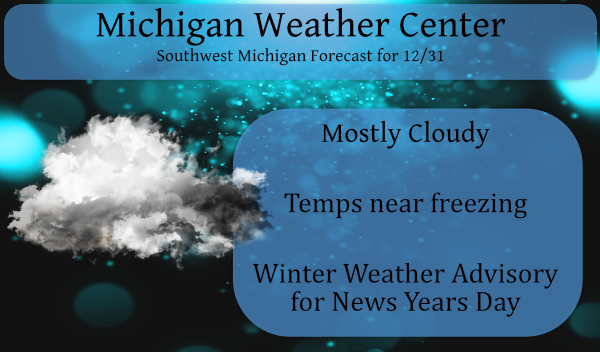
Skies will be mainly cloudy and it will be seasonably cold today. High temperatures will end up mostly in the upper 20s to lower 30s. The evening is forecasted to be dry. A winter weather advisory will go into effect tomorrow at 1 pm for another sloppy system coming our way. This looks to be an icing event mixed with some snow.
* WHAT...Mixed precipitation expected. Total snow accumulations
  of up to two inches and ice accumulations of around two tenths
  of an inch.

* WHERE...Portions of central, south central, southwest and west
  central Michigan.
-  A slight colder trend to the upcoming storm for New Years Day

The center of the storm is still down in NRN Mexico.  Guidance is in
relative agreement in lifting this system up into Southern
MI/Northern IN for Friday night. While there has been a slight
cooler trend to the models the associated wintry mix is likely to
lead to impacts. Overall though...the forecast will feature more
snow in the Muskegon to Grand Rapids to Alma area.

The onset of the precipitation looks to be roughly 19z to 22z from
south to north. The initially warm temperatures up around 925/850 mb
will act to support freezing rain and possibly sleet into the late
afternoon hours generally along and south of Interstate 96.  Further
north...models are showing temperatures at those levels going below
freezing in the afternoon so it may end up being a mainly snow event
there. The system pulls away Friday night so a transition to snow
should occur across southern zones as the column cools. Several
tenths of an inch of freezing rain are possible...especially south
of Interstate 96 with several inches of snow further north.  Trends
will need to be monitored closely.

- Another winter system possible for later Saturday night into
Sunday morning

The main mid to upper level trough in the Southwest U.S. will be
lifting out on Saturday. This feature will track through the
Southern Great Lakes and OH Valley later Saturday night into early
Sunday. There is some uncertainty as to how far north the
precipitation will make it into Michigan so we will still keep POPs
relatively low at this time. Being on the north side of the
storm...the main precipitation type is expected to be snow. Impacts
are possible though...especially if the storm and associated
precipitation shield trends north.
Todays January update from the CPC is guessing wet and mild for January.
https://www.cpc.ncep.noaa.gov/products/predictions/30day/
Slim
Beautiful!!! Happy WARM New Year!!
Great news – officially 78 more days of winter! Plenty of time to get hammered with cold and snow! Bring it n!
There looks like a major Sudden Stratospheric Warming event will take place. Not sure if the cold will come here or in Europe or Asia. Time will tell.
Slim
Bring it and the polar vortex! That would be awesome!
I got a real good work out last night. Around 7 PM the snowplow, plowed my road and left a huge pile of hard pack snow at the end of my driveway. I mean they were huge boulders of almost ice. I had to break them up and then try to move them out of the way. It sure was not fun for a old guy like me. I would have much rather they did not plow the road at all. At this time it is cloudy and 29 here at my house.
Slim
Been a pretty average week. Still below average snow about 2 feet! And more warmth coming into January.
Even with yesterday’s wet heavy snow fall of around 4” or so Grand Rapids will go into January with the 3rd lowest amount of snow fall for this late in the season. At this point there has been a total seasonal snow fall here at Grand Rapids of 5.3” Looking back only 1913/14 with 3.6” and 2011/12 with 5.2” have had less. As for December (unless we get some today) will end up at 4.9” and that will be good for the 11th least amount for any December.
Slim
Wow 3 winter weather advisorys in the last week so much for the Winter that wasn’t keep the snow piling up …Happy New 2021 ..INDY
Incredible stretch of winter weather! Rock n roll is here too stay!
Well one big positive heading into the new year would be the CPC maps for the coming weeks. The deepest red colors are stamped right over this area! January rain is always a great outlook!
Get ready – the snow just keeps coming! Bring it!
I haven’t shoveled slop that heavy in a looong time. I didn’t even attempt the snow blower… My back/arms are protesting this morning. I think I would have preferred a foot of wind-blown powder over the mess we had to move yesterday.
Ditto on putting 2020 behind us and hopes for a better year ahead!
Yes, give me foot of cold, wind driven snow any-day!