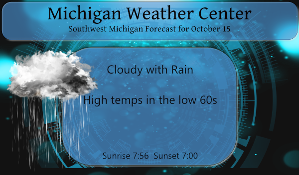
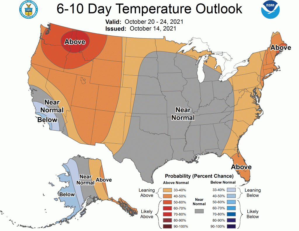
For the first time in a long time, we are moving into a period of near-normal temps in most of the central U.S. and much of Michigan through at least the 24th. We have been spoiled with the extended summer so this may seem like a shock to some but a sigh of relief for others. Normal highs are around the low 60s for SW Michigan. I am still not seeing any frost events over the next 10 days.
Yesterday we reached 71° with a low of 54°, rainfall was less than a tenth of an inch.
We will remain in our wet pattern through the first half of the weekend then drying out through mid-week next week, not seeing any 70° temps through the short term. Fall colors are lagging behind this year – the sunny dry spell with cooler temps should remedy that over the next couple weeks.
The CPC released an update yesterday on the ENSO El Nino conditions – their thoughts are a moderate La Nina is favored for the winter months. I hate to predict a cold, snowy winter as predictions are pointing this year with the previous busts over the past couple years of disappointing snowfall. It seems as soon as the words are committed to the blog the winter is jinxed.
Forecast Discussion
- Low moving into Eastern Great Lakes brings rain today

Low pressure riding up the front that passed through our area
yesterday will bring rain showers today. Highest chances for rain
will be over our south and southeast towards AZO/BTL/JXN and LAN.
Much lower chances exist up towards Ludington where only scattered
at best precipitation should occur. Very limited instability
exists today with the low passing off to our east so any chance at
thunder is very small. If it occurs it would be towards JXN this
afternoon. HREF precipitation forecast would suggest 0.10 or less
through 800am Saturday for Ludington and as much at 0.75 inches
locally in our southeast towards JXN.

- Upper trough associated rain expected tonight

Tonight the upper trough will be moving through and we will see
additional scattered showers. The precipitation associated with
the low is currently moving through Indiana. The precipitation
with the upper trough that will come through tonight is out in the
plains states IA/NE/MO. Precipitation tonight will be much lighter
and scattered.

- Lake effect rain showers Saturday into Saturday evening

Delta T`s over Lake Michigan tonight, a proxy for low level
instability, will reach the upper teens C. This is significant
instability that will produce steep low level lapse rates. The
3km NAM reflectivity progs show the activity the best with
scattered showers pouring off Lake Michigan all day on Saturday.
Stronger winds will carry these showers through the entire
forecast area. Breezy conditions with showers and colder
temperatures will certainly make it feel like fall. High
temperatures will not get out of the 50s.

Deeper moisture begins to lift out of the area Saturday evening,
so we should see showers begin to taper off as we head towards
midnight Saturday night. Many times lake effect rain showers and
for that matter snow showers continue longer than we expect. So,
would not be surprised to see them go through the night on
Saturday night. Anything Saturday night though should be quite
light.

- Dry Sunday through Tuesday

A dry period in the weather is expected from Sunday through at
least Tuesday. This is due to high pressure both at the surface
and aloft sliding through the Great Lakes. At this point we even
expect Wednesday during the day to remain dry. Temperatures should
rebound back into the upper 60s in many areas for early next week
which is actually above normal, just not as warm as we have been.

- Chances for precipitation next Wednesday night/Thursday

The next system to bring precipitation to the area moves in next
Wednesday night and Thursday. The trend in the models is slower
with this system as last night they were bringing in rain on
Wednesday. Showers are expected beginning Wednesday night. Cooler
air wrapping in behind this system will bring lake effect rain
showers back into the picture Thursday night.


What its raining again.. Talk about a wet Fall …Soon it will be all snow woo wooo …INDY
Bring it!
Funny the forecast is for mostly cloudy with showers. In fact my point forecast shows 80 to 90% cloud cover all day! Currently it is completely sunny with temps around 60 degrees! Incredible!
It really is nice outside!
It’s been cloudy all day here with periodic sprinkles.
Not weather, but I know several of us here enjoy feeding the birds. Thanks to our lovely governor we could now be charged with a felony???
https://www.audacy.com/wwjnewsradio/news/local/feeding-your-backyard-birds-a-potential-felony-in-michigan
This is only if you are saying you are feeding the birds but really are baiting the deer.
That is so wrong and not even sportsmanship. Deer as a rule are night time feeders so you can’t shoot them anyway. So go ahead and feed the birds we do. I never have seen a deer in my yard.
We have had deer at our feeders in the past during the Winter, but the last several we really haven’t had any snow so they haven’t been looking for food. We don’t do it to bait them, but if they’re hungry they’ll come looking.
Sports note: the Lions are the worst pro team ever and no change in sight!
Looking longer range (not very accurate) it looks like we might have a chance of lows in the upper 30s around 10 days out. But I agree, the next 10 days look unlikely for any frost events (except maybe Monday in low lying areas to the north).
Also the leaves have still barely changed here. I’d have to imagine that is due to the record warm low temperatures. Without consistent lows in the 38-48 range it is probably hard to get the leaves changing.
Here is some information on why leaves change color.
https://wonderopolis.org/wonder/why-do-leaves-change-color-in-autumn
and
https://www.zmescience.com/ecology/autumn-leaves-color-432432/
Slim
One of the issues I have with CoCoRahs is that the rain fall reports are mostly due in at 7AM (in the fall and winter I am many times late as I do not get up all the time before 8 or even 9 AM) while the official end of the day reports are taken at 12 midnight. And of course it is hard to match the two up. My report for today is 0.12″ At this time it is clear and 52 here at my house. So far this month all 14 days have been much warmer than average… Read more »
I for one have no problem with the warmer temperatures we have had since the start of meteorological fall in fact I wound not have a issue if it stay as warm as it has been all year long.
Slim
Me either. It’s been pretty nice having it on the warm side.
Around normal sounds like relief to me! 5 or 6 months of this humidity is not pleasant working in at all. Yesterday was yet another double digit above average day. What a crazy long streak!