Yesterday we reached 70° after a morning low of 29.5°. Our low this morning was 31°.
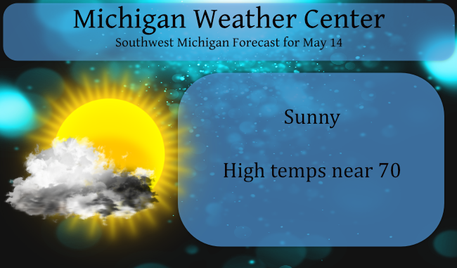
We are closing in on the midpoint of May and we have only received a meager .29 of an inch of rain. Rain chances today are pretty much zero with lots of sun and warm temps near 70° with high pressure continuing to dominate our weather.
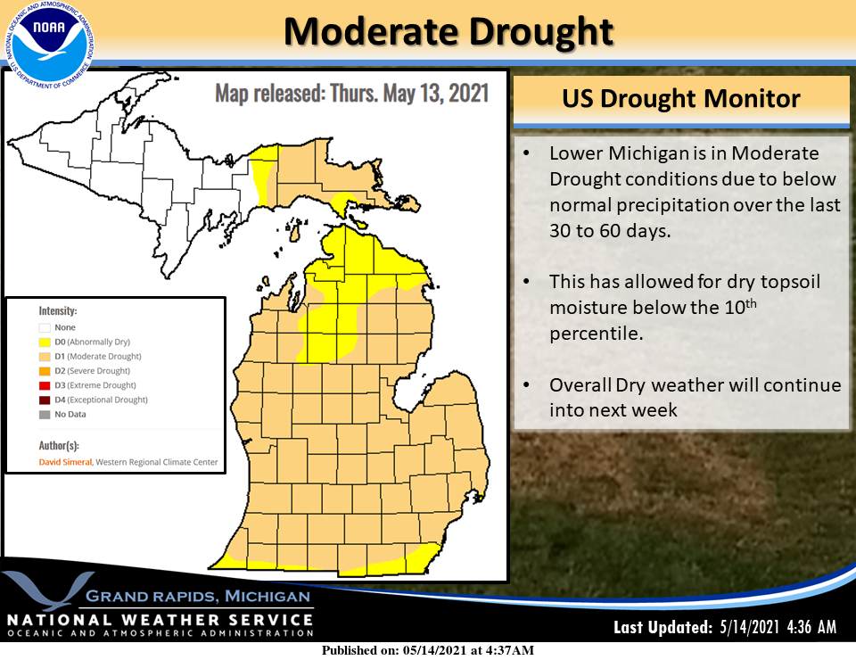
Precipitation since March 1st has been 4.15 inches below normal. That has allowed for Moderate Drought conditions along with topsoil moisture below the 10th percentile. Last year we had 7.57 inches of precipitation. Since January 1st we are 5.58 inches below normal.
Rain chances increase slightly over the weekend however I don’t have expectations of more than a hundredth of an inch or so. Forecast models keep pushing better rain chances further into next week.
Forecast Discussion
- Cold temps this morning with fair weather into Saturday

The overnight lows that have been at or below freezing the past
week look to finally be in the rear view mirror after this
morning. Overnight lows will drop to the low 30s but will quickly
increase as high pressure continues to dominate the weather
pattern today into tomorrow. A weak upper level trough will ripple
through the northern Great Lakes late today. however surface and
mid level high pressure will stifle any instability and any cloud
formation. Expect warming temperatures back to around normal with
highs in the low 70s.

- Small chance for Precipitation Saturday into Sunday

Overnight temps into Saturday morning will be in the upper 30s to
low 40s and clouds will be increasing as a negatively tilted upper
level wave will extend from the Southern Canada, through the Upper
Midwest and through SW Michigan. That short wave Saturday into
Saturday evening will propagate through lower Michigan with a
chance of precipitation. The best chances will be along the
lakeshore in far SW Michigan. However given the dry lower levels,
this is more of an opportunity for virga with only light
accumulation of precip possible.

- Overall Dry pattern continues into next week

Michigan has been listed in D1 drought status which is a Moderate
Drought. These conditions will continue through early next week.
There will be multiple chances for precipitation next week. The
first will be a weather system that will be moving through the
central US early in the week. The warm front associated with this
has large amounts of moisture associated with it. However, downsloping
winds in the upper levels should keep this boundary to the south
of Michigan through mid next week. There are some members of the
models that drift the boundary into Lower Michigan as far north
as the I-94 corridor on Tuesday but trends show we should remain
dry until the high pressure is finally overtaken by and long wave
trough Thursday into Friday next week.
We just had 10 straight days in May with low temps in the 20’s and 30’s! This must be some sort of record! Incredible May cold! Wow, wow, wow!!!
Tough call but I think I would pick hotter temps over humidity. Humidity just wipes you out while heat without humidity you can at least cool down at times.
Goodbye Rocky, we will hear from you again in November! As for the rest of us, looking like 70’s and 80’s as far as the eye can see! Looks like I’ll be coming back home at just the right time! BRING IT!!
https://weather.com/weather/tenday/l/b4ea0280869baa46799dc75eacef8904785ec43ad2f6fb098355fbc208a55e2c
While it is only May and way too early to tell if it is going to stay dry for the whole summer time but in 1987 and 1988 it was very dry and there were some really hot days. In 1987 at Grand Rapids there were 21 days of 90 or better the high for the year was 96. In 1988 there were 37 days of 90 or better and 14 of 95 or better the official high for the year was 100. There were 14 days with highs of 95 or better. Last year there were 17 days of… Read more »
Barry and I have had this discussion before. We remember the summer of ‘88 very well (or maybe not 😵🥴).
Class of ‘88! 🤘
Here comes the heat! This drought makes me think we’re in for another hot summer!
It could. Still too early to say for sure. But we could have some hot days but a chance of lower humidly then in some of the more recent years. We shall see.
Slim
I would imagine (if this drought doesn’t end soon) that this summer could have some very warm days. I haven’t checked soil moisture in the corn belt but I understand a lack of soil moisture can also contribute to more severe heatwaves in the center of the country which will probably affect our area too.
In the meantime it looks really pleasant the next couple of weeks. Have to enjoy it before the summer weather arrives.
Here is the latest map on the drought
https://droughtmonitor.unl.edu/
Slim
We had some fog here at sunrise. It made for a pretty sight. It’s been nice to be able to open the windows the past few days.
Happy Friday … Spring has finally arrived weather wise get outside and enjoy this beautiful day … PARTY time …INDY
Stayed above freezing here all week, looks like it did officially at the airport last night as well. It is crazy dry now. The muck fields along Chicago Drive have had their sprinklers running all week. Can’t remember the last time they had to irrigate in early May already. Problem is the creek they pump the water out of is almost nonexistent.
At Holland it has gotten down into the low 30’s on 5 of the last 8 nights with the lowest reading being 31. At Muskegon the same 5 nights have been the same with the coldest night getting down to 29. At Grand Rapids officially at the airport they have gotten also have been in the low 30’s on 5 nights with the coldest officially being 33. Here at my house I have gotten down into the upper 20’s on two nights with the coldest being 28. As for it being dry that could become a big issue if it… Read more »
I now have two outdoor temperature sensors, one is in a spot that is some times colder than the other. The overnight low at the colder one was 34 (33.7) and at the warmer one it was 37 (36.8) it looks like the official low at Grand Rapids overnight was 37. At this time it is 40 (on both) here with clear skies. It should be noted that once there is some good air movement they both are generally the same reading.
Slim