Yesterday we had a very brief period of snow with mainly rain throughout the day. We have a rather large pond of water here on our dead-end road with the rest becoming a mud run. A mix of rain and snow showers is expected across southern lower Michigan this afternoon and evening with an isolated thunderstorm possible as well. Southern lower Michigan is in the general thunderstorm outlook area:

Grand Rapids Forecast
3 26 grrLansing Forecast
3 26 lanKalamazoo Forecast
3 26 kzoForecast Discussion
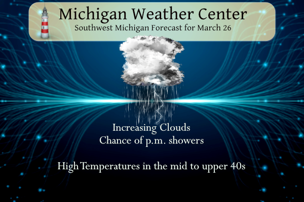
...Chance of rain/snow,  perhaps some thunder later today...

Water Vapor imagery shows a compact short wave over eastern Nebraska
moving toward Michigan and will likely produce precipitation across
the southern cwa later today. Models don`t depict much of a surface
low with it, but they do show some dynamics that catch our
attention. The Nam 3km shows 100-200 j/kg MUCAPE in the 23z-04z time
frame south of I-96 which might be good enough to support a
thunderstorm or two, especially over the southern cwa. The 00z GFS
shows lapse rates...~7 C/km...during this time frame. The 06 HRRR
shows weak instability over the southern cwa, but much more so over
northern IN. There will likely be enough juice in the atmosphere to
produce a few storms, but stronger storms will remain well south of
the cwa.

This will be mostly a light rain event that begins late afternoon,
mainly south of M-46. The rain will likely mix with some wet snow
later this evening before ending after midnight.

...Light snow possible Wednesday...

Weak low pressure moving across southern Canada Wednesday will push a
cold front through the cwa. This will likely lead to a brief period
of light snow, possibly mixed with rain. This system is somewhat
moisture-starved and so QPF is generally less than a tenth of an
inch.

...Stronger system late in the week...

ECMWF/GFS show a much more dynamic system developing late in the
week, courtesy of a short wave crossing the Rockies and inducing a
lee side low. As the upper wave moves east, strong southwest flow
will develop and that`ll help to pull moisture northward and push
surface temperatures to around 60 across the southern half of the
cwa. The models show this low riding northeastward along a southward
moving cold front such that we may be looking at a prolonged period
of moderate rainfall Friday. The GFS is a bit farther north with the
track of the low than the ECMWF and shows very steep...8.0
C/km...lapse rates just to the west and a 60kt LLJ that moves into
the southern CWA along with LI`s that fall below 0c. Thus Friday and
Friday night we may be looking at more thunderstorms, a few of which
may contain strong winds.
Got my trip all planned to Mississippi. I’d like to deliver some stuff to the people who are struggling. I see there is another moderate risk again from Louisiana through southern Mississippi to Alabama.
Good luck!
GR is now approaching 110 inches of snow this season! I see the word snow mentioned at least 3 times in the GR forecast! The winter that keeps giving! I love long winters!
Check out these great ski conditions! I am on my up to Boyne! 6 to 8 inches of fresh snow! Who wouldn’t want to ski in late March with fresh snow? What a fantastic very snowy winter! Wow, the wow, WOW!
https://www.boynemountain.com/current-conditions
So much for the big snow storm yesterday! It’s always a good week when NWS mentions 60 degrees and big thunderstorms.
There used to be lots of names I remember from Bill’s Blog: fixxxer, DF, and many others
It sure is nice out this morning. Calm winds and sunshine with birds chirping. Definitely a big difference from yesterday
A quick thank you to Indy. Yesterday I asked about the old poster from the east side of the state and it looks like it was one of two Yes Travis. Indy thinks that Travis lived in Oxford and that maybe the case. Anyway at that time that Travis or whoever used Flint as his home bass as at that time Flint was warmer compared to average then other areas. Anyway thinks Indy.
Slim
It is a very frosty morning here in MBY the current temperature with all that frost is 26. Yesterday the official H/L at GR was 37/32 there was 0.89” of precipitation and 0.2” of snow fall. There was no sun. For today the average H/L is now up to 49/30 the record high of 77 was set in 1976 and the record low of 6 was in 1996. The most snow fall of 10.2” fell in 1970. Last year the H/L was a cool 34/25 and there was 0.5” of snow fall. The next week looks to be on the… Read more »
Nice to see the sun this morning. It was a washout yesterday. It rained pretty much nonstop yesterday. My wife is out of town so our son and I spent the day together. It was nice to have that one-on-one time.
I reviewed the comments from yesterday. Slim, you asked about Rob Dale. Last I heard, he is still in this area working in emergency management for Homeland Security.
Enjoy the sunshine, friends, and make someone smile. 😀
Thanks for the update on Dale
Slim