March/meteorological Spring
Well, this is the last weekend of not only February but meteorological winter. This winter will end up being one of the warmest on record at Grand Rapids even with almost 90” of snow fall (for the season). As we march forward to March and spring on Wednesday here is some information on not only March but also meteorological spring.
In March the average mean at Grand Rapids is 35.7 with the average H/L starting the month at 38.2/22.7 on the 1st and ending the month at 51.0/31.5 on the 31st On average there is 2.39” of precipitation of that on average there is 7.6” of snow fall.
For March the warmest March was March 2012 when summer like weather came in that March only to see major crop damage in April of that year. The mean that March at Grand Rapids was 50.7 the highest temperature that March was a unbelievable 87 that is of course the record high for any March day. In total there were 5 days that highs in the 80’s and of course the trees leaves had all came out. The coldest March was in 1960 with a very winter like mean of 23.9 There were 14 days that did not get out of the 20’s for highs and there were two nights that had lows below 0. There was 13.2” of snowfall and there was 4” or more snow on the ground all the way up to March 26th. The all time record low for March is -13 on March 8th 1943. The record snow fall on 36.0” fell in 1965. Only 1910 did not have any snow fall.
For meteorological spring the mean average is 47.5 and there is on average 10.38” of total precipitation and 9.6” of snow fall. The warmest spring was in 2012 with the help of that March with a mean of 54.1. The 2nd warmest spring was in1977 with a mean of 52.6. The most spring snow fall amount of 41.4” fell in 1965 in 1945 only a trace of snow fell.
I will do a met winter summery next week. The AWSSI is a tool that can be used to estimate how severe winter conditions are at a location based on how conditions have been in the past. At Grand Rapids the current value is 488 for a borderline moderate/mild winter and at Lansing the value is 346 for a mild winter season. Across the eastern US most locations have had a mild winter season. In Michigan only Marquette and Ironwood seem to have had a average winter season. But at Marquette with a value of 1452 is average to the west at Herman a value of 1625 is mild and further west at Duluth a value of 1570 is severe. So the tool is location dependent as to what kind of total weather is mild, moderate, average or severe.
https://mrcc.purdue.edu/research/awssi/indexAwssi.jsp
Some fun information. Based on statewide averages, our state ranks as the sixth snowiest in the Union. On a list of snowiest U.S. cities with populations greater than 100,000, While this has been a “mild” winter Michigan none the less has the most with four cities in the top 25; Grand Rapids is highest at number four. Only the cities of Syracuse and Rochester, New York, and Anchorage, Alaska, beat out G.R. The small Upper Peninsula town of Calumet is the snowiest place in Michigan with a yearly average of 187.4 inches and a record total of 390.4 inches set during the winter of 1978-79
https://goldensnowglobe.com/current-top-10-snowiest-cities/
The official H/L yesterday at Grand Rapids was 29/22 there was a trace of snow fall. There was 1” of snow/ice on the ground (here at my house there is just over 1.5” of snow/ice on the ground) and yesterday had 241 minutes of sunshine good for 37% The overnight low here in MBY was 23 and there was around a half inch of new snow fall. At the current time there is some light snow falling with a temperature of 25. For today the average H/L is now up to 37/22. The record high of 61 was set in 1976 and the record low of -14 was set in 1950 the record snow fall amount of 8.1” fell I 1935.
DISCUSSION
(TODAY THROUGH NEXT FRIDAY)
ISSUED AT 304 AM EST SAT FEB 25 2023
– LIGHT SNOW EARLY THIS MORNING –
A SHORTWAVE WILL COMBINE WITH FAIRLY STRONG MID LEVEL
FRONTOGENETICAL FORCING NEAR TO SOUTH OF I-96 TO BRING LIGHT
SNOW THROUGH THE EARLY MORNING HOURS TODAY. LIGHT SNOW
ACCUMULATIONS OF AN INCH OR TWO ARE EXPECTED ACROSS MUCH OF OUR
AREA WITH RELATIVELY HIGHEST AMOUNTS IN THAT RANGE OCCURRING
WHERE MID LEVEL FGEN FORCING IS STRONGEST/MOST PERSISTENT.
TRANQUIL WX IS FCST FOR LATE MORNING THROUGH SUNDAY AFTERNOON AS
RIDGING BUILDS IN.
– MESSY SYSTEM LATE SUNDAY NIGHT AND MONDAY –
STRONG SE TO SOUTHERLY FLOW WILL RESULT IN INCREASING MOISTURE
ADVECTION SUNDAY NIGHT OUT AHEAD OF A STRONG LOW PRESSURE SYSTEM
MOVING EAST FROM THE CENTRAL PLAINS STATES. A WINTRY MIX OF PCPN
WILL LIKELY DEVELOP EARLY MONDAY MORNING DUE TO STRONG ISENTROPIC
LIFT. THERMAL PROFILES PRIOR TO 12Z MON COULD BE SUFFICIENTLY COLD
ENOUGH NEAR THE SFC AND ALSO DUE TO DYNAMICAL COOLING EFFECTS
AFTER PCPN BEGINS FOR A VERY BRIEF PERIOD OF -FZRA OVER OUR
SOUTHERN FCST AREA. THIS BEFORE MODERATING SUFFICIENTLY ENOUGH
FOR RAIN NEAR TO SOUTH OF I-96 FOR THE VAST MAJORITY OF THE
EVENT.
NORTH OF I-96 WE EXPECT A WINTRY MIX OF SNOW… SLEET AND
FREEZING RAIN MONDAY. THERE IS POTENTIAL FOR SIGNIFICANT WINTER
WX IMPACTS WITH A POTENTIAL SWATH OF A QUARTER TO NEAR A HALF AN
INCH OF FREEZING RAIN NORTH OF THE I-96 CORRIDOR AND A SWATH OF 3
TO 6 INCHES OF SNOW MAINLY NORTH OF A LINE FROM BIG RAPIDS TO MT.
PLEASANT. MOST OF THE PCPN WILL LIKELY FALL FROM EARLY MONDAY
MORNING THROUGH EARLY MONDAY AFTERNOON. STRONG WINDS ARE EXPECTED
ON THE BACK SIDE OF THIS DEPARTING SYSTEM MONDAY NIGHT INTO
TUESDAY.
– ANOTHER SYSTEM FOR MIDWEEK –
ANOTHER LOW PRESSURE SYSTEM WILL MOVE QUICKLY EAST FROM THE PLAINS
STATES AND BRING OUR AREA A LIGHT WINTRY MIX OF PRECIPITATION
WEDNESDAY. THIS SYSTEM WILL NOT BE NEARLY AS IMPACTFUL AS THE
MONDAY SYSTEM HOWEVER.
Detailed Forecast for Grand Rapids
Today
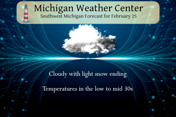
Snow likely, mainly before 7am. Cloudy, with a high near 34. Light and variable wind becoming west southwest 8 to 13 mph in the morning. Chance of precipitation is 60%. Total daytime snow accumulation of less than a half inch possible.
Tonight
Mostly cloudy, then gradually becoming mostly clear, with a steady temperature around 31. Breezy, with a southwest wind 13 to 21 mph, with gusts as high as 31 mph.
Sunday
Sunny, with a high near 39. West wind 10 to 15 mph, with gusts as high as 23 mph.
Sunday Night
Freezing rain likely after 2am, mixing with rain after 5am. Increasing clouds, with a low around 26. Light and variable wind becoming east 10 to 15 mph in the evening. Winds could gust as high as 23 mph. Chance of precipitation is 60%. New precipitation amounts of less than a tenth of an inch possible.
Monday
Rain. The rain could be heavy at times. High near 43. Windy, with an east wind 23 to 31 mph, with gusts as high as 41 mph. Chance of precipitation is 100%.
Monday Night
Rain, mainly before 8pm. Low around 33. Breezy. Chance of precipitation is 80%.
Detailed Forecast for Holland
Today
A 40 percent chance of snow before 7am. Mostly cloudy, with a high near 35. Light and variable wind becoming southwest 5 to 10 mph in the morning.
Tonight
Partly cloudy, with a low around 29. Breezy, with a southwest wind 13 to 20 mph, with gusts as high as 30 mph.
Sunday
Sunny, with a high near 38. West northwest wind 6 to 14 mph, with gusts as high as 22 mph.
Sunday Night
Rain after 1am. Low around 27. Light east wind increasing to 13 to 18 mph in the evening. Winds could gust as high as 29 mph. Chance of precipitation is 80%. New precipitation amounts between a tenth and quarter of an inch possible.
Monday
Rain. High near 45. Windy, with an east southeast wind 25 to 30 mph decreasing to 18 to 23 mph in the afternoon. Winds could gust as high as 40 mph. Chance of precipitation is 100%.
Monday Night
A 40 percent chance of rain before 1am. Mostly cloudy, with a low around 33. Windy.
Detailed Forecast for Lansing
Today
A 40 percent chance of snow before 7am. Mostly cloudy, with a high near 37. South southeast wind 6 to 11 mph becoming west in the afternoon.
Tonight
Partly cloudy, with a low around 28. Breezy, with a west southwest wind 9 to 14 mph increasing to 15 to 20 mph after midnight. Winds could gust as high as 30 mph.
Sunday
Sunny, with a high near 43. West wind 10 to 16 mph, with gusts as high as 24 mph.
Sunday Night
A chance of freezing rain between 1am and 4am, then a chance of rain after 4am. Increasing clouds, with a low around 28. West northwest wind 5 to 14 mph becoming east southeast in the evening. Chance of precipitation is 50%.
Monday
Rain, mainly after 7am. High near 44. Windy, with an east southeast wind 25 to 30 mph decreasing to 16 to 21 mph in the afternoon. Winds could gust as high as 41 mph. Chance of precipitation is 100%.
Monday Night
A 30 percent chance of rain before 1am. Cloudy, with a low around 33. Windy.
This mornings power outage map
https://www.consumersenergy.com/outagemap
Chuck up another beautiful winter day in late February definitely not them 50’s from that was predicted on here months ago for the end of February try snowy and 29 out in my hood .. Looks like March could be colder and snowy also great scotty everyone….INDY
I am heading over to the Muskegon Winter Sports Park! Snowshoeing, ice skating etc! Who wouldn’t love cold and snow this time of year? Rock n roll will never die baby!
Let the good times roll!
Two more ice storms next week? There’s not enough good luck to go around 🙁 Try to prepare for the damage.
What you mean it is still winter outside?
Not to be negative…but I saw that too. It could be another interesting week!!!
Really?? When? Thanks.
Been a wild winter and GR is still a huge 20 inches above normal for snowfall! We have seen blizzard warnings, ice storm warnings, winter storm warnings, etc, etc!
Thanks Slim. Hard to believe met Spring already in a few days. Most of the past 2 months have already felt like Spring. It will be interesting seeing the stats for met Winter as even Gr is now below average for snowfall like most surrounding areas.
Check out the March out look maybe hard for some to see it and take it all in ..BLUE!! Lol… INDY
They will say; winter is dead, winter is over, no sign of any snow coming! Too funny!
If the latest 3-4 week outlook is right spring temps are on hold for a while. Shows a great chance of below average temps.
Hoping that changes. I am ready for spring weather
It looks like snow country will be seeing more accumulating next week! Skiing till April again! Wow to the wow! Winter is awesome! Cold and snow rules.
The snow Just keeps coming! I Picked up another inch of fresh snow! It looks like another great winter weekend! I could care less what the winter severity index says! This has been a wild winter with above normal snowfall! Keep it rocking! I love it!
Woah an inch of rain upcoming this Monday. That can’t be good for winter activities!
Yesterday WOOD had the end of their 8-day forecast 27 degrees and snow. Today, it’s 42 degrees. They seem to do that frequently.
Everything is covered in a blanket of white this morning. As many others, I prefer warmth over cold. With the winters continuing to weaken, I really only dislike Jan and Feb. That said, I am looking forward to flipping the calendar to March.
Have a great Saturday my friends and remember, make someone smile. You never know what that person is going through. It will make them feel good and do the same for you.
Same to you, Mark : < ) I enjoy the positive energy that you impart. I send up a small prayer every morning that I may be put into a situation that day to be able to help someone, in some way, no matter how small.
Another quarter to a half inch of ice Monday? Yikes. This time north of I-96. I guess freezing rain isn’t done with Michigan yet.