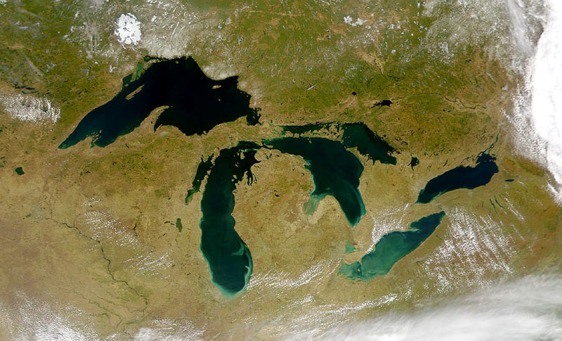
I am taking a look at the Great lake water temperatures today which is another factor in a winter forecast for Michigan. When cold Canadian air rolls over the warmer lake waters it can created lake effect snow or rain. When I am asked how much snow we will get I say it depends on which way the wind blows. This is the main reason non-synoptic events can be quite variable over the state.
When I lived near Holland we could have blizzard conditions. Moving eastwards towards US131 the snow would decrease to the point that areas east of the freeway would have next to nothing and have clear skies. Our lake effect could never compare to the winter nor’easters I lived through in the central highlands of Maine. Similar to lake effect but moisture is swept in from the Atlantic ocean hitting the colder higher altitudes of the mountains where I saw amounts of a foot an hour of snow.
In November of 1972 we had a nor’easter dump 5 feet over night. Schools never closed out there in the 70’s and the old adage ‘when I was a kid we had to walk two miles to school in knee deep snow held true (until you got to the road anyway). Maine doesn’t have the highway system we do around here so the snow is no problem for them. I remember very well the blizzards here in Michigan in the late 70’s burying everything for days on end, nothing moved except snow mobiles.
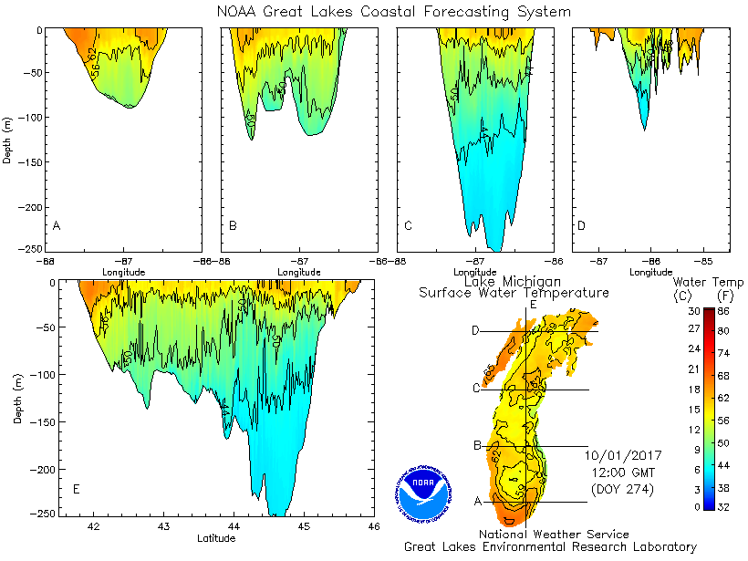
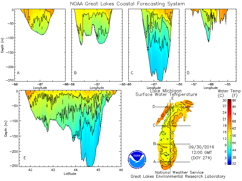
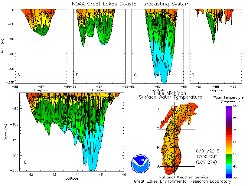
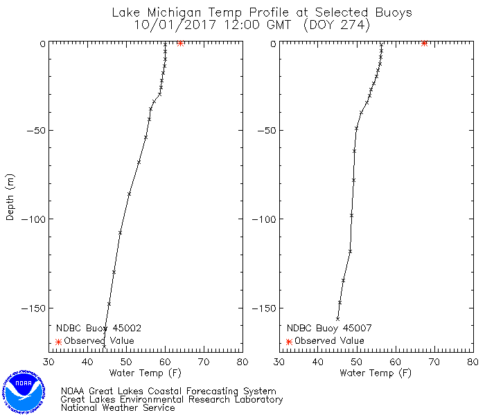
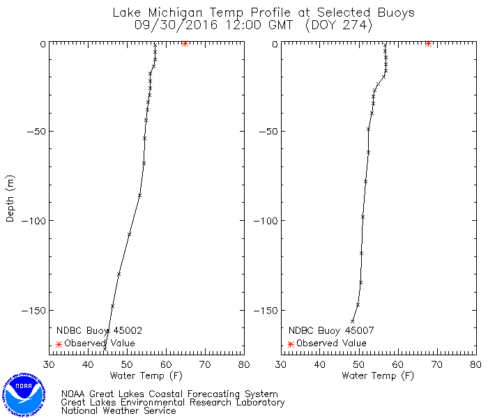
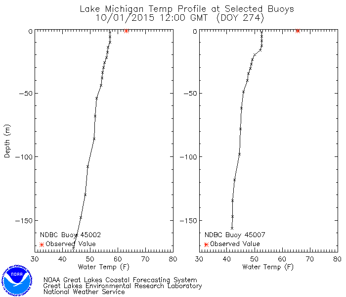
The first three maps are the current surface temperature of the Great Lakes compared to 2016 and 2015. The recent heatwave has caused the temperatures to rise. The second set of maps are the zonal temperature depth maps. The third set are the buoy charts.
[columns] [span4]
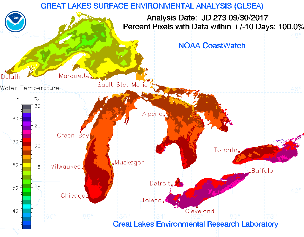
October 1 2017
[/span4][span4]
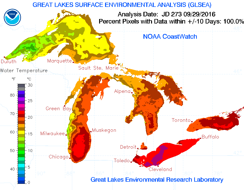 September 30 2016
[/span4][span4]
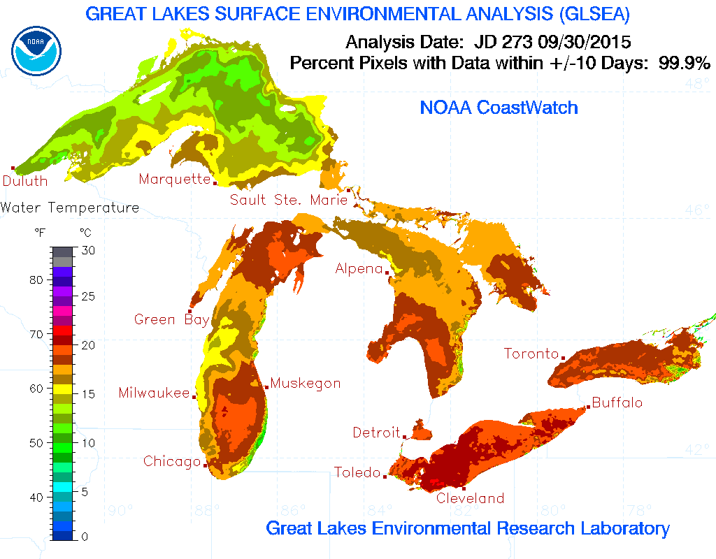 September 30 2015
[/span4][/columns]
[columns] [span4]
 2017
2017
[/span4][span4]
 2016
2016
[/span4][span4]
 2015
2015
[/span4][/columns]
[columns] [span4]
 2017 Current
[/span4][span4]
2016 Sept 30
[/span4][span4]
2015 Sept 30
[/span4][/columns]
We have had a lot of wave action this summer and fall to stir up the lake and mix the water compared to the last couple years. Below are the current Lake Superior water temperatures, definitely our coldest lake…
[columns] [span4]
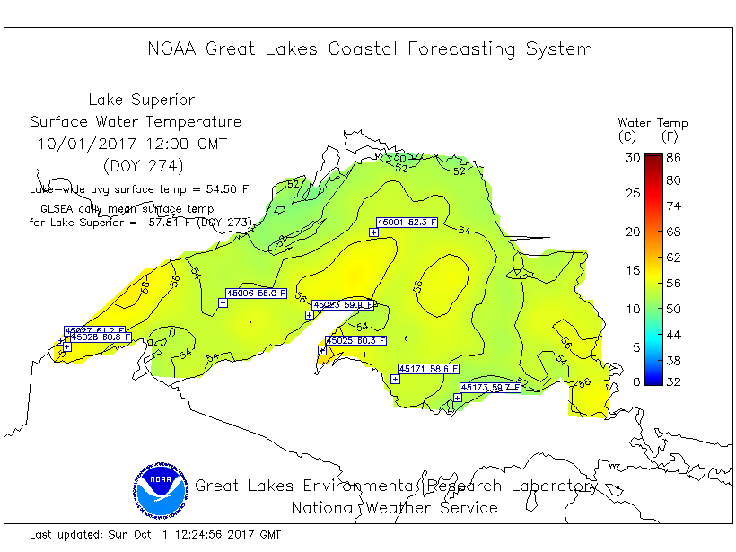
Surface Temperature
[/span4][span4]
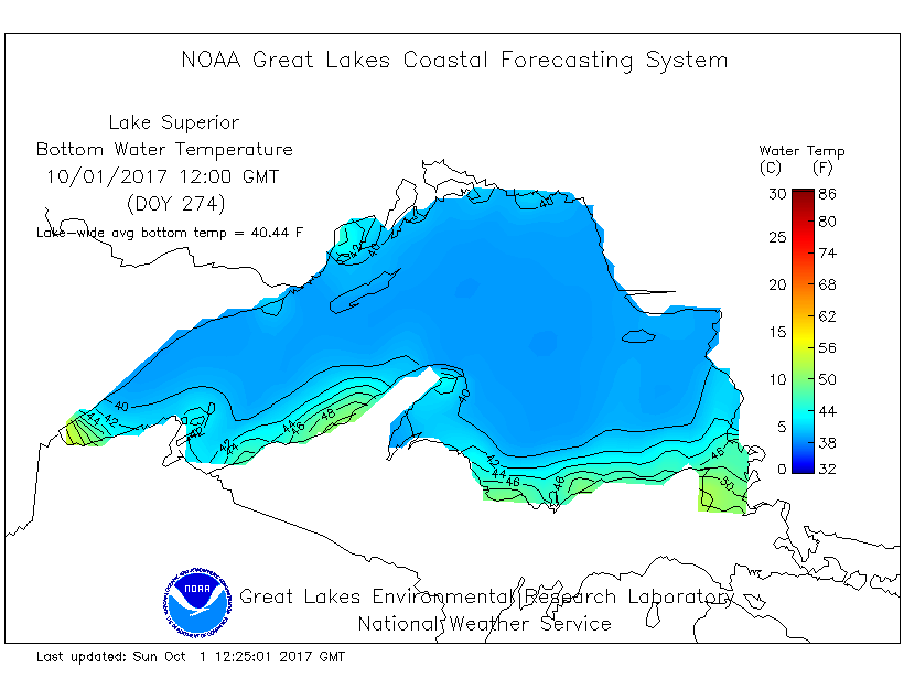
Bottom Temperatures
[/span4][span4]
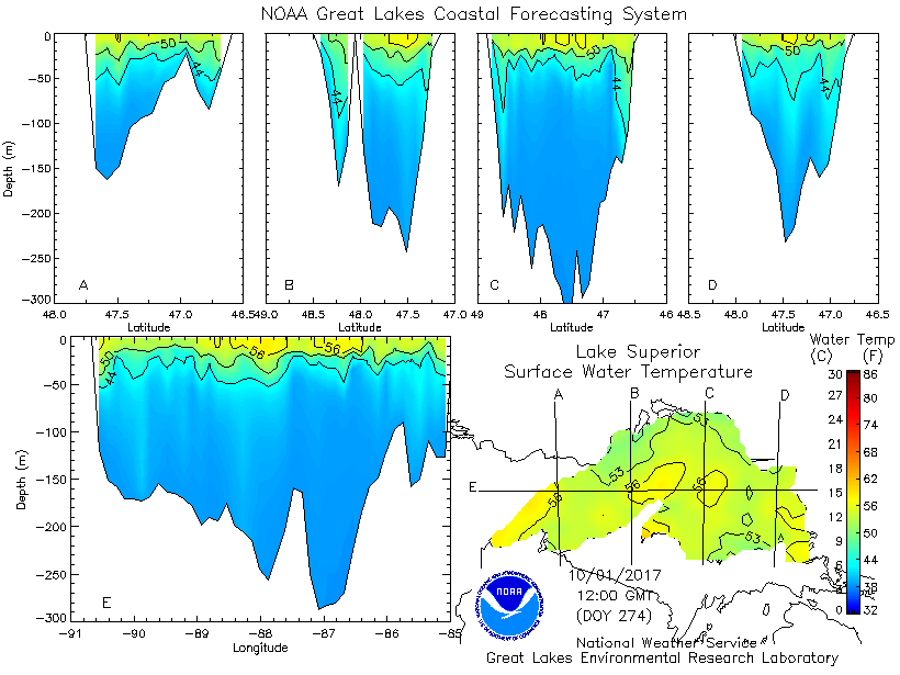
Depth Temperatures
[/span4][/columns]
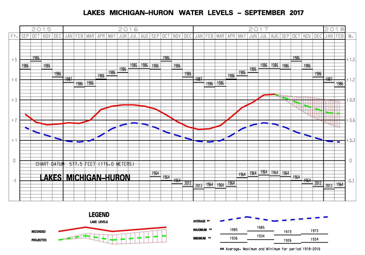
Water levels are forecasted to continue to go down in Lake Huron/Michigan – below is the chart with past – current and forecasted conditions. (click to enlarge)
81 here today after a forecasted high of 73. What’s tomorrow going to bring, another 90 degree day? Pretty hot out in the yard trying to clean up leaves and apples!
Here is some information on how dry September 2017 was
This September was the 3rd driest in Grand Rapids recorded history. It now has been much dryer for 3 months in a row. Here is the top 5 driest Septembers in Grand Rapids
1. 1979 Trace
2. 1940 0.65”
3. 2017 0.66”
4. 2004 0.67”
5. 1956 0.68”
As for the next winter snowfall well 1979 48.5” 1940 54.7”, 2004 81.7” and 1956 60.0” so for snow fall it looks like past very dry September’s at Grand Rapids did not have snowy winters in 3 out 4 past very dry September’s were NOT that snowy.
Slim
Nice info on the lakes water temperatures. There are a lot of influences that go into how the winter will end up. I have mentioned before that on average a pattern will change ever 60 to 90 days we have now been a dry pattern for about 3 months so that could change soon. Of course we have been in a warm pattern for almost 2 years so not sure when that will change.
Slim