Happy Labor Day, the day set aside for all the mothers who go through excruciating labor to bring forth our wonderful children – just kidding, however, we should have a day set aside for this – perhaps Mothers Day part two. God bless all the mothers out there! Actually, Labor Day celebrates the contribution and achievements of American workers and it is celebrated on the first Monday of September each year. The annual parades were first introduced by the labor movement in the late 19th century and Labor Day became a federal holiday in 1894.
We can expect another great day for outdoor activities – take care if you go our on Lake Michigan as there is a gale watch in place. Waves are expected to be three to four feet so swimming is discouraged.
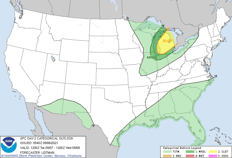
This is the SPC outlook for tomorrow, most of the state with the exception of the U.P. and SE corner is in the slight risk area for severe weather with a 15% chance of damaging winds over 50 knots (58 mph), a 2% chance of tornadoes and a 5% chance of hail (within 25 miles of any one location).
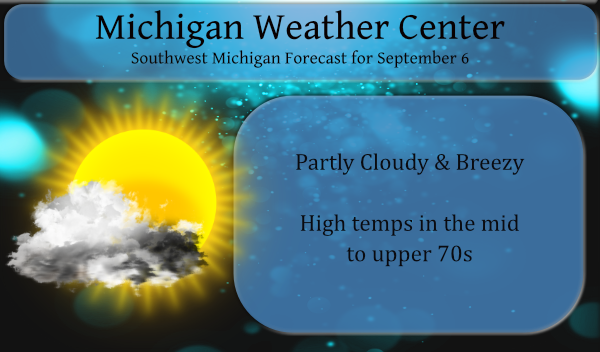
We currently have 58° at 6 am with expected highs in the mid-70s today. Yesterday’s high was 77°. We had .03 of an inch of rain overnight which brings us to .05 for September in the Otsego area.
Sunrise today is 7:14, sunset is 8:08 pm. For those of you in central Michigan, sunrise is 7:09 and sunset is 8:03 pm.
Forecast DIscussion
After a fair weather Labor Day, we look to the risk of severe
weather on Tuesday as an upper trough amplifies across the central
Great Lakes with wind profiles show 40 knots of shear. Strong
unidirectional shear suggests storm type will favor linear,
bowing segments. Any deep convection will be capable of wind
damagegiven 50 knots progged to be in the lowest 5 kft AGL. Dry
adiabatic subcloud layer will enhance downburst potential.

Timing looks to be from mid-afternoon across the northwest
forecast area to mid-evening by the time the storms clear the
southeast sections near Jackson County. Synoptic wind gusts in the
cold advection behind the storms could also gust over 40 mph. The
storms could also build deep enough to produce large hail with
forecast soundings showing CAPE through the minus 10C to minus 30C
zone. The storms will be moving quickly so even in heavy rain
rates materialize, flooding should be mitigated by storm speed.

Fair and cool weather follows for Wednesday through Friday with
overnight lows in the 40s in most places by Thursday morning and
even some 30s are possible in the cold spots.
There was 0.06″ of rain fall both here at my house and officially at GRR. That brings the September total to 0.11″ Going back to August 12 there has been just 0.19″ of rain fall at GRR. Yesterdays official high at GRR was 81 and for the month we are just about average with a departure of -0.2° At this time it is clear here at my house and I have a temperature of 58.
Slim