There are currently (7 am) some storms moving across the lake heading towards Pentwater and Ludington. These have a lot of lightning in them and have prompted special marine warnings. Looking at the radar images these probably have some hail and heavy rain.
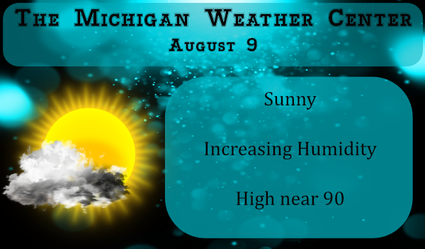
After a cool start to August, the heat and humidity will increase today to mark the beginning of a warm work week. With the humidity in place, we have slightly increased chances of rain today, and tonight though they are small from Grand Rapids to the south (about 20%) and would be of the popup variety.
Forecast Discussion
- A Classic Summer Day Today

We have been in a cool weather pattern most of August so far.
However today we will change modes and it will be very summer
like. The heat and humidity come back in response to the incoming
northern stream system. We will have an enhanced southerly flow of
warm and humid air today. My 1000/925 mb thickness tool suggest
lower 90s this afternoon inland.

- Best Thunderstorms Threat Monday Night

While the threat for thunderstorms is not zero today, due to the
shortwave ridge over us there is a lot of mid level subsidence so
it even with decent surface based capes this afternoon, near 2500
j/kg based on the NAM, there is to much mid level dry air to do
much with that. Also there is no low level jet or upper jet to
help the cause for thunderstorms today. There is a weak shortwave
that does come through our CWA mid morning but again to much dry
air for it to do any good in creating thunderstorms.

Tonight another MCS is expected over MN/WI and it will track
toward us after midnight but the low level jet is focused way
north of here so we have speed divergence as the storms try to
come in. There is also not much effective deep layer shear or a
good upper level jet either. So whatever gets here will likely be
dying storms that will have a hard time getting past US-31.

During the day on Monday it would seem there is some suggestion of
convection over Southeast Lower Michigan during the afternoon
since the NAM shows a low level jet over Lake Erie in the evening.
There is once again decent instability but we lack much of a
focus to get the storms to develop over the western CWA (once what
remains of the early morning storms is gone).

The best chance for storms, as it has it has been all year here
really, during the early morning hours of Tuesday. That is when
into the jet entrance region of the jet core rotating through the
upper trough moving into this area. Moisture transport is focused
on our southern CWA. The precipitable water rises to over 2
inches by midnight and there is some suggestion of enough deep
layer shear too. If there is going to be widespread rain in the
next 72 hours, it would be between midnight and sunrise on
Tuesday. Being so late at night the risk of severe looks low at
this point.

- Tranquil Weather Rest of Week

Once our closed upper low, tracking east around 55N reaches
southern Hudson Bay (Tuesday afternoon) we should be behind the
cold front associated with that system centered well to our
north. The next upstream system, another closed upper low over
British Columbia on Wednesday will have several Pacific
shortwaves dive into the western part of the system. That will
slow down the movement east and put Michigan in shortwave ridging
from Wed through at least Friday. The southern stream jet will be
well south of Michigan that entire time. So I see very little in
the way of active weather. It should all be well south of here.
Since the 500 heights stay over 585 dm most of the week, our
afternoon highs should mostly be in the 80s.

- May get Stormy Next Weekend

The system over British Columbia early this coming week finally
gets pushed east into the our area by Sunday the 16th. That could
being a considerable amount of convection with it if plays out
like the ECMWF and GFS currently suggest.
It’s Trying it’s Hardest to Rain here Right Now in Allendale .
Ultra ultra Lite precip. Is falling.
Currently Tracking Showers and Storms over the BIG Pond moving East….
Will they DIE before they Get Here? Hope not I’m Storm Starved here in the Metropolis of Allendale .Thoughts ! Comments …..!
I am thinking that they will weaken before they get across the lake.
Slim
Looks like prediction is Spot on Slim.
Nothing more than “a million to one chance of something less than mist”. 🙁
Lol..,you are prolly right
Love seeing it dark at 9pm and at the end of August it will be 8pm or better transition to Fall is happening Summer is on the outs ….Have a super Sunday funday…INDY
That is kind of an odd blob of rain on the radar over the lake. It’s spreading East, but the back edge continues to stay and reform by the Wisconsin shoreline.
The past week was nice with the dryer air after all the heat and humidity this Summer. Now it’s back to the thick and stuffy air again.
Today will be the first day of above average mean temperatures after 10 days in a row of below average. The official overnight low at GRR was 69 and here at my house it was 70. At this time it is 75 here at my house with a DP of 68. The 8 am reading at GRR was 75 with a DP of 67.
Slim