We picked up 1.51 inches of rain from the storms passing through last night which brings us to 2.94 inches for the month of August. No severe weather for the Otsego/Plainwell area, just the heavy rainfall and a few flashes of lightning and some thunder. Our high temp was 90.7° with a 79° dewpoint which gave us a feels like temp 106.2°.
We have a heat advisory in place for much of southern Michigan today from noon through 8 pm due to high temps and dew points and heat indices around 100° or better – actual air temps will be in the low 90s. Rain chances are in the 40% range. We will think back on the hot humid days when we are in the throes of winter.
Weather History for SW Michigan:
August 22
1936: The Dust Bowl summer of 1936 produced more record heat, with a high of 98 degrees at Grand Rapids and 94 at Lansing.
1964: Tornadoes struck in Calhoun, Lenawee and Hillsdale Counties. Three people were injured northeast of Battle Creek as a house and factory were damaged.
1966: A tornado struck Bellevue in Eaton County, damaging a house, garage and two cars.
2001: Severe weather and flooding hit Allegan, Ottawa and Kent Counties. Damaging winds hit Hudsonville, Plainwell, Dorr and Grand Rapids. Flooding occurred in eastern Van Buren and Kalamazoo Counties where three to five inches of rain is estimated to have fallen in less than 6 hours. Several streets were closed by flooding in Oshtemo flooded. Some businesses had to pump water out of their stores in Kalamazoo during the height of the storms.
August 23
2002: Several inches of rain in less than three hours caused flash flooding in Kalamazoo, where two homes and two businesses sustained extensive damage. Waldo Stadium, on the campus of Western Michigan University, also had major flooding. At one point, three feet of standing water covered the entire football field. The flooding caused an estimated 200,000 dollars in damage.
2007: Severe weather strikes Lower Michigan with large hail and damaging winds. Some of the worst damage is across Montcalm County where thousands of trees are downed by a tornado and downburst combination that produced estimated wind speeds up to 100 mph.
August 24
1947: The second long heatwave of the month comes to a close with record highs of 98 degrees at Grand Rapids and 96 degrees at Muskegon, contributing to the warmest August on record across West Michigan.
2006: Up to baseball-sized hail fell from a severe storm at Grand Junction in Van Buren County.
2007: Tornadoes strike Lower Michigan, with the worst damage near Potterville in Eaton County. Five people are injured and 15 homes are destroyed by a tornado with peak winds estimated at 140 mph. A weaker tornado hit southeast of Lansing but the damage was limited to trees falling on mobile homes.
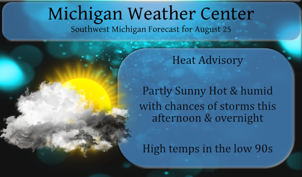
August 25
1910: A tornado injured four people near Scottville in Mason County. The tornado destroyed a cement block building, hurling the roof a half-mile. Several other buildings were unroofed.
1940: A stalled cold front brings clouds and very cool high temperatures. At Muskegon, the high was only 56 degrees and Lansing was 57, both records for the coldest maximum temperatures for the month of August. The high of 60 degrees at Grand Rapids is only one degree higher than the record of 59 degrees set on August 26, 1987.
2004: A strong downburst tore the roof off a section of the Maple Valley High School in Eaton County. The same storm produced a weak tornado minutes later that took the tin roof off a house in Vermontville.
August 26
2000: Heavy rain and high winds produce scattered damage and some flooding. The roof of a bowling alley near Jackson was damaged by an apparent microburst. Roads were closed due to flooding across southern Kalamazoo County.
August 27
1948: A late-season heatwave with eight straight days in the 90s at Grand Rapids is underway. Record highs are set at Lansing with 98 degrees, Grand Rapids with 95 and Muskegon with 91.
1977: Only two days after setting a record low of 43 degrees, the low temperature at Muskegon is a balmy 74 degrees, a record warm low temperature for the date.
2004: A weak tornado struck near Sherman City in Isabella County. A mobile home was slightly damaged but no one was injured.
August 28
1982: A strong cold front pushes through and temperatures tumble to 36 degrees at Lansing, setting a record low for the date.
1986: There is an autumnal chill as morning lows fall to a record low of 41 at Grand Rapids and to 36 degrees at Lansing, tying the record low set only four years before.
Weather History for SE Michigan
August 22
On August 22, 1964, an F3 tornado hit Lenawee County at 2:35 PM around the community of Springville. Two people were injured as a result of this tornado. This was the last F3 or greater tornado to hit Lenawee.
August 23
On August 23, 2007, the event began with a thunderstorm in Midland County that moved east across the Thumb. This storm produced some large hail and the first tornado of 2007 near Argyle in northwestern Sanilac County. At the same time, this was occurring, a very fast-moving squall line approached the lower half of Southeast Lower Michigan. Although the squall line became less organized, it still produced numerous reports of wind damage between M-59 and Interstate 94.
Also on August 23, 1998, Clio reported 1-inch hail that came with a severe thunderstorm at 6:50 pm.
August 24
On August 24, 2011, scattered severe thunderstorms developed over Metro Detroit, with both large hail and wind damage occurring. There were over 20 reports of severe weather including golf ball-sized hail in Marysville.
On August 24, 2007, a tornado and severe weather outbreak hit the greater Flint and Detroit metro areas. The strongest tornado was an EF2 that was on the ground for 26 miles from northern Livingston County, through Fenton and into Holly. Additional tornadoes hit northeast of Durand (EF0), near Hadley (EF1), and near Salem (EF0).
Also on August 24, 1947, the temperature soared to 101 degrees in Flint, which is the record high temperature for the month of August in the city of Flint!
August 25
On August 25, 1948, a record high of 98 degrees occurred in Detroit. Also, records of 95 degrees on the 24th and 98 degrees on the 27th were reached during this short hot spell.
August 26
On August 26, 1970, 1-inch hail was reported at 5:15 pm from severe thunderstorms passing through Saginaw county. Also, in 1986, thunderstorms produced wind gusts of 64 mph in Genesee county.
August 27
On August 27, 1965, thunderstorms in Wayne county brought winds of 73 mph at 7:00 pm.
August 28
On August 28, 2020, several rounds of morning showers and thunderstorms trained over the same areas, bringing 2 to 4 inches of rainfall over just a few hours and causing flooding throughout the Metro Detroit area. Scattered severe storms during the afternoon then brought damaging wind to the US-23 corridor as well as large hail (up to 2 inches near Flushing).
On August 28, 2018, a line of severe storms impacted the Tri-Cities and Thumb regions with damaging winds downing numerous trees and power lines.
On August 28, 2013, an EF0 tornado touched down near Brighton, Michigan. The pathwidth was 0.3 miles wide and 2.8 miles long. Peak winds were estimated to be near 80 mph. Numerous trees were uprooted and minor siding damage to homes occurred.
Also, on August 28, 1992, the temperature rose to only 59 degrees in Flint!
Forecast Discussion
- Heat Advisory Today from I-96 southward

We have gone ahead and issued a Heat Advisory for today from the
I-96 corridor southward. This includes Holland...Grand Rapids and
Lansing. Heat index values yesterday eclipsed 100 degrees across
Southern Lower Michigan and the setup appears ripe for much the
same today. There has been no airmass change. The 850mb
temperatures remain nearly the same in the +19C to +20C range.
Convective debris clouds are already thinning/moving south, so we
are expecting a fair amount of sunshine once again. Surface dew
points have fallen back into the upper 60s F early this morning,
but we expect them to surge back into the low to mid 70s F today
ahead of the cold front. So, with temperatures pushing to near 90
or a bit higher and very humid air we think heat index values of
100F is possible once again. The advisory will run from noon
through 800pm.

- Another chance for showers and storms today

Today will be another day of high CAPE and low to moderate shear.
So, just like yesterday severe weather cannot be ruled out.
Confidence is not high in storm morphology today. What we do know is
that MUCAPE values will be high given at least partly cloudy
skies, temperatures soaring towards 90F with surface dew points
that will be in the 70-75F range. This will push MUCAPE values at
least into the 2500-3000 J/KG range with values likely exceeding
that. Deep layer shear this afternoon is on the order of 20-30
knots so there will be some storm organization. The question is
how convection evolves. Storms will likely fire on the upstream
cold front and try to move our direction or form in our area on
the lake breeze front. There may be a tendency for the convection
to be forced off to our south and southwest on the outflow
boundaries from yesterday evening`s storms. Expecting at least
scattered showers and storms this afternoon and evening. Severe
weather is a possibility with marginally severe wind once again
being the main threat along with locally heavy rain/flooding.

- Additional chances for showers and storms into weekend

As we have been advertising the threat for showers and storms will
continue the remainder of the week and into the weekend. Thursday
through Saturday a warm front/stationary front will be situated
across the area. On Sunday a cold frontal passage is still
expected. Therefore, given instability that will remain in place
and boundaries to force it, showers/storms will remain in the
forecast. A heavy rain threat will persist into the weekend given
high PWAT air.
2 places in Michigan currently have a dew point of 81. At 8:15 in the evening.
I just got back from a walk and yes it is very warm and humid. The current temperature is 85 here with a dew point of 73.
Slim
We just tried to go for our evening walk. Made it maybe a quarter mile and turned around and came back. Had to take a shower from a half a mile walk. It is smothering out there.
Great summer and no heat waves! I love it!
I had about 200 customers today that would tell you otherwise. All I heard all day was “holy smokes it’s hot out”.
I can agree with that!! I think it has been a really hot and humid summer.
I got a lot of yard work done and then used the pool! Not a bad day.
It is hot, hot, hot out there. We were out watering and had to take a break to cool off.
Whew!!! Back to back 90 degree days here!! Just another heat wave in this already hot summer!!
Gee back to back 90° days has that ever happened before? Grand Rapids now has had 4 days of 90 or better this year. The average number for Grand Rapids is around 10.
Slim
We still might get there Slim!
Very nice…it’s beginning to feel like “Summer”. Glad it decided to visit this year.
The overnight low both here at my house and officially at GRR was 67. I recorded a total of 0.40″ of rain yesterday. I had a high of 92 yesterday with the highest dew point I have ever had of 80. That is good for a heat index of 111. At this time there it is cloudy and 70 here with a dew point of 69 the 8 AM reading at GRR was 68 with a dew point of 67. I think that during the upcoming winter I will start pointing out the wind chill more often.
Slim
Great idea! I love the wind chill!
Let it snow let it snow let snow …INDY
Phew GR hit 92 yesterday! Ugh the NWS redid their whole data site. I don’t like the new look at all.
It is going to take a while to get use to the new look. But I like having all the information at one location instead of going back and forth.
Slim
Only a tenth of an inch of rain here, but wow there was some incredible lightening for a long time off in the distance! Not looking forward to at least another week of this heat crap. Record high for today looks to be 94. Unfortunately we’ll be close to that if not over.
Yes at Grand Rapids the record high for today is 94. The record for today at Holland is 95 at Lansing it is 96 at Kalamazoo it is 98 and at Muskegon it is 90. Muskegon would have the best chance of seeing a record.
Slim
Another heat advisory? Probably should have issued one yesterday with the triple digit feels like temps all over the place.
Here is the NWS definition of a heat advisory.
” Heat Advisory
Issued within 12 hours of the onset of the following conditions: heat index of at least 105°F but less than 115°F for less than 3 hours per day, or nighttime lows above 80°F for 2 consecutive days.”
Officially none of the official locations made the 105 level in their hourly reports. The highest at GR was 101 at Lansing 102 at Holland 101. Kalamazoo was much closer with 104.
Slim
Slim
Interesting. If you read the text of today’s Heat Advisory, they are only predicting a max heat index of 102.