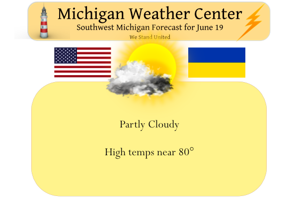
We have been experiencing a stretch of very pleasant weather the past few days. Yesterday we had a high of 73° the low was 50°. After today, it’s looking like a very warm week with limited chances for rain. Tuesday should bring the worst of the heat and humidity. It still appears above normal temps and dry weather will continue through the rest of the month.
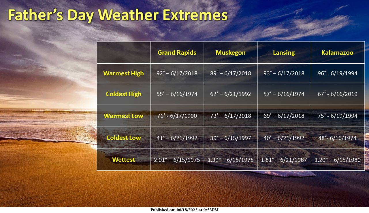
Take a look at the weather extremes for our main climate sites for the history of Father’s Day, which dates back to 1966.
Forecast Discussion
-- Warm and Dry weather will dominate the weather this week --

An upper level ridge over the United States will dominate the
weather pattern through the week. Looking at the ensemble SA
tables for both the GEFS and the ECMWF M climate QPF anomalies
and they are both dry for at least a week. Any precipitation
chances continue to trend either east or south of the region so
precipitation is not expected.

-- Temps could level off Wednesday --

As the upper level ridge builds into the region it will advect
hot air into the region with 850mb temps at +20C maxes Monday and
Tuesday. A dry cold front will flatten the ridge briefly
Wednesday, bringing in slightly cooler air. Temperature trends in
the EC and the GFS continue to be cooler then previous runs. The
GFS is cooler then the EC which would mean temps in the low to mid
80s. Am leaning toward the EC with grids having Max temps in the
mid to upper 80s.
 So temps Monday and Tuesday will be 10 to 15 degrees above
normal with temps Wednesday through the end of the week only 5 to
10 degrees above normal. Skies will be a mix of sun and clouds.
The 2PM CDT temperature at Fargo ND was 100 with a dew point of 66 and a heat index of 104.
Slim
I have to wonder just how much this will cool down when it gets here? This is the forecast for Fargo. “JuneteenthSunny and hot, with a high near 102. Heat index values as high as 109. Breezy, with a south wind 16 to 21 mph increasing to 23 to 28 mph in the afternoon. Winds could gust as high as 37 mph. TonightA 20 percent chance of showers and thunderstorms after 11pm. Partly cloudy, with a low around 78. Breezy, with a south wind 20 to 25 mph decreasing to 14 to 19 mph after midnight. Winds could gust as… Read more »
My phone weather app has 97 here at my house Tuesday. We shall see.
Also Tuesday has the highest sun angle of the year… it is going to feel very hot
Happy Fathers Day everyone! About to go golfing with my dad… looks like today is the last comfortable day before the heat sets in again
HAPPY FATHER’S DAY TO ALL THE DADS ON HERE. HOPE YOU HAVE A WONDERFUL DAY!
Happy Fathers Day to all the dads out there. I had a nice country breakfast at home with my dad this morning and plan on going later this afternoon to Texas Roadhouse. Have a great day everyone.
Happy Father’s Day to the Dad’s out there. Happy Father’s Day to the Grandpa’s, Uncle’s and other men important in the lives of other’s. To all those with Dad’s in Heaven… Bless you and tell a funny story about your Dad today!!
Another beautiful morning with a temp of 52 and cloudless skies once again. It’s been nice to be able to have the windows open the past two nights, but it appears to be short-lived. The local tv met showed upper 80s and 90s for two weeks following today. He said there will be very little chance of rain, as well. Things will likely become significantly dry without some precip during this above average temp stretch.
Check out the forecast for Fargo ND above. And highs are forecasted in the upper 90’s in the Twin Citys as well.
Slim
Happy Fathers Day! The official H/L at Grand Rapids yesterday was 76/52 there was no rain and there was 97% of possible sunshine. The overnight low in MBY was 50 and the official overnight low looks to be 51 at GRR. At the current time it is clear and 52 here. For today the average H/L is 81/59 the record high is 98 set in 1953 and the record low of 45 was set in 1926 and 1945. Last year the H/L was 76/63. Today should be the last cool day for a while with highs next week mostly in… Read more »
I have a very cool 48 this morning at my house