We have a cool breeze blowing early this morning at 3:30 as a prelude to a cooler pattern over the next few days. There is a frost advisory in place for the northern counties for early this morning where temps will drop into the 30s. The coldest I have seen thus far this morning is 32.7° in Harrison and most of the northern lower is in the mid-30s. We have 50° and falling in Otsego.
While not a drought buster yesterdays rain was beneficial and fell in areas that needed it the most where severe drought conditions exist.
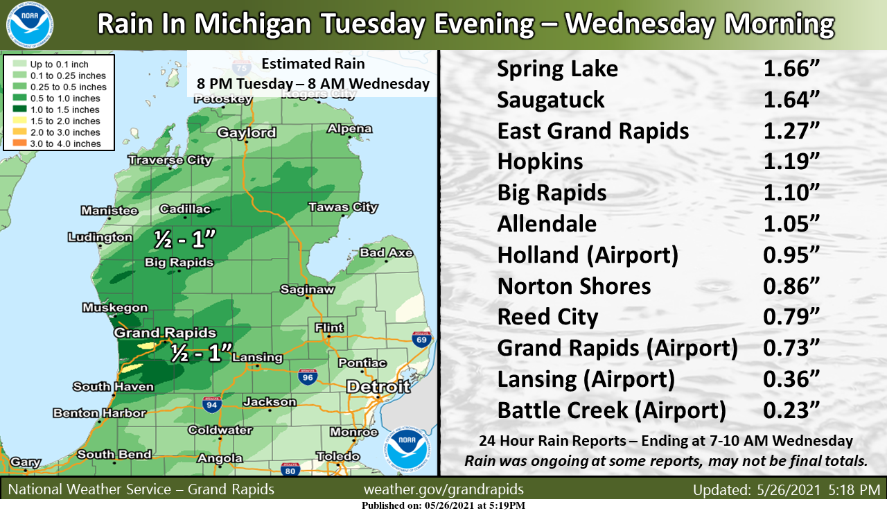
Here is a look at how much rain fell across the area from the rain and thunderstorms that spread into the area late last evening and moved out of the area this morning.
We have a good chance of another soaking rain for southern Michigan late today, overnight on into Friday with an area of low pressure passing over southern Michigan. Rain guesses are from half an inch north to an inch or better south of Grand Rapids.
Forecast Discussion
- Low pressure brings rain later today into Friday

Another round of beneficial rain to ease the dry conditions is
expected later today into Friday as a surface low tracks across
Lower Michigan. QPF from this event is expected to be from about a
half inch across northern Lower Michigan to 1.5 inches across the
south. Thunder chances are low enough to leave out of the forecast
although a few embedded thunderstorms are possible across the far
south where some marginal mid level instability exists.

- Dry and slightly cool Saturday through Monday

Northerly flow in the wake of the departing low will bring drier
air in for the holiday weekend. Lows Saturday and Sunday mornings
will be in the mid to upper 30s with some frost possible across
the northern zones.

- Low chance of rain Tuesday

Shortwave trough moves east and shears out early next week with
only slight chance of showers on Tuesday and Wednesday/ We do not
expect much QPF with this although there is a signal for wet
weather to exist later in the week.
It is staring to feel a bit chilly with the wind. All my plants are inside.
55* degrees outside in my area is it September?? Feels great!! Happy Memorial Day …INDY
Well chalk off no 90’s in GR for the month of May hopefully very little or none in June!! Enjoy the next few weeks as our days are darn near the longest of the year time flys Happy Memorial Day …INDY
Since 1900 the average number of 90° days in June is just 3. There have been a total of 37 years with no days in June of 90 or better and 21 more with just 1 day. So the odds are that there will NOT be a lot of 90° days in June. The most in that time was 12 in 1933 and in the next year there was 11 in 1934 and in 1988 (a very dry June) there was 10. Last year there was 3.
Slim
Let’s hope O thanks Slim ….INDY
I have been loving all the Irises blooming this year.
Agreed!
Love this air mass over the mid July heat we’ve had the last 2 weeks! Doesn’t look like it will last long though and then the heat builds back in.
Low of 42* degrees in my area early this morning wow to the wow!! Looking forward to a cool holiday weekend and a Fall like feel in the air at night ….Crazzy June is 5 days away and we are talking about lows in the 30’s get that fire cranking …Happy Memorial Day INDY ….
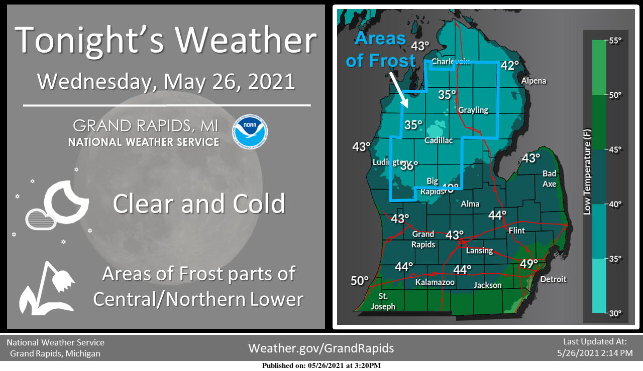
We will have to see how cold it gets over the next few mornings. The record lows at Grand Rapids the next 3 days are in the lower 30’s it has not gotten down to 32 or lower the 3 days in recorded history. The official total rain fall yesterday at Grand Rapids was 0.73″ The total at Muskegon was 0.76″ and at Lansing just 0.39″ The overnight low here at my house was 43 and it looks like it will be 42 officially at the airport. At this time with clear skies it is 49 here at my house.
Slim
Lansing set a record high of 90 two days ago, and now we’re looking at lows in the 40s the next couple of nights. Yep, it has been a typical rollercoaster May.
Get ready for incredible late May night time cold temps!