In just 4 more days we will flip the calendar over to February. In doing my research on February I came across the coldest of cold waves. February 1875 must have been the coldest month on record here in Michigan. There were only two locations that have records that go back to 1875 Lansing and Detroit. At Lansing the mean for the month was +4.7° 21 days had low of below zero, every day from the 3rd to the 18th had a low below zero. From the 6th to the 9th the lows were -31, -28,-33 and -32. There were 5 days when the high stayed below 10. At Detroit they had 13 days in a row of lows zero and below. The mean for the month at Detroit was 12.2. Now that is one cold month.
Now for the month of February the average mean at Grand Rapids is 26.6 there is on average 2.12” of rain/melted snow and 17.2” of snow fall. At Lansing the mean is 25.9 with 1.71” of precipitation of that 14.3” is snow fall. The warmest February at Grand Rapids is 34.7° in 2017 in 2nd place is 1998 with a mean of 34.1 and in 3rd place is 1984 with a mean of 34.0° at Lansing the warmest mean is 35.5 in 2017. In 2nd place is 1882 with a mean of 35.3 and in 3rd place is 1998 with a mean of 33.7. On the cold side at Grand Rapids the coldest February is 2015 with a mean of 13.3 in 2nd place is 1918 with a mean of 14.3 and in 3rd place is 1904 with a mean of 14.6 last year the mean at Grand Rapids was 24.6 At Lansing the coldest mean of 4.7 was that 1875. In 2nd place is 7.5 in 1885 and in 3rd place is 1978 with a mean of 11.3. As for snow fall the most for any February at Grand Rapids is 41.6” in 2008 in 2nd place is 2011 with 38.2” and in 3rd place is 1900 with 35.5” At Lansing the most snow in February was in 2011 with 29.1” in 2nd place 2008 with 27.6” and in 3rd place 2022 with 27.1” The least amount of snow fall at Grand Rapids for any February is 0.5” in 1998 in 2nd place is 1987 with 0.9” and in 3rd place with 1.6” is 1984. Last year Grand Rapids had 19.0” and Lansing had that 27.1”
The biggest one-day February snowstorm at Grand Rapids was in 2007 with 11.3” the total for the 4 day event was 20.4” The 2nd biggest one day snow storm was the so call ground hog day storm of 2011 with 11.1” and a storm total of 17.2” At Lansing the biggest one day storm total was 13.3” that fell last year.
Before we slip into February, we still have 4 more days left in January. This January will end up being one of the warmest on record for most of lower Michigan. The current mean at Grand Rapids is 33.5, at Lansing it is 36.4, at Muskegon it is 35.9 that would be the warmest if it can stary above 34.8 the next 4 days. At Holland the current mean is 35.1. All locations are at the current time in the top 5 warmest Januarys of record. For those that think that that 33.5 is so much cooler than the other locations (in a way it is) but for a perspective to the east at Flint the mean there so far this month is 33.5 and at Saginaw the mean is at 23.9.
For today it still looks like we will have a good chance of several inches of snow along I 96 to M 20 with less to the south and north of M20.
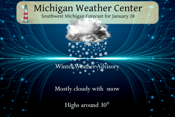
AREA FORECAST DISCUSSION
NATIONAL WEATHER SERVICE GRAND RAPIDS MI
339 AM EST SAT JAN 28 2023
LATEST UPDATE…
DISCUSSION/MARINE
DISCUSSION
(TODAY THROUGH NEXT FRIDAY)
ISSUED AT 339 AM EST SAT JAN 28 2023
— MAINLY SNOW THIS AFTERNOON INTO SUN MORNING; MIXED PRECIP
POSSIBLE SOUTH —
A SURFACE LOW BENEATH THE RIGHT-ENTRANCE REGION OF AN UPPER JET
STREAK WILL PROPAGATE EASTWARD LATER TODAY AND TONIGHT ALONG A
BAROCLINIC ZONE SITUATED ACROSS THE REGION. AS THIS OCCURS,
LOW/MIDLEVEL DEFORMATION WILL CONTRIBUTE TO A PERIOD OF
FRONTOGENESIS ACROSS THE FORECAST AREA. THIS FRONTOGENESIS, IN
CONJUNCTION WITH THE JET STREAK ALOFT, WILL RESULT IN SWATH OF
PRECIP ACROSS MUCH OF THE FORECAST AREA FROM THIS AFTERNOON INTO
TONIGHT, LIKELY TO BE MODULATED IN MANY AREAS BY WEST-EAST-ORIENTED
MESOSCALE BANDS.
OVERALL FORECAST CONFIDENCE WITH THIS EVENT REMAINS SOMEWHAT
LIMITED, OWING TO (1) THE AFOREMENTIONED MESOSCALE-BANDED CHARACTER
OF PRECIP PRODUCTION, WITH CORRESPONDING UNCERTAINTY IN THE NORTH-
SOUTH POSITION OF AN AXIS OF RELATIVELY HEAVIER SNOWFALL
ACCUMS, AND (2) UNCERTAINTY REGARDING THE NORTHWARD EXTENT OF AN
ELEVATED WARM LAYER, WITH IMPLICATIONS FOR THE POSSIBILITY OF
MIXED PRECIP TYPES (AND SUBDUED SNOWFALL AMOUNTS) ACROSS THE
SOUTHERN FORECAST AREA.
THE 06Z DETERMINISTIC HRRR AND 3-KM NAM CONTINUE TO EXHIBIT A
DECIDEDLY NORTHERN TRACK OF THE SURFACE WAVE (ACROSS SOUTHERN LOWER
MI). THESE SOLUTIONS ADVANCE AN ELEVATED WARM LAYER INTO SOUTHERN
COUNTIES, ACCOMPANIED BY SLEET/FREEZING RAIN, THEN SUGGEST THAT A
SHORT PERIOD OF ORDINARY RAIN IS POSSIBLE IN FAR SOUTHERN AREAS AS
THE SURFACE FREEZING ISOTHERM ADVANCES NORTHWARD TONIGHT. THE AXIS
OF HEAVIEST SNOW IN THE 06Z HRRR ROUGHLY COINCIDES WITH M-20, AND
WAS LITTLE CHANGED (ABOUT 20 MILES) FROM THE 00Z RUN. MEANWHILE, THE
00Z DETERMINISTIC ECMWF AND GFS KEEP SLEET/FREEZING RAIN JUST
SOUTH OF THE FORECAST AREA AND PLACE HEAVIEST SNOW CLOSER TO I-96.
THE ECMWF SOLUTION HAS BROAD SUPPORT FROM ITS ENSEMBLE (EPS),
WHICH PLACES HIGHEST PROBS OF 3″+ ALONG THIS SAME AXIS. THE
FORECAST PACKAGE WITH THIS UPDATE, BASED LARGELY ON NBM AND WPC
GUIDANCE, HAPPENS TO BROADLY RESEMBLE THE 00/06Z HRRR SOLUTIONS
WITH RESPECT TO THE PLACEMENT OF HEAVIEST SNOW AND THE RISK OF
MIXED PRECIP ACROSS SOUTHERN COUNTIES.
HRRR PROFILES ACROSS THE FORECAST AREA SHOW TRANSIENT CONDITIONAL
INSTABILITY FOR ELEVATED PARCELS THIS EVENING/TONIGHT. EVEN IN THE
ABSENCE OF CONDITIONAL INSTABILITY, GUIDANCE SHOWS SMALL POSITIVE
VALUES OF GEOSTROPHIC EPV AT SATURATION (EPVG*), INDICATING WEAK
MOIST SYMMETRIC STABILITY. THESE ENVIRONMENTAL CONSIDERATIONS
SUGGEST THAT MESOSCALE ASCENT ARISING FROM FRONTOGENESIS MAY BE
OCCASIONALLY ROBUST, AND THAT BRIEF, LOCALLY ENHANCED PRECIP/SNOWFALL
RATES MAY OCCUR.
ADDITIONALLY, HRRR PROFILES AT SEVERAL LOCATIONS (E.G., MKG, GRR,
LAN, RQB, AND MOP) SHOW A PERIOD OF DEEP, SATURATED, AND
APPROXIMATELY ISOTHERMAL PROFILES AT TEMPS WARMER THAN -10C. THIS
FAVORS ICE-CRYSTAL GROWTH VIA AGGREGATION (YIELDING FLUFFY CLUMPS OF
FLAKES) AND SUPPORTS HIGHER SLRS (15-18:1). HOWEVER, IF STRONG
ASCENT BENEATH THE DGZ OCCURS WITHIN ANY CONVECTIVE ELEMENTS,
APPRECIABLE RIMING/ACCRETION MAY RESULT (YIELDING SNOW
PELLETS/GRAUPEL), WITH REDUCED SLRS DURING THOSE PERIODS.
NO CHANGES ARE PLANNED TO THE WINTER WEATHER ADVISORY WITH THIS
UPDATE. GREATEST SNOWFALL ACCUMS ARE CURRENTLY EXPECTED IN THE AREA
ROUGHLY BOUNDED BY I-96 AND M-20 (6″ COMMON). ALONG THE SOUTHERN
SEGMENT OF THE ADVISORY (ALLEGAN TO INGHAM COUNTIES), 2-4″ IS
EXPECTED, WITH A LIGHT GLAZE OF FREEZING RAIN POSSIBLE. AN EXPANSION
OF THE ADVISORY INTO THE I-94 CORRIDOR WAS CONSIDERED, OWING TO THE
POSSIBILITY OF FREEZING RAIN (0.05″ OR LESS) AND RELATIVELY LIGHT
SNOWFALL ACCUMS. GIVEN THE CONTINUED UNCERTAINTY PROVIDED IN LATEST
GUIDANCE, THE NEED FOR AN EXPANSION WILL BE REASSESSED LATER
TODAY. REGARDLESS, SLIPPERY ROAD CONDITIONS ARE EXPECTED TO
DEVELOP IN MANY AREAS BY THIS EVENING AND CONTINUE INTO SUN
MORNING.
— BELOW-NORMAL TEMPS NEXT WEEK —
ENSEMBLE GUIDANCE CONTINUES TO LEND HIGH CONFIDENCE IN BELOW-NORMAL
TEMPS NEXT WEEK. LAKE-EFFECT SNOW IS POSSIBLE ON MON AND MON NIGHT
AS NORTHWESTERLY LOW-LEVEL FLOW DEVELOPS OVER THE LAKE AND 850-MB
TEMPS DROP TO NEAR -18C. HOWEVER, ACCUMULATIONS ARE LIKELY TO BE
LIGHT, GIVEN RELATIVELY LOW INVERSION HEIGHTS (3-5 KFT) AND A
SHALLOW CLOUD LAYER.
A STRONG SURFACE ANTICYCLONE IS EXPECTED TO BUILD INTO THE REGION ON
MON NIGHT AND TUE, EFFECTIVELY SHUNTING THE BAROCLINIC/FRONTAL ZONE
SOUTHWARD. ANOTHER ANTICYCLONE WILL LIKELY APPROACH LATER IN THE
WEEK (THU-FRI), PROVIDING ANOTHER INCURSION OF COLD AIR.
Detailed Forecast for Grand Rapids
Today
Snow, mainly after 3pm. High near 28. West wind 5 to 8 mph becoming calm in the afternoon. Chance of precipitation is 80%. Total daytime snow accumulation of around an inch possible.
Tonight
Snow. The snow could be heavy at times. Low around 24. East northeast wind 6 to 10 mph, with gusts as high as 24 mph. Chance of precipitation is 100%. New snow accumulation of around 5 inches.
Sunday
A 50 percent chance of snow before 1pm. Cloudy, with a high near 28. North wind 10 to 13 mph.
Sunday Night
Mostly cloudy, with a low around 15. North wind 5 to 8 mph.
Monday
A 20 percent chance of snow showers. Cloudy, with a high near 20. West northwest wind 6 to 11 mph increasing to 12 to 17 mph in the afternoon. Winds could gust as high as 25 mph.
Monday Night
Mostly cloudy, with a low around 5.
Tuesday
Mostly cloudy, with a high near 17.
Tuesday Night
Mostly cloudy, with a low around 12.
Wednesday
Mostly cloudy, with a high near 24.
Wednesday Night
Mostly cloudy, with a low around 14.
Thursday
Mostly cloudy, with a high near 23.
Thursday Night
Mostly cloudy, with a low around 5.
Friday
Mostly cloudy, with a high near 21.
Detailed Forecast For Lansing
Today
Snow likely, mainly after 4pm. Cloudy, with a steady temperature around 26. West wind 5 to 9 mph becoming light west southwest in the afternoon. Winds could gust as high as 21 mph. Chance of precipitation is 60%. Total daytime snow accumulation of less than a half inch possible.
Tonight
Snow, possibly mixed with freezing rain before 2am, then snow between 2am and 4am, then snow, possibly mixed with sleet after 4am. Low around 26. East wind 5 to 8 mph, with gusts as high as 18 mph. Chance of precipitation is 100%. Little or no ice accumulation expected. New snow and sleet accumulation of around 2 inches.
Sunday
Snow likely before 1pm. Cloudy, with a high near 29. North wind around 10 mph. Chance of precipitation is 60%. New snow accumulation of less than one inch possible.
Sunday Night
Cloudy, with a low around 17. North wind 6 to 9 mph.
Monday
Cloudy, with a high near 22. West northwest wind 7 to 14 mph.
Monday Night
Mostly cloudy, with a low around 0.
Tuesday
Mostly cloudy, with a high near 17.
Tuesday Night
Partly cloudy, with a low around 6.
Wednesday
Partly sunny, with a high near 24.
Wednesday Night
Mostly cloudy, with a low around 13.
Thursday
Partly sunny, with a high near 23.
Thursday Night
Mostly cloudy, with a low around 3.
Friday
Mostly cloudy, with a high near 20.
Detailed Forecast For Holland
Today
Snow, mainly after 3pm. High near 29. West wind 5 to 8 mph becoming northeast in the afternoon. Chance of precipitation is 80%. Total daytime snow accumulation of around an inch possible.
Tonight
Snow. Low around 25. East northeast wind 7 to 9 mph, with gusts as high as 23 mph. Chance of precipitation is 100%. New snow accumulation of around 3 inches.
Sunday
Snow likely, mainly between 7am and 1pm. Cloudy, with a high near 29. North wind around 11 mph. Chance of precipitation is 60%. New snow accumulation of less than a half inch possible.
Sunday Night
A 20 percent chance of snow showers after 1am. Mostly cloudy, with a low around 17. North wind 6 to 9 mph.
Monday
A 40 percent chance of snow showers. Cloudy, with a high near 22. Northwest wind 8 to 17 mph, with gusts as high as 26 mph.
Monday Night
Cloudy, with a low around 11.
Tuesday
Cloudy, with a high near 19.
Tuesday Night
Mostly cloudy, with a low around 14.
Wednesday
Mostly cloudy, with a high near 26.
Wednesday Night
Mostly cloudy, with a low around 18.
Thursday
Mostly cloudy, with a high near 24.
Thursday Night
Mostly cloudy, with a low around 11.
Friday
Mostly cloudy, with a high near 23.
Took a quick measurement and there is 5.5″ of new snow in my yard and now there is just under 8″ of snow on the ground. There is light snow falling and the current temperature is 26.
Slim
What a storm!!!! It looks like the NWS and the RDB nailed another forecast! Wow, just wow!
We are getting pummeled with no stop snow and no change in sight! I love it!
Snowing heavy here since late this afternoon. Roads are very slick and snow covered. Good night to stay in and watch a movie or play a game.
2.5” already at my house. Snowing very hard
Currently getting hammered with snow in my hood lot more then just 1-2 inches and no systems on the way lol… INDY
Too funny’ no Systems just a WSW with multiple inches of snow and then mid winter cold! I love it!
+1000 DDDDDD INDY
So far still just light snow falling here in NW GR.
Slim
3rd winter storm warning of the winter here!
Along with some WWA’s! What a winter!
Funny how some people that do not even live in West MI, said a few days ago no snowstorms were in sight! Wow just wow! Glad to see the NWS settled in the exact snowfall forecast that the RDB predicted about 8 hours ago. The most trusted model on the market!
Yep…and so it begins. Let’s see if we receive enough overnight, to start the blower.
Count on it!
Very light snow just started here. At the current time there is 3″ of snow on the ground here in my yard.
Slim
…WINTER WEATHER ADVISORY NOW IN EFFECT UNTIL 10 AM EST SUNDAY…
* WHAT…Snow. Accumulations of 2 to 5 inches.
* WHERE…Allegan, Barry, Eaton and Ingham counties.
* WHEN…Until 10 AM EST Sunday.
* IMPACTS…Plan on slippery road conditions.
…WINTER STORM WARNING IN EFFECT UNTIL 10 AM EST SUNDAY…
* WHAT…Heavy snow. Snow accumulations of 5 to 8 inches.
* WHERE…Portions of central, south central, southwest and west
central Michigan.
Newaygo-Mecosta-Isabella-Muskegon-Montcalm-Gratiot-Ottawa-Kent-
Ionia-
* WHEN…Until 10 AM EST Sunday.
* IMPACTS…Travel could be very difficult.
* ADDITIONAL DETAILS…Inch per hour snowfall rates are possible
for a time tonight.
That was not all that unexpected. We will now see how that plays out. Light snow has just started here at my house. I have 3″ on the ground and there is just patchy snow on the road at this time.
Slim
A slight southward trend has definitely occurred with the heaviest snow. Bullseye looks to be near the 96 corridor. I see a possible upgrade to a Winter Storm Warning for a handful of counties could be in the works shortly in collaboration with the DTX office.
The new 12Z NAM and HRRR are in great agreement and have trended farther south with the axis of greatest snowfall. Their solutions are now very much in line with the consistently more southerly track of GFS/ECMWF/NBM/WPC guidance and our official forecast. This is good news as forecast confidence in the main swath of heavy snow setting up from MKG and GRR toward MBS has increased. This narrow one or two county wide corridor could see inch per hour snowfall rates for a period tonight with total amounts flirting with warning criteria. An upgrade will be considered in collaboration with… Read more »
And of course the RDB already made this prediction! Incredible!
Bring it!
Good news: the above freezing temps melted what little snow we had on our street
Bad news: the below freezing temps turned our street into a complete sheet of ice
6 to 9 inches of snow coming definitely winter storm warning criteria im thinking out in my hood today buckle up here we go let it more SNOW…INDY
BINGO …. INDY was on it!! INDY
Great post, Slim. Imagine a February as cold as 1875. Now imagine being there in 1875 –
no technology
no electricity
no heating source other than firewood
no running water
no indoor plumbing
no thanks
I’m sure there’s more, but it’s early. Need coffee.
Breaking>>>>the latest RDB model gives GR 5 to 8 inches of snow! Get prepared now!