The cool Canadian air will remain entrenched over the area today with temperatures 10° below normal today. Normally we would be in the low 60s this time of the year. We have 28° at 6 am. Yesterday’s high was 49°. With high pressure moving into the area will see lots of sunshine today and tomorrow which is a plus. We will see our temperatures moderate into the 60s tomorrow with rain showers moving in for the end of the week into the weekend.
Weather History for SW Michigan
April 23
1968: A tornado struck Big Rapids in Mecosta County, injuring 11 people and doing half a million dollars in damage as it covered a path 10 miles long.
1986: Freezing weather prevails across Lower Michigan. Record cold temperatures for the date include 19 degrees at Muskegon and 20 degrees at Grand Rapids which is also a record for coldest so late in the season.
April 24
1980: Only two days after setting record highs in the 80s, a record snowfall blankets Lower Michigan. Grand Rapids sets a record for the date with 2.4 inches of snow, after hitting 86 degrees on the 22nd.
April 25
1976: Winter returns after summer-like weather the week before. After four days in the 80s from the 15th to the 18th, temperatures are held in the 30s today and heavy wet snow falls. Lansing sets a record for the date with 4 inches of snow, as does Grand Rapids with 3 inches.
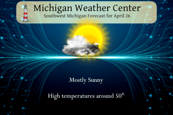
April 26
1915: A record three-day spell of warm weather in the 80s peaks with a high of 88 degrees at Grand Rapids and Lansing.
April 27
1966: A cold rain falls across Lower Michigan, holding temperatures in the 30s. The high of 37 at Grand Rapids and 38 at Lansing are both record-cold high temperatures for the date.
April 28
1964: A tornado destroyed a cottage and downed trees north of Newaygo.
1991: A restaurant was destroyed and a hardware store was unroofed as a tornado moved along the northwest edge of Hart in Oceana County.
April 29
1899: Grand Rapids sets the record high for the month of April at 90 degrees after a balmy morning low of 70 degrees.
1909: Heavy rain mixed with snow sets records across Lower Michigan. The daily total liquid equivalent precipitation is 2.53 inches at Grand Rapids, and this includes a daily record of 2.2 inches of snow. The 1.75 inches at Lansing includes four inches of snow. Temperatures remain in the 30s all day.
Weather History for SE Michigan
April 23
On April 23, 1985, the daytime temperature rose to 85 degrees in Flint, which is the record-high temperature for the day. Curiously enough, the very next year, in 1986, the overnight temperature dropped to 22 degrees, setting the record-low temperature for this day.
April 24
On April 24, 2005, a 3-day snowstorm swept across Southeast Lower Michigan dropping 16.5 inches of snow on NE Clarkston. The thumb reported drifts of 3-4 feet of snow. The storm began on the 23rd and lasted through the 25th.
April 25
On April 25, 2009, A strong cold front pushed into Southeast Michigan during the afternoon hours, producing several severe thunderstorms, generally confined to the M-59 Corridor, where tree damage and power outages were most prevalent. Over 50 severe reports were recorded with most of those being wind damage and severe wind gusts as high as 70 m.p.h. There were 80,000 homes and businesses which lost power in Oakland County.
Also on April 25, 1990, the temperature rose to 87 degrees in Flint. This set the record for the high temperature in the month of April in Flint and was tied by the records set on April 16, 2002, and April 18, 2004.
April 26
On April 26, 2009, it was a sunny and very warm day with a record high of 86 set at Detroit.
April 27
On April 27, 1915, the temperature in Detroit never dropped below 65 degrees. The temperature never dropped below 65 degrees the day before (April 26) as well.
April 28
On April 28, 2011, heavy rain that started on April 27 continued across Southeast Michigan. All locations received over an inch of rain during the two days, but many locations in the Saginaw Valley and Thumb had over 3 inches. Several roads in the Thumb region were closed. This rainfall helped to make it the third wettest April in Saginaw, the fourth wettest in Detroit, and the fifth wettest in Flint. The wet April assisted in making the spring of 2011 the wettest in Flint history, the second wettest in Detroit, and the eleventh wettest in Saginaw.
Also on April 28, 1986, an F2 tornado hit Saginaw county at 2:33 pm which cost $2.5 million in damages.
April 29
A very impressive late-season rain/snowstorm hit Southeast Michigan late on April 28th – 29th in 1909. The very intense low-pressure system moved through the region bringing Detroit 1.99″ of rain along with 3.0″ of snow, sleet, and hail from thunderstorms. Easterly winds gusted up into the 40s mph much of the 29th and then late in the evening, a strong cold front brought a northwest wind gust to 54 mph. In Saginaw, they were buried under 13.0 inches of snow.
Forecast Discussion
-- Cold air will continue to dominate into Thursday --

A large negatively tilted upper level low situated over Ontario
will continue to dominate the weather pattern through today into
tomorrow. That low will weaken and retrograde to the north as a
weak ridge is pushed downstream out ahead of another upper level
low moves into the upper midwest. This will allow for 850 mb
temperatures to remain between 0C to -8C keeping freezing
overnight lows across the region Wednesday and Thursday mornings.
Daytime highs on Wednesday will be around 10 degrees below normal.


--Return to warmer air with chances for rain Friday--

Warmer air will return Thursday into Friday as a shallow upper
level wave moves up from the Plains bringing copious amounts of
mid to low level moisture. The best moisture will be through
eastern Michigan, however there should be a chance for rain
showers Friday. Latest models bring around a tenth to a quarter of
an inch of precipitation to the region with the higher amounts
south and east of I 69.

-- April Showers return this weekend into Monday --

The mid to long range models are in good consensus that a large
upper level low will drop down into the Great Lakes region over
the weekend into next week. This low will at first have warm
daytime highs on Saturday but will shift cooler as the weekend
progresses. Colder rain will overspread the region by Sunday
though there are questions in timing and intensity. There is the
potential the precipitation will turn to snow along and north of
US 10 Monday morning.
The cold pattern and the beat goes on and on! Another day with double digit below normal temps and a FREEZE Warning! Wow, just wow, WOW! This is an amazing and unbelievable cold spell!!!!!
This past winter was a wow to the wow WOW! Winter but would have been even better if these below average temps lingered then like it is now.
100% agree! Nothing better than an above average snowfall winter with below normal temps!!!!
At this time it looks like at least the first 10 days of May will be on the cool side. So look for more chances for frost and maybe cool days as well.
https://www.cpc.ncep.noaa.gov/products/predictions/610day/index.php
and up to May 10
https://www.cpc.ncep.noaa.gov/products/predictions/814day/index.php
Slim
The darker below average blues are disappearing so that’s good. I’ll take upper 50s low 60s
Cold and no change is in sight!
https://www.cpc.ncep.noaa.gov/products/predictions/WK34/
Currently 48 out in my hood the 30’s and 40’s have become the norm this month crazzy for being the end of April our cold Spring continues but the sunshine is nice … INDY
Sunny today and tomorrow and warmer! I like this!
Yesterday was yet another day with double digit below normal temps! The cool pattern is still rocking with NO change in sight! Wow!
Here are the current April means across southern Lower Michigan. Grand Rapids 49.7, Lansing 50.5, Muskegon 49.8, Holland 50.0, Detroit 50.6, Flint 49.3 and Saginaw 49.0. All locations are still above average for April.
Slim
The official H/L yesterday at Grand Rapids was 49/32 There was a total of 0.16” of precipitation of that 0.2” was snow fall. That 0.2” of snow is the 3rd most for any April 25th at Grand Rapids. There was 54% of possible sunshine. It now looks like April will end up much closer to average than it looks earlier in the month. The average H/L for today is 62/41 the record high of 88 was set in 1915 and the record low of 24 was set in 1907. The record snow fall is just a trace last set last… Read more »