We have 39° at 6:30 this morning in Otsego and the furnace is running. I still remember having to stoke the fires in the wood stoves on these chilly mornings in a previous house I owned, thankfully my day’s woodcutting and splitting are over. Yesterday’s high was 64° with lots of sunshine and the low temp was 47°.
We close out the month of September with 2.13 inches of rain in Otsego. We had 22 days that were dry. We had three days at the beginning of the month with temps in the mid-80s.
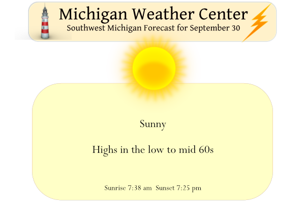
No precipitation is expected until the middle of next week. Until then, relatively mild temperatures are expected along with somewhat breezy conditions Saturday into Sunday. Temperatures will be in the mid to upper 60s.
Forecast Discussion
IR loop shows clear skies across the Lower Peninsula. High pressure
is centered over northern Lower early this morning and will provide
plenty of sunshine today. Areas of morning frost will dissipate
quickly. The next several days will be dry as high pressure over
southern Canada maintains it`s grip on the region.

A weak backdoor cold front will move through dry on Sunday, but drop
our highs 5 degrees or so. We`re looking at highs in the 60s through
the middle of next week. Our next chance of rain looks like it will
come Wednesday when a strong cold front moves through. Highs by the
end of next week will be in the lower 50s.
Here is a news story that helps explain why some people do not evacuate before a hurricane hits their area. And remember this can be a reoccurring problem that may play out several times a year.
https://abcnews.go.com/Business/people-evacuating-hurricane-ian-face-dire-financial-choices/story?id=90630756
Slim
Your life is more valuable that a few hundred dollars! Otherwise move to a different climate!
Yesterday was a great late September day with an official H/L at Grand Rapids of 63/45. There was no rain fall and 84% of possible sunshine. The grass dried out enough and I was able to cut the grass. And yes it was very long. The overnight low here in MBY was 41 and that is still the current temperature. For today the average H/L is now down to 68/48 the record high of 85 was set in 1922 and 1971 the record of 30 was set in 1993. The next several days look to be sunny and average to… Read more »
It’s a cold 35 this morning up here in Gaylord. Attended the tornado gathering put on by NWS Gaylord yesterday evening. Nice little recap of things. Certainly an event I will never forget.
I’m off to Alpena today. Everyone enjoy your Friday!
I’ll have to watch the replay of the event whenever the NWS posts it online. How’s the leaf color looking up there? (it seems like Gaylord would be the furthest along in northern lower)