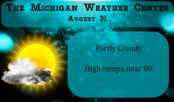
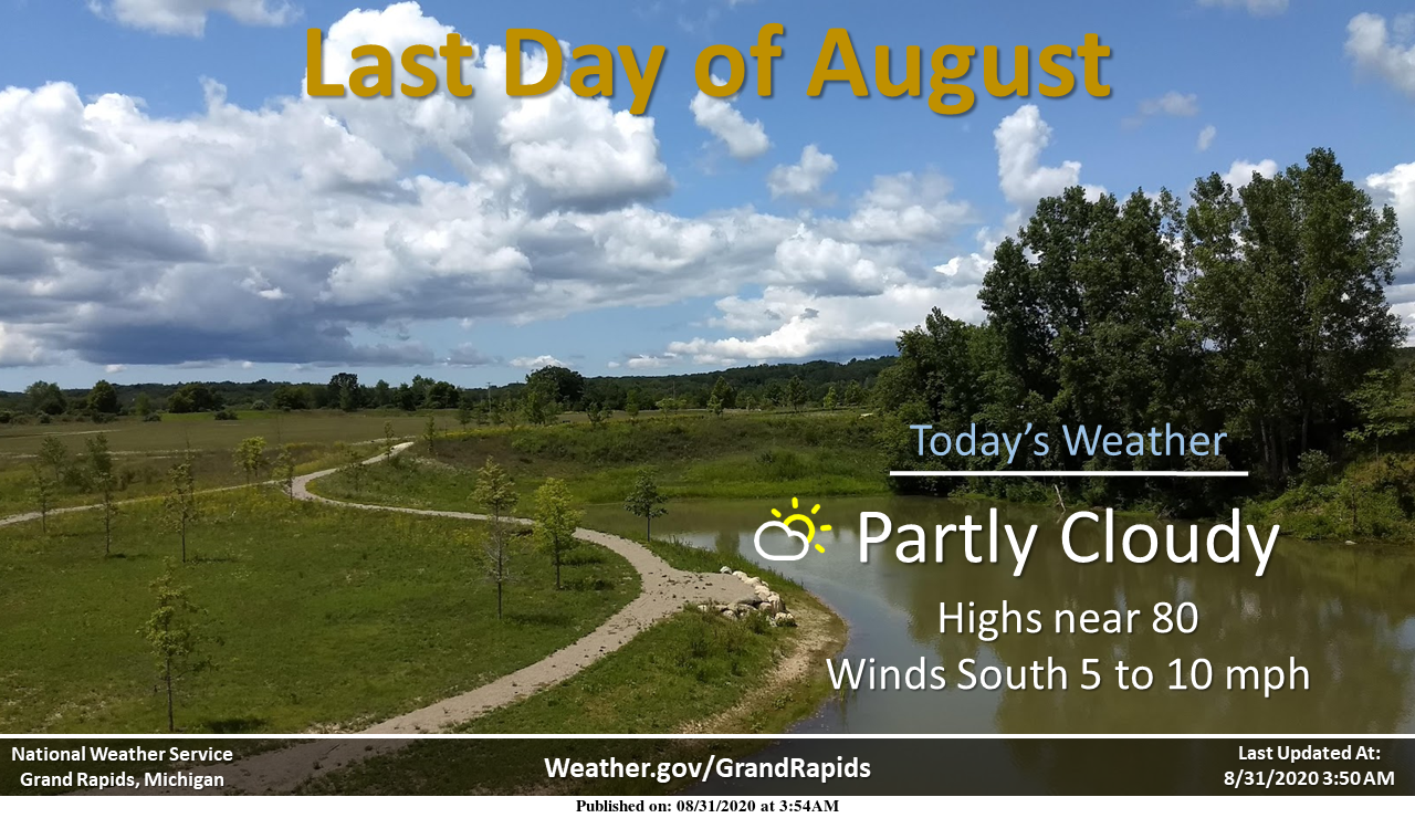
Well, we all knew it was coming with the days becoming shorter and cooler nights due to the lower azimuth of the sun. The autumnal equinox doesn’t begin until September 22. Today is the end of meteorological summer.
Today the sunrises at 7:07 am and sets at 8:18 pm in Otsego. By the end of September, we will lose around another hour and a half of daylight.
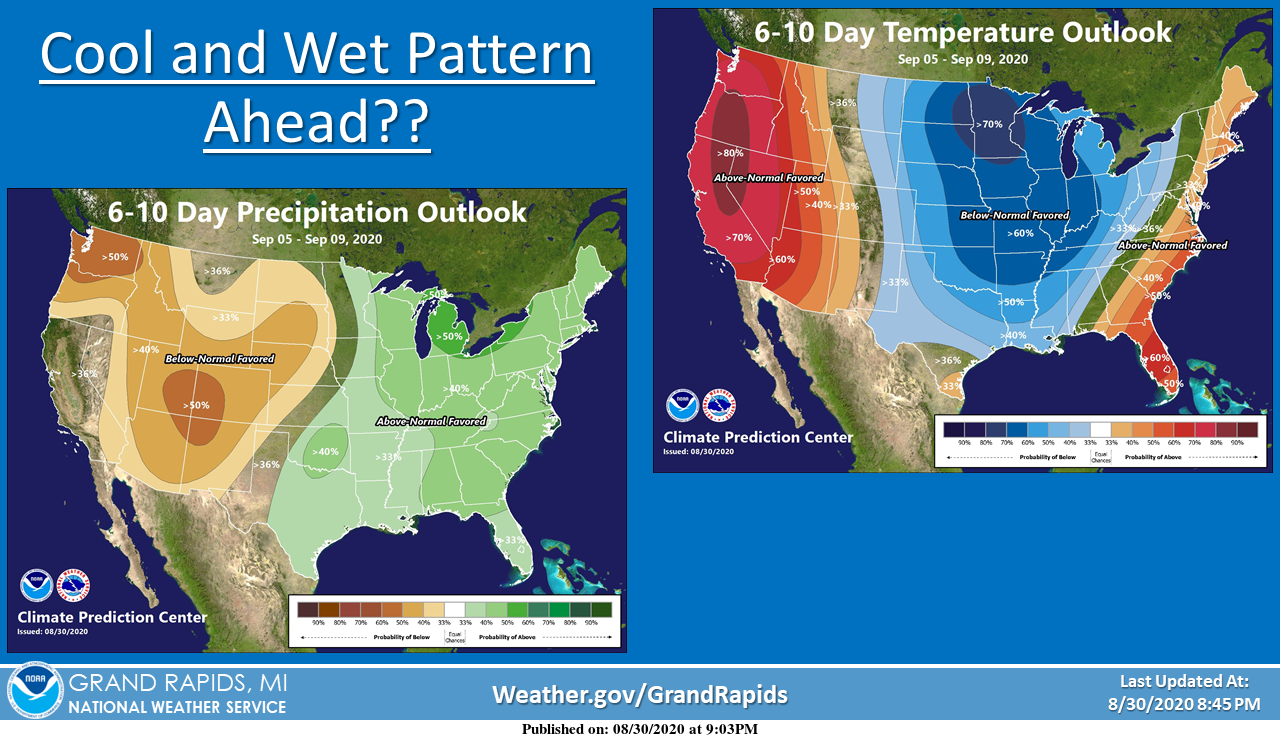
According to the CPC, we will see temps dropping down over the Labor Day weekend through at least the first half of September with normal temps in the upper 70s. On Friday the temps are predicted to be in the low 70s.
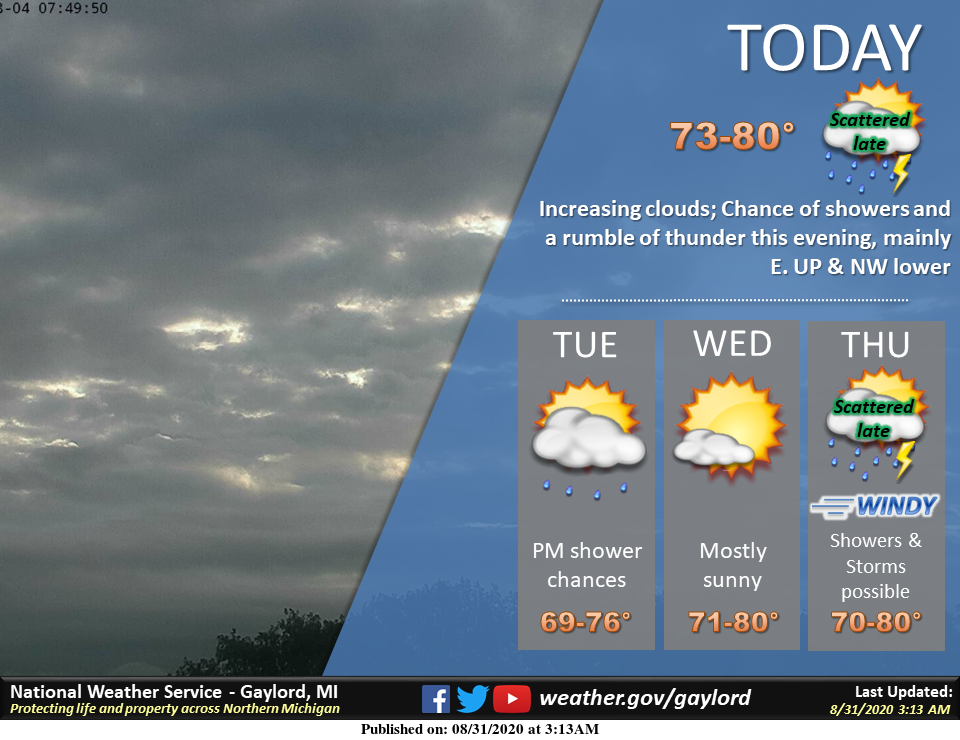
Chances of showers will be around tonight through Thursday for SW Michigan with the best chances tomorrow night.
[columns] [span6]
Southwest
[/span6][span6]
Southeast
[/span6][/columns]
[columns] [span6]
North
[/span6][span6]
U.P.
[/span6][/columns]
Forecast Discussion
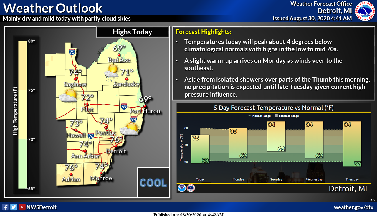
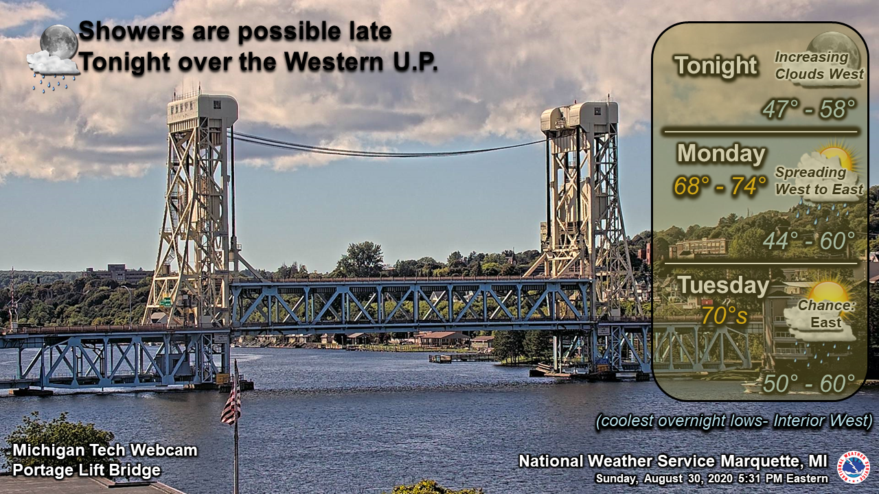
-- A chance of Showers tonight --

The High pressure that will bring fair and mild weather for most of
the day today will be pushed eastward by Monday night. Highs today
will be back in the upper 70s to low 80s. A frontal system will
swing through Monday evening. Latest CAMS have some showers near
Ludington around 8 PM but the main line shouldn`t swing through the
region until overnight into Tuesday morning. The system doesn`t
have have a lot of moisture along with it so most rain amounts
will be a tenth of an inch or lower.

-- Cloudy and rainy Tuesday through Wednesday --

The weak front that moves through Monday night into Tuesday will set
up a frontal boundary that will drape across the Great Lakes state
Tuesday into Wednesday. That will bring considerable warm air
advection. The mid level moisture should keep the region cloudy with
chances for light showers through Wednesday. Given the warm air
advection and increased instability, there is better moisture
transport and thunderstorms will be possible Tuesday afternoon into
Wednesday.

-- Strong cold front on Thursday --

An upper level trough at 500 mb will be moving through the upper
midwest Thursday. Both the EC and the GFS has a closed low at 850 mb
 with a strong surface low. The ensembles are fairly consistent in
timing and track. A much stronger front sweeping through on
Thursday will be a bit moisture deprived as the deeper moisture
will be to the south and ahead of the first front. There is
slightly anomalous moisture for the potential for some showers
and thunderstorms ahead of the front.

-- Return of dry weather Friday into the weekend --

We look to be mainly dry late in the week and into next weekend with
zonal flow aloft and southwest flow at the surface. The upper
level pattern through the upper midwest is fairly consistent due
to the fact that there are two semi-permanant highs settled over
the Southern Atlantic and the intermountain west respectively. The
long range models tend to do well with forecasting highs so this
lends itself to confidence for the mid to long range pattern.
Given this understanding, A front should traverse the region next
Sunday with a positively tilted long wave trough that currently
will drag a elongated front through the region Sunday afternoon
into Sunday night. Will need to wait till this event is closer for
more details.
On a side note the CPC new long range guess now calls for below average temperatures here for September
Slim
Who would have thought? 6 to 10 day = below normal, 8 to 14 day = below normal, 3 to 4 week = below normal, so the month will obviously be below normal. This despite the warm weather hype from some on here! Incredible!
We took a road trip up to Ludington and had a lunch at the park at the beach. It was cloudy and a cool 72 there at the beach. But all in all a good road trip for the end of met summer. At this time it is partly cloudy and 73 here at my house.
Slim
Hey Slim, if you head back to the Ludington/Pentwater area again, make sure to hit Summit Park on Lake Michigan. Bortells fishery is right across the street. It’s outstanding takeout seafood! Summit Park beach is beautiful and isolated. My wife and I like to get Bortells Fish and take it across the street to eat it at the park and listen to the waves crash in.
https://www.visitludington.com/stories/summit_park_on_lake_michigan_in_ludington
I love these short summers with virtually no heat waves! Bring on Winter!
75* degrees yesterday our draft was beautiful outside lookin more and more the same today who doesn’t love the 70’s ….Have a super Fall of a day ….INDY
81 degrees today seems a fine end to another warm month.