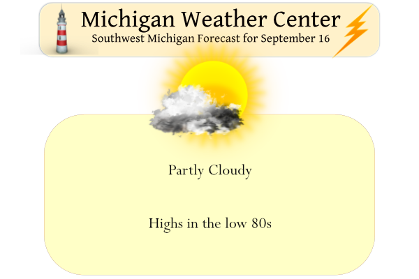
Yesterday was another great day in the weather department with mainly sunny skies. Our high was 78° and the low was 55°. This month has been on the dry side thus far with only .59 of an inch of rain in Otsego.
We are in the second half of September and it is time to bring in the thoughts of our first freeze like it or not. We still have about a month to go before seeing this come into the playing field. Below are the dates of earliest and latest freeze dates:

As we enter the fall season and the first freeze potential is coming up, here is the earliest date and the average date of Temperature 32 degrees or lower
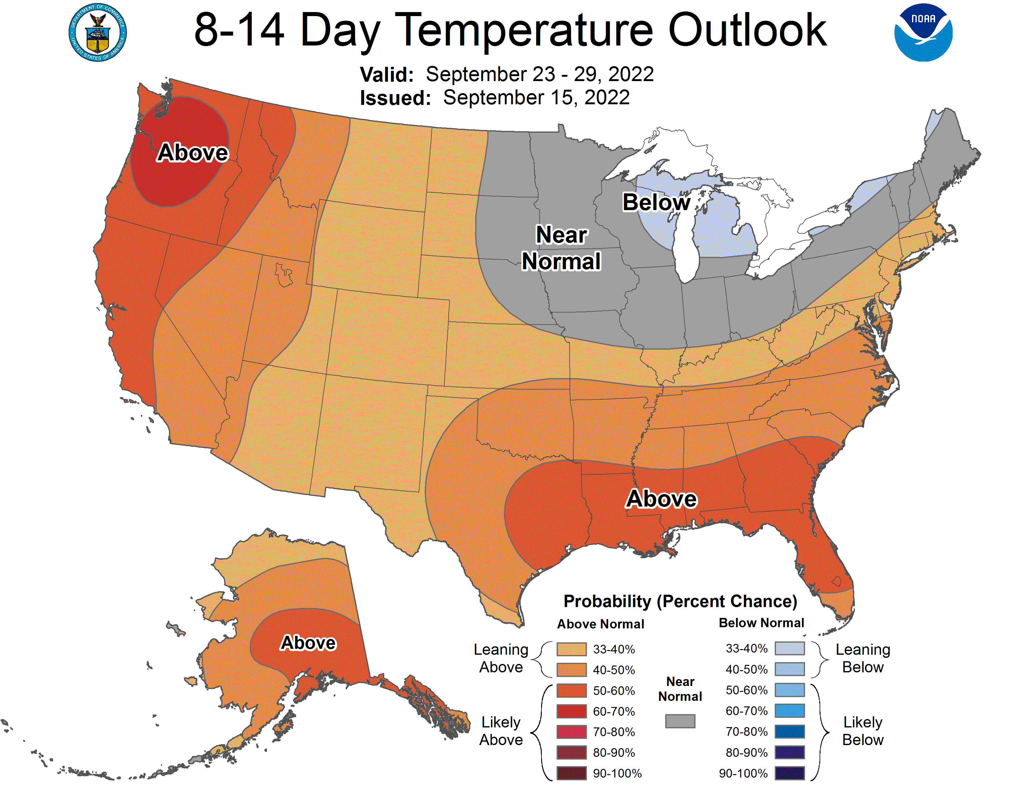
Towards the end of next week, we will see a cooling trend coming into the pictures shown in the 8 to 14-day outlook from the CPC:
Forecast Discussion
-- Mostly dry through Saturday --

Most of the area should see a majority of the next two days with a
decent amount of sunshine and dry weather. First of all, the smoke
modeling indicates that the milky white skies we saw yesterday with
the wildfire smoke should shift to the ESE and allow for more blue
skies today. We will see some thin high clouds float by, but the net
change will be the appearance of more sun.

It does look like most of Saturday will remain dry, and see a fair
amount of sun also. The caveat to that is that Central Lower (and
areas further North) will see a small chance of a shower or some
sprinkles. This will be facilitated by a weakening short wave that
will take aim mostly on Northern Michigan. Moisture progs show that
moisture return will be quite limited, which is what should keep
rain chances fairly small on Saturday.

-- Rain chances increase Sunday and Sunday Night --

Rain chances will be increasing on Sunday, but they will be kind of
on and off through that time frame until Sunday night. We will see
the leading edge of the low level jet impinging on the area from the
WNW Sun morning. However, as the low level jet starts to approach
the area, it will go through its normal diurnal weakening. This will
result in a few showers and maybe a storm surviving into the area,
but any rain will be on a weakening trend for the first part of the
area.

What is left of this low level jet will shift east of the area by
late Sunday afternoon. The models do not indicate significant
amounts of instability with cloud cover and some showers around,
limiting the amount of destabilization that can occur.

We will see better instability advect over the area Sunday evening
as moisture pooling ahead of the incoming cold front will help
destabilize the atmosphere ahead of it. Widespread rain and severe
weather does not look likely at this time, as there is another low
level jet that develops and is focused on Northern Indiana. The
shower and storm chances will linger into the early morning hours of
Monday when the front will clear the area to the east.

-- Unsettled for the coming week ending with cooler weather --

We should see a break in the weather in the wake of the cold front
that moves through Monday morning. Right now, it looks like the
latter half of Monday and Tuesday morning would be dry. Then, rain
chances would return on Tuesday afternoon as the next wave embedded
in the somewhat zonal flow over the region would arrive. As we get
into the small waves of next week, the timing is apt to change a
bit. As this next wave does come through around Tuesday afternoon,
the chance of rain, with a chance of a storm during peak heating
would be plausible.

The next period of weather then looks to arrive over the area around
the late Wednesday time frame. This feature will be another short
wave, but this time the long wave trough is expected to dive
southeast over the area. The models have been fairly consistent in
showing this trough diving over the area. It will support a fairly
formidable cold front to move through, dropping 850 mb temps from 22-
23C ahead of it supporting higher 80s to 90, then dropping to +4C by
12z Thursday.

That kind a strong front associated with a strong upper system,
along with a strong mid and upper level flow, could bring some
severe weather possibilities. This is still way to early to nail
down details like that, but we will continue to monitor.

Either way, it does look like much cooler air will be arriving later
next week. Depending on the way the low comes in, there could be
some instability showers in its wake next Thursday, and maybe even
some lake effect rain showers.
Get ready, a big cold front is coming thru next week! The near normal temp pattern continues to rock! Incredible!
The sun altitude is down to 49 degrees, the same as March 24th. We are still in the sunnier half of the year… but not much longer.
We will begin to loose daylight at a pretty rapid rate not long from now. Sunset today in Grand Rapids is 7:50. By the 30th of September it’s 7:25. And one month from now it will be 6:58.
Rather hazy and humid out today again with the dew point creeping into the mid 60’s. Not quite the cool, crisp air you’d expect for the second half of September. AC continues to crank.
6 more days of mid Summer like weather? I’ll take it! What a summer it was.
The official H/l at Grand Rapids yesterday was 77/54 there was no rain fall and there was 55% of possible sunshine. The overnight low both here in MBY and at GRR was 58. For today the average H/L has now dropped down to 74/53. The record high for today is 89 in 1906 and 1955. This is the first time the high for the day has not been 90 or better since May 24th The record low for today is 32 in 1902. Most of the next week looks to stay on the warm side until late next week when… Read more »
Interesting that Hollands average first freeze is earlier than GR. Seems with the close proximity to the lake it would be a bit later.
The dates above are since records started at each location. For the last 30 years the average first
32 at Grand Rapids is October 14th and at Holland October 16th. The more important first hard freeze of 28 or colder the average date for GR is October 28 with a range of September 23 1974 to November 29 1948. For Holland the average first 28 or colder low is October 29 with a range of September 27th 1989 to November 23rd 1941.
Slim