We had a trace of rain yesterday which amounted to a few sprinkles. Temps this morning are below freezing once again. We currently have 28° at 6 am. Our freeze warning continues through 9 am.
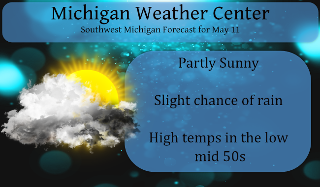
It has been pretty boring being a weather person this spring with few if any events to get excited about. It has been a concern as we go through the last month of spring locked in drought conditions. There is more on this in the forecast discussion (in blue). There is a 20% chance of rain showers this afternoon and evening. Other than that we don’t have a decent chance of rain until next week.

Much of the southern half of Lower Michigan received half the normal amount of rain over the past 30 days. Northern Lower Michigan is running a little above average but nothing overwhelming, while it’s a mixed bag in the U.P. though fairly close to normal. A soaking rain on Sunday slipped by to the south of Michigan.
Forecast Discussion
- Freeze expected again tonight / possible Thursday morning-

I expect tonight (Wednesday morning) actually has the greatest
risk of freezing temperatures of any day this week. I believe this
since this coming night, unlike this morning, we will have the
surface high moving into the area while the upper low will finally
be moving off the east. That will allow decoupling and
temperatures should have no problem falling into the mid to upper
20s north and near 30 inland south.

We will more than likely issue another freeze warning for tonight.
Typically do not have two headlines for the same thing, so we
will wait for the current freeze warning to expire before we
issue the one for TONIGHT.

The question is then is will we need one for Thursday morning? I
am thinking we will likely need at least a frost advisory and
possibly a freeze warning northern sections. The upper high is
moving in by then and the surface high will be overhead. So winds
will be near calm and skies should be clear. I could see lows
getting colder than our models are suggesting.

- Dry conditions into this coming weekend-

For starters, as of the 10th of May, at Grand Rapids, this is the
driest year to date (10th of May) since 2001! Grand Rapids was
5.19 inches below normal for total yearly precipitation, which is
a little below only 1/2 of normal. At Muskegon it is the driest
year to date, since 1989! Muskegon is 5.78 inches below normal for
the year. Going to the Midwest Climate Center, climate Group 8
(Grand Raids, Holland, South Have, and Kalamazoo) is, for January
through April, is the driest since 1958! The 5.84 inch mean
precipitation for this group was only a 1/2 inch wetter than the
driest year, 1934 (5.31"). This is the 4th driest on record (1895
to 2021). By the way, the median for Group 8, for January through
April is 9.37". I hope, by now, I have convinced you this has been
unusually dry so far this year across the area. I see no reason
to believe in the next 5 days this will change. We have an upper
ridge moving in with the polar jet solidly holding south of this
area.

The best we can do for rain is this afternoon, getting some
isolated showers inland of US-131. The upper cold pool will still
overhead, so we will see some instability showers, mostly well
east of US-131 (where the instability is greater). The Equilibrium
level there is forecast near 14000 ft. That puts cloud top
temperatures below 0F. So precipitation will be more than
possible. It will just be isolated through.

After that we get an upper ridge to move over us for Thursday
while a surface high is over us. On Friday we do get another
northern stream shortwave coming through the area so isolated
showers would be possible in the afternoon. Even so the surface
high remains over this area into Sunday. Most locations will
likely see no precipitation at all from today through Sunday.

- Possible change to warmer and wetter next week-

Things may change next week. The MJO is forecast to become to weak
into influence the upper level wave pattern by then. Also by next
week the models show the NAO and AO remaining weakly negative
while the PNA is also negative. That is a classic wet pattern for
this area. Beyond that, the models all show, in one form or
another, an digging Pacific shortwave that should be strong enough
to bring the polar jet north of us. That in turn will bring us
back into a pattern that would bring rain into this area. It`s to
early to have much detail about this through. So who knows, maybe
it will figure out way to rain meaningfully here yet this month?
The next next 3 months will be nice giving our furnace a break looking forward to it ..INDY
This could be a record breaking cold Spring! Incredible!
Has Spring weather even started yet??? Lets be real here ….Another Frezzee warning tonight how many is that now since so called Spring has started ??? Asking a friend….INDY
The cold just keeps coming! Relentless May cold! Absolutely incredible! Week after week of below normal temps! Wow!
Just like from the mid of February till halfway through April was week after week of above normal temps. Funny how it all works out that way.
At the current time the official temperature is just 50 at Grand Rapids if it fails to reach at least 55 it will be one of the ten coldest maximus for any May 11th at Grand Rapids.
Slim
Of the years mentioned in the NWS discussion 2001, 1988, 1958 and 1934 the total at the end of the years at Grand Rapids were 2001 40.71″ 1988 36.37″ 1958 27.33″ and 1934 25.30″. While 1934 was the driest year up to May 10th it was not the over all driest year at Grand Rapids as that was 1930 with just 20.92″ with 1962 coming in at 2nd place with 22.77″ 1934 ended up as the 9th driest year at Grand Rapids with that 25.30″
Slim
It continues to be cool and dry. The low here at my house was 33 and it looks like the official low at GRR will be 34. At this time it is clear and 39 here.
Slim
Wow, for the region it’s the driest year since 1958 and 4th driest ever! Those are records we really don’t need to be chasing down. Wasn’t it last year or the year before we had our wettest year ever? What a flip!
That is true. And guess what how long do you think it will be that people that live along the lake shore (and even inland lakes) will be complaining that they have to “drag” their boats out to the water and that their docks are not in the water anymore.
Slim
“For starters, as of the 10th of May, at Grand Rapids, this is the driest year to date (10th of May) since 2001!”
NWS GR is trying to outdo our resident almanac, Slim. Or are you moonlighting for them, Slim?
Dry here. Very dry here. 36 here this morning and once again (thankfully), no frost. Our local met said that today will finally be the last truly cool day.
It’s nearly impossible to sleep in nowadays. It’s getting light out at 5:30 am and birds are chirping like there’s no tomorrow.
I know the NWS is trying to do my job but they get paid for it LOL
As for it getting light at 5:30 just think some people want to stay on standard time all year long and if that was the case it would be getting light out at 4:30
Slim
Good point. I guess that’s the downside of being on the far western edge of the time zone.
I personally think we should stay on our current time all year. It would be nice to have light until 6PM in the winter (the morning would be dark, but it is dark while I drive to work anyways, so there would really be no difference in the morning).