I would like to reiterate we need to keep the comments weather-related pertaining to the current blog posting or historical data and current conditions. I am getting some blowback on repetitious comments and nonweather-related opinions. Yes, we all have the right to our own opinions but sometimes it is best to keep them to ourselves especially on the world stage of blogdom.
There is a small group here in the commentary in comparison to the number of people who come here for information. I don’t want to have to go the same route as Bill and close down the comments section. Slim and I work hard to keep this site up and running and I don’t want to have to worry that some are offended that some comments which are made don’t fall in line with their own opinions. Thanks…
Weather History
February 28
1998: Record warm temperatures include the high of 53 degrees at Muskegon and 54 at Grand Rapids, helping to make this the warmest February on record at those sites.
March 1
1882: March comes in like a lamb with high temperatures in the 60s. Lansing hits 64 degrees and goes on to reach 66 degrees the next day. This continued the warmth from the previous month, which was the warmest February on record at Lansing.
1962: Bitterly cold weather begins the month with morning lows below zero and high temperatures only around 10 degrees.
March 2
2002: A strong low-pressure center moves across the Ohio Valley bringing record snows to Lower Michigan. Grand Rapids has 13. 9 inches and Muskegon 10.5 inches, both set records for their snowiest March day on record.
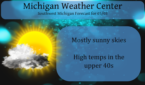
March 3
1943: Arctic air dominates the first ten days of the month. Record cold temperatures this morning include the 10 below zero at Muskegon and the 9 below at Grand Rapids.
1983: Record highs are set across Lower Michigan with Grand Rapids hitting 72 degrees and Muskegon 69 degrees. The first week of March is incredibly balmy with six straight days of high temperatures of 60 or above at Grand Rapids.
March 4
1912: Subzero cold continues during one of the coldest months of March on record across Lower Michigan. Muskegon sets a record low of 2 below zero on this morning, during a spell of five straight days below zero.
March 5
1948: Arctic high pressure dominates the first half of the month of March with record lows this morning of 8 below zero at Grand Rapids and 5 below at Muskegon.
1976: Thunderstorms move over cold air near the ground to produce one of the worst ice storms in history across Wisconsin and Lower Michigan. From 2 to 5 inches of ice builds up on trees and power lines, resulting in hundreds of thousands of people without power, some for as long as ten days.
March 6
1956: Severe thunderstorms moved across Lower Michigan ahead of a strong cold front. A tornado destroyed five barns and unroofed homes in North Blendon and Bauer in Ottawa County.
Forecast Discussion
- Dry Cold Front Today -

An Upper level short wave will swing through the region this
afternoon through early evening. This short wave will correspond
with a dry cold frontal boundary. Winds will slacken behind the
front this afternoon. Temperatures will be around normal today but
the temperatures will drop to slightly below normal tomorrow and
Friday due to the northerly flow and cold air advection.

- Mild weather through the weekend -

Michigan will be sandwiched between a large upper level low in
Eastern Canada and a high pressure system sitting over the plains
and intermountain west. This will allow the state to have mild
weather and near normal temperatures through the weekend and into
next week.

Several perturbations will traverse the state from the low,
however the ridge will dry out any moisture and as it is pushed
eastward will keep the region precipitation free.


- Rain possible mid to late next week -

The biggest story is a deep trough that will traverse the region
next Wednesday to Thursday. The models have it extending from the
Upper Mid west to Texas. This trough should funnel Gulf moisture
into the region that will bring southwest Michigan the next
chance for precipitation. 850 mb temperatures are +4C out ahead of
the system. Latest PWATS from the EC and GEFS are showing 0.75 to
1.0. This is a fairly anomalous signal that lends some confidence
to the chances for precipitation. However there is some timing
issues on when the front will move through, the GFS brings it
through Wednesday, where the EC moves it through Wednesday night
into Thursday. There will be some cold air behind the front so
can`t rule out some brief snow.

 Out ahead of the system will be decent instability which, given
the time of year and the moisture could bring the chance for some
early spring thunderstorms. The largest snowpack is in central
lower, and if the rain shifts slight northward would hasten any
snowmelt. However, given the current river levels there isn`t any
flooding concern though it certainly would need to be monitored.
It was a beautiful Spring day! Awesome sunset too. I love this time of year when all my flowers “wake-up”. I saw 6 black red wing birds today.
It is now up to 54 here at my house the official reading at GRR was 49 will have to see if it makes it to 50. Either way this is the warmest it has been at Grand Rapids this year so far.
Slim
Anyone notice the moon for the past six seven nights? So pretty and very bright. You could almost read a book outside in the middle of the night. Just returned from taking the dog for a walk. Nice day today. NWS GR says 58 for a high next Tuesday. I think we have turned the corner.
The average 1st day with a high of 58 or better is March 8th so if that happens we are right in the zone.
Slim
MV Happy Anniversary to you and your wife. I was outside this morning with the dog and it felt much warmer. Sunny and no wind. I noticed some of my early Spring flowers are coming up.
Today March 3rd is the earliest day of the year that it ever officially reached 70 or better. As stated above it reached 72 on this date in 1983 and it also reached 71 in 1974. The next March day with a record high of 70 or better is not until March 7th. Also of note it that as of today Grand Rapids has not had a thunder event yet. To bring you up to date any day that has a recorded lightning strike is considered a thunderstorm event. At this time it is clear here at my house and… Read more »