We are now at that time of year when we see more clouds than sun and with a more active weather pattern, we can see a range of different types of precipitation. Uncertainty of the various weather models makes it hard to predict whether rain or snow will fall with temps expected to be slightly above average over the next eight days or so. I don’t take much stock in computer long-range forecasts as they can change daily. The models are still in disagreement about a storm system expected to impact the area in the Friday/Saturday time frame.
It is my opinion we will have more snow than last year. We had 46.5 inches in Otsego (December through February). We are already halfway there this year (24 inches in November). Our total from November through March was 60.4 inches.
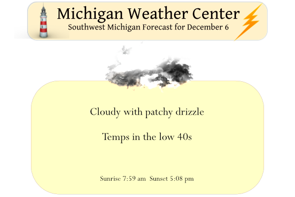
Yesterday’s high was 43° and the low was 28° with mostly cloudy skies and a trace of drizzle.
Water Levels
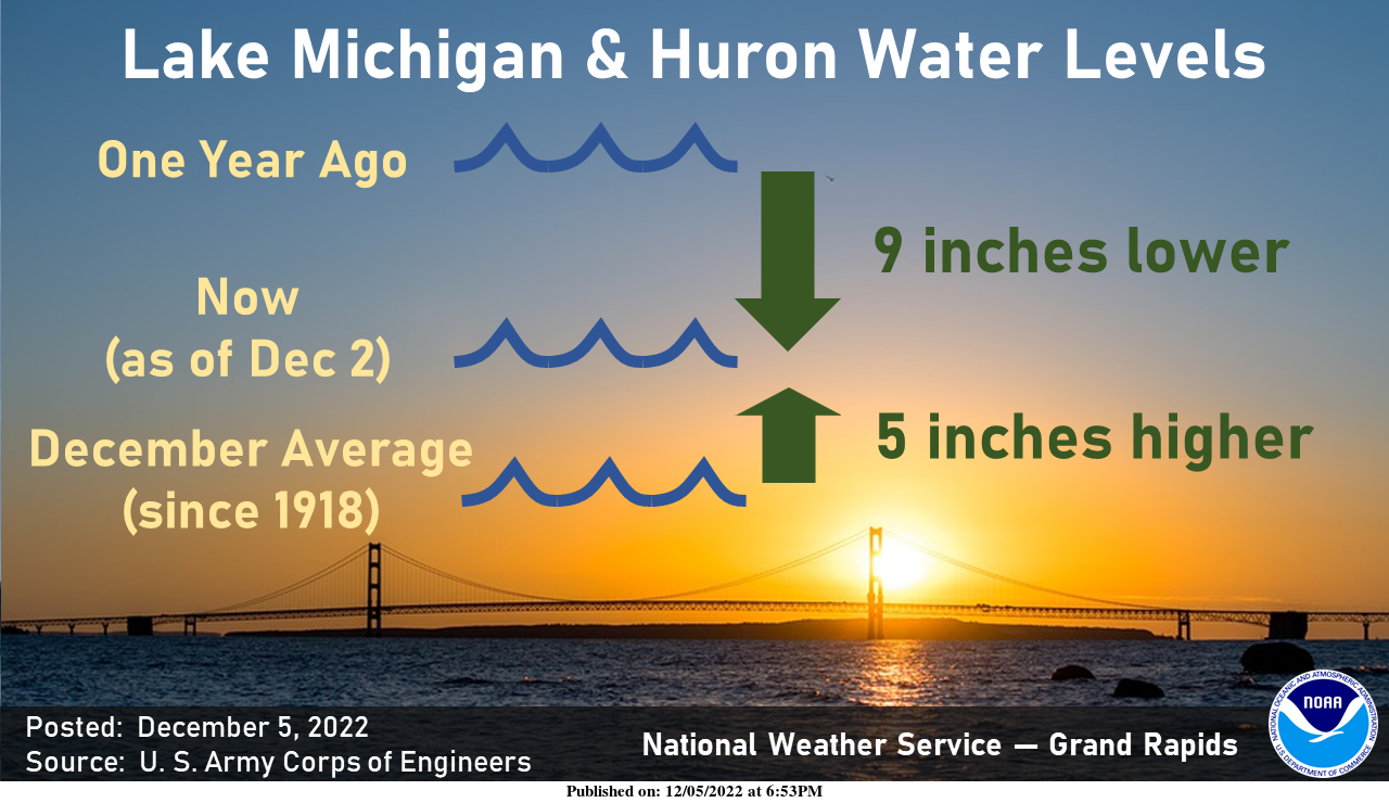
The water level of Lake Michigan and Huron (hydrologically a single lake) has fallen 9” from one year ago. This level now stands at 5” above the Dec average (since 1918). Seasonally, water levels typically drop during the autumn and early winter, when relatively cold air blowing over relatively warm water leads to strong evaporation. The lowest water, on average, occurs in February.
Forecast Discussion
-- Chances for light precipitation into Wednesday --

The next few days through Thursday, we will be in this pattern
between the northern stream well north of the area, and southern
stream well south of the area. Essentially that means no major
systems through Thursday, although there will be some light
precipitation possible at times today into Wednesday morning.

This precipitation will result from a couple of weak short waves
embedded in the somewhat zonal flow across the Nrn portion of the
country. The biggest factor that will almost assure limited impacts
for the area will be temperatures and wet bulb temperatures above
freezing for most areas.

A weak sfc front is dropping down through the area early this
morning. We have some low level moisture and high level moisture,
but quite a bit of dry air in the middle of the atmosphere. Some
sprinkles and/or drizzle seem like the most likely precipitation
types near the sfc front which is just NW of Grand Rapids. The air is
cooler up north, but precipitation has mainly ended. The threat up
there for precipitation is much lower.

It seems there should be a break in the precipitation chances after
this morning. They will then return this evening and overnight as
another weak short wave moves through. Temperatures staying above
freezing through tonight and dew points coming up, will keep any
precipitation of the liquid variety.

Precipitation will taper off Wednesday morning, and we will see a
dry period then through early Thursday night. High pressure builds
in, but there are indications that a low cloud deck will likely get
trapped under a subsidence inversion, along with potential shallow
lake effect cloud cover coming in from Lake Huron with a NE flow.

-- Potential for accumulating snow centered around Friday --

It is looking more and more likely that there will be a swath of
accumulating snow that falls in a band across the region from late
Thursday night through Friday. The million dollar question is where
does it fall. Unfortunately, it is still quite uncertain the exact
track that it will take.

There seems to be a good chance that it will affect a portion of the
area, but could be anywhere from the U.S.-10 corridor, to down
toward the I-94/I-80 area. The band of accumulating snow depends all
on the track of a strong mid level wave that looks to actually close
off a bit, and move from West to East across the area. The models
are all on board with the wave/low.

The uncertainty of the track lies with the exact evolution of this
wave/low as it comes out of the Western U.S.. The main wave is
currently off the coast of Nrn CA, and will swing over the Rockies.
There will be another piece of energy that interacts with this main
wave, which will affect the strength, and resulting track of the
system. The various models, and their ensembles remain varied with
their solutions, leading to a lower confidence forecast for now.

As far as amounts are concerned, it is obviously way too early to
get into that detail for now. While there likely will be
accumulating snow on the northern edge of this system, it should not
get too out of hand. This system is mainly a srn stream system, with
the nrn stream (and associated cold air) remaining well north for
now. There will be just cold enough air at the sfc on the northern
periphery of this system to go with the fgen in the mid level
deformation zone to produce snow. We will fine tune this forecast as
the models come into better agreement as we get closer to the event.
I like the new look!
Great news, we are still on track for a snowy middle to end of December! Mark it down and get prepared now!
I see you found the comment section. Do you like the new format?
Not sure yet?
Snowing pretty good up in Big Rapids on the Ferris State University Campus cam
https://osprey.ferris.edu/
It was nice out last night. Took the dog for a walk after sundown and it was still in the low 40s at the time. I don’t mind the cold and snow of winter. Winters around here don’t last very long and they are not that harsh, as compared to other areas. What I dread is the lack of daylight. It’s a drag when you go to work and it’s dark, and you finish work and it’s dark again.
On the bright side, the earliest sunset of the year is in a couple of days. After that we start gaining daylight in the evening as the sunsets get later each day.
That IS good news. I was not aware of that.
Good morning. The official H/L yesterday at Grand Rapids was 42/26 there was no rain or snow fall, and of course there is no snow on the ground. There was 17% of possible sunshine. The overnight low here in MBY was 35 and the official low was 36. At the current time it is cloudy and 38 degrees here at my house. At the airport there is drizzle being reported. For today the average H/L is 39/27, The record high of 63 was set in 1951 and the record low of 2 was set in 1964. The record snow fall… Read more »