We had four hundredths of an inch of rain yesterday afternoon, our first in nine days. We now have a total of 2.59 inches for the month. Driving around Allegan and Kalamazoo counties I see the soybeans and corn crops are stressed and small for this time of year except where irrigation occurs. I suspect this will continue as long as the parade of areas of high-pressure march across the Great Lakes. Any precipitation heading towards the state is sucked dry. As we move into the first week of July the CPC is guessing a 33 to 40% chance of above-normal rainfall…
Yesterday we had a high temperature of 83°, the low was 59°. We lost 17 seconds of daylight yesterday and 35 seconds since the summer equinox. We are on a gradual spiral to fall.
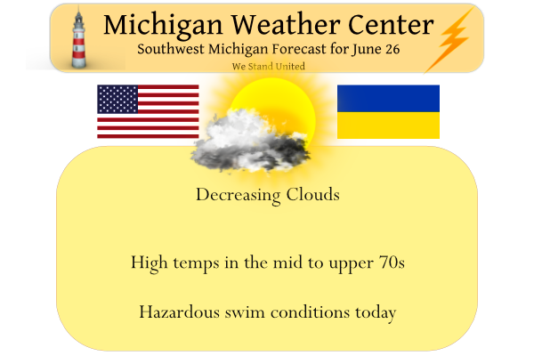
We expect another dry day today with decreasing clouds and breezy conditions.
Forecast Discussion
- Becoming cooler today through Monday -

A consensus of latest short range guidance and CAMs suggest that
Lingering early morning showers mainly over our se fcst area will
exit our area by around 12Z this morning. Skies will be partly
sunny today and it will be cooler with temps this afternoon in the
70s. It will also become breezy this afternoon through this
evening with wnw winds ramping up to 15-25 mph.

The coolest day will be Monday with h8 temps of only around 5 to
7 C by then. As a result high temps will struggle to reach the
upper 60s to perhaps lower 70s. Temps will be warmer Tuesday as
winds back to the sw and warm air advection commences. A cold
front moving in from the northwest will bring some showers mainly
to our northern fcst area Tuesday night. However moisture with
this system is quite limited and rain of any significance is not
expected.

- Moderating trend of temps mid to late week -

Temps will undergo a moderating trend mid to late week as h8 temps
moderate significantly to around 20 C by Thursday. As a result
high temps by then will flirt with the 90 degree mark. A high
pressure ridge will bring fair wx Wed/Thur. A cold front moving in
from the northwest will bring the next chance of rain late
Thursday night and Friday. Temps will return to closer to normal
for this time of year by next weekend.
Just checked my rain gauge. 0.15” of rain fell here last night. Need more, but that was better than nothing.
In the whole state of Michigan Lansing had the most reported rain fall yesterday with a total of 0.15″
Slim
One year ago today West Michigan saw numerous Tornado Warnings along with several tornadoes. Probably one of the most intense tornadoes of the day was in Ionia County near Lake Odessa. I’ve never seen NWS Grand Rapids issue so many tornado warnings in one day before. I was out storm spotting that day and was the first handful of people on the damage near Lake Odessa. One house was completely destroyed. I drove by there about a week or so ago and that house is being rebuilt.
I am not sure if the NWS keeps track of the number of warnings they issue.
Slim
That would be interesting to know if they did.
Wasn’t it supposed to get in the 90″s yesterday?? INDY
There were a few locations that reached 90 yesterday mostly in northern lower Michigan. In the south were there were more clouds Lansing was one of the few loculations that did report 90 for a high. And they reported 0.17″ of rain fall.
Slim
We had just under 2 tenths of an inch last evening, two miles east of Hamilton. BTW, I’ve always been a bit confused as to the hundredths measurement (I slept through most of my math classes as a kid)? Can someone shed some light on that?
10 hundredths are in a tenth of an inch. .01 is one-hundredth of an inch. We had .04 of an inch of rain in Otsego which is four hundredths.
Thanks for clarification on that. It makes sense the way you explained it!
Here at my house I doubt we have had over 3/4” of rain all month. Lack of rain coupled with the hot days has made everything very dry. Farmers are watering and the crops without are yellowing. I actually had to put a hose on my animal pasture yesterday for the first time ever. Just to keep the dust down.
06/26/2022 The official H/L at Grand Rapids yesterday was 86/63 and while there was some rain fall it was not much as just officially only 0.04” fell and here at my house just 0.03” fell. There was less sunshine then the past few days as there was just 44% of possible sunshine. To the east where there was more sun it reached 90 at Lansing. And to the west where there was less sun it the highs were in the low 80’s at Holland and Muskegon. The overnight low both in MBY and the official low so far at Grand… Read more »
Goodbye heat, hello cooler and less humid temps! Get ready for lows around 50 degrees! Incredible cold!
While it has been warm it has not been too bad over all. The bigger news for our area is how dry it is becoming. Lows in the low 50’s and even the 40’s are not all that uncommon in our area. Remember unless one is outdoors over night lows in the 50’s are not cold.
Slim
A low of 50 degrees in late June is definitely cold!