I was out and about yesterday morning at 10:30 when we had a large amount of hail mixed with heavy rain falling along with some lightning and thunder. We had enough hail to cover the ground though it didn’t last long with the rain falling. We ended up with .52 of an inch of rain and a high temp of 54° yesterday. It is currently 38.5° at 6:30 am.
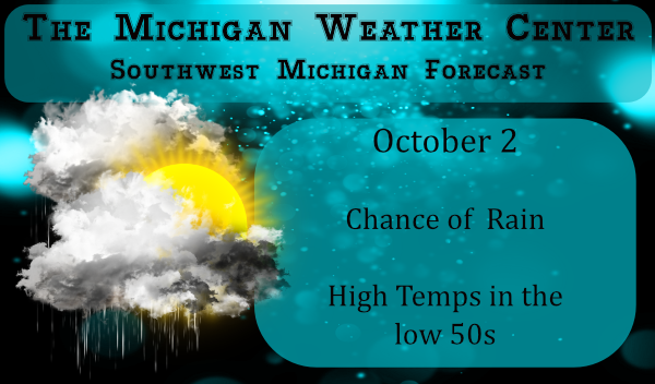
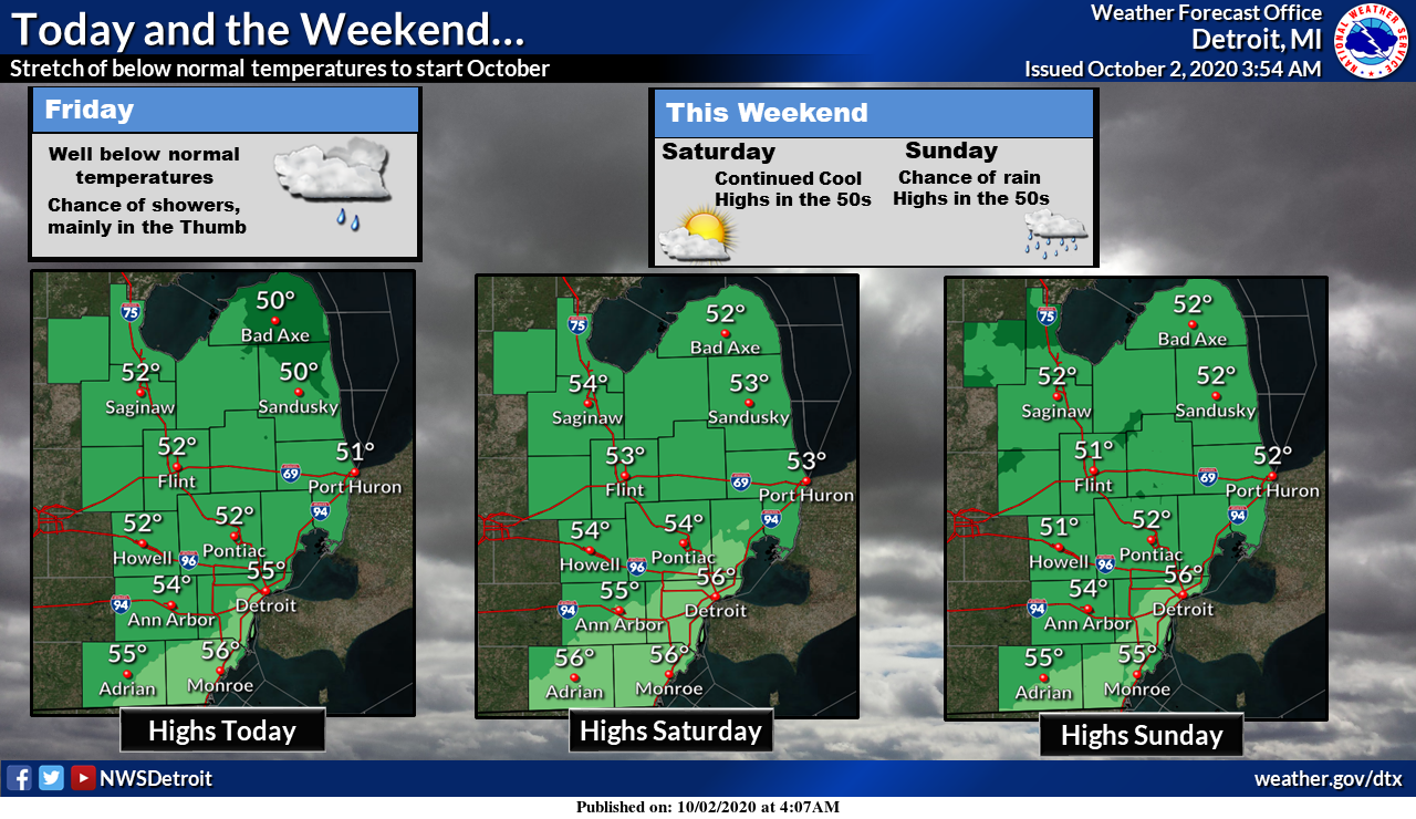
It will be partly cloudy today with scattered showers, mostly west of US-131. Highs will only be in lower 50s. Frost is expected inland again tonight with freeze temperatures possible near and north of Route 10. Showers are expected on Sunday but it will remain chilly. Monday will be sunny with highs near 60.
Below is the September wrapup from the NWS:

Michigan Forecast
[columns] [span6]
SW
[/span6][span6]
SE
[/span6][/columns]
[columns] [span6]
North
[/span6][span6]
U.P.
[/span6][/columns]
Forecast Discussion
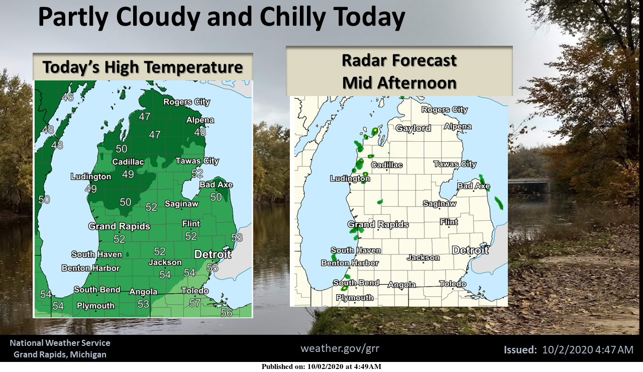
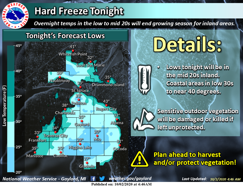
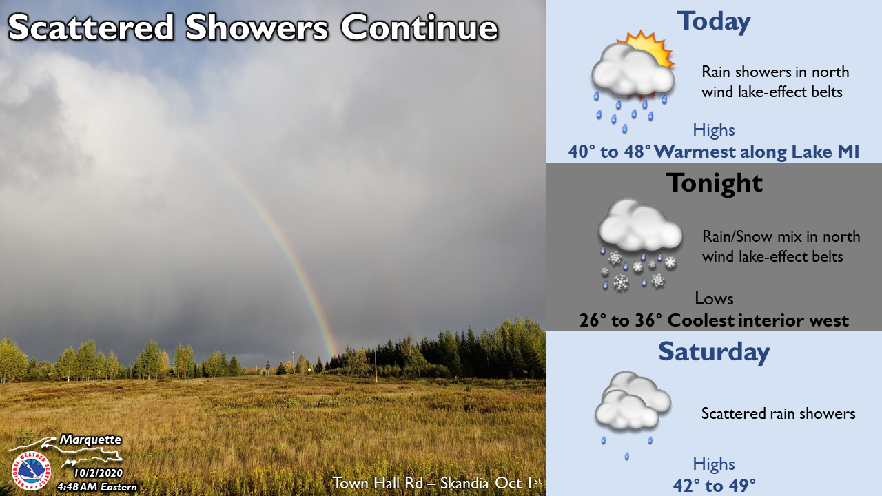
-- Showers today --

Currently the nocturnal land breeze convergence band of lake
effect rain showers is streaming toward Berrien County. These
showers should gradually nudge inland today as winds in the
convective layer become increasingly westerly. The combination of
diurnal heating and steep low-level lapse rates to about 750 mb
should also sustain the showers over land, and the latest CAMs
suggest they could reach US- 127 by mid/late afternoon. The EL of
the convection will be lower today than the previous two days, now
less than 10,000 feet which will be about -10 C. Enough for rain,
but lightning and hail seem unlikely.

Lake surface to 850 mb delta-T of about 18 C and convective cloud
depth of about 5,000 feet will maintain a chance of a waterspout
or two on Lake Michigan today.

-- A potentially frosty night --

With the surface high over the state Friday night/Saturday
morning and 850 mb temperatures about -2 C, this would ordinarily
be a pretty good freeze scenario. And indeed, we are predicting
lows a few degrees colder than Friday morning in interior Central
Michigan. However, mitigating the potential for a widespread
freeze farther south will be some high clouds and perhaps a few
low clouds. A frost advisory does seem prudent for most locations,
though it doesn`t appear it will be quite as cold as September
19.

-- A couple more rainmakers in the next week --

While a few lake effect showers may linger around the lakeshore
areas on Saturday, the greater chance of rain will occur on Sunday
as another digging jet streak reinforces and sharpens the trough
over the Great Lakes, inducing some loosely consolidated low-level
cyclogenesis over the region. Rain amounts on Sunday don`t look
overwhelming in the ensembles, likely a tenth to quarter inch.

A stronger and more zonal jet streak from the northern Pacific
will flatten out the western North American ridge, and under the
left exit region, a faster-moving and deeper low-level cyclone
passing through the Great Lakes late Tuesday and Wednesday should
give us our next chance of rain, along with a potentially breezy
day on Wednesday.

Temperatures over the next week may trend closer to normal, but
the return of any 70s for highs (above normal) doesn`t seem likely
until at least next Friday.
Currently 47* degrees out at the YARDOFBRICKS did we even hit 50* degrees today??? kind of cold for early October standards around here but whoe’s complaining not me lol…Love it!! have a good Friday …INDY
It looks like the official high at Grand Rapids will be 52. That will tie 2003 and 1961 for the 3rd coldest maximum at Grand Rapids for any October 2nd in history with just 1993 (49) and 1974 (44) being colder.
Slim
Well the facts are in! September was another below normal temp month for GR! We are having an incredibly cold week! Wow!
Another? More like it was our first (barely) below average month since May. What spin!
Boy, for all the carrying on about how “incredibly” cold and “November” cold we were having in September, how is it that half of the nearby reporting stations above ended the month “above” average???
You’re correct. Battle Creek, Muskegon, Kalamazoo, Saginaw, and Traverse City all reported a warm September.
There was no hail that I know of here yesterday. I did record 0.17″ of rain fall and there was a few claps of thunder yesterday afternoon. The overnight low here was 35 but the clouds have now moved in and the current temperature here is 39.
Slim
We had hail in north Rockford yesterday. It only lasted a few minutes!