The sun made an appearance yesterday which is welcome any time during the late fall early winter. We had a high temp of 51° then the wind picked up and the temps dropped to 31°. Our liquid precip is at 1.7 inches (rain and melted snow), and snowfall is at 3.7 inches.
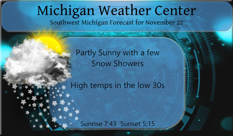
Wind chills will be in the teens this morning with winds still a little gusty and air temperatures in the 20s to 30s. Winds should continue to weaken through this morning with highs in the 30s this afternoon. Lake effect clouds will linger for much of today before dispersing this evening. Snow chances are around 20%,
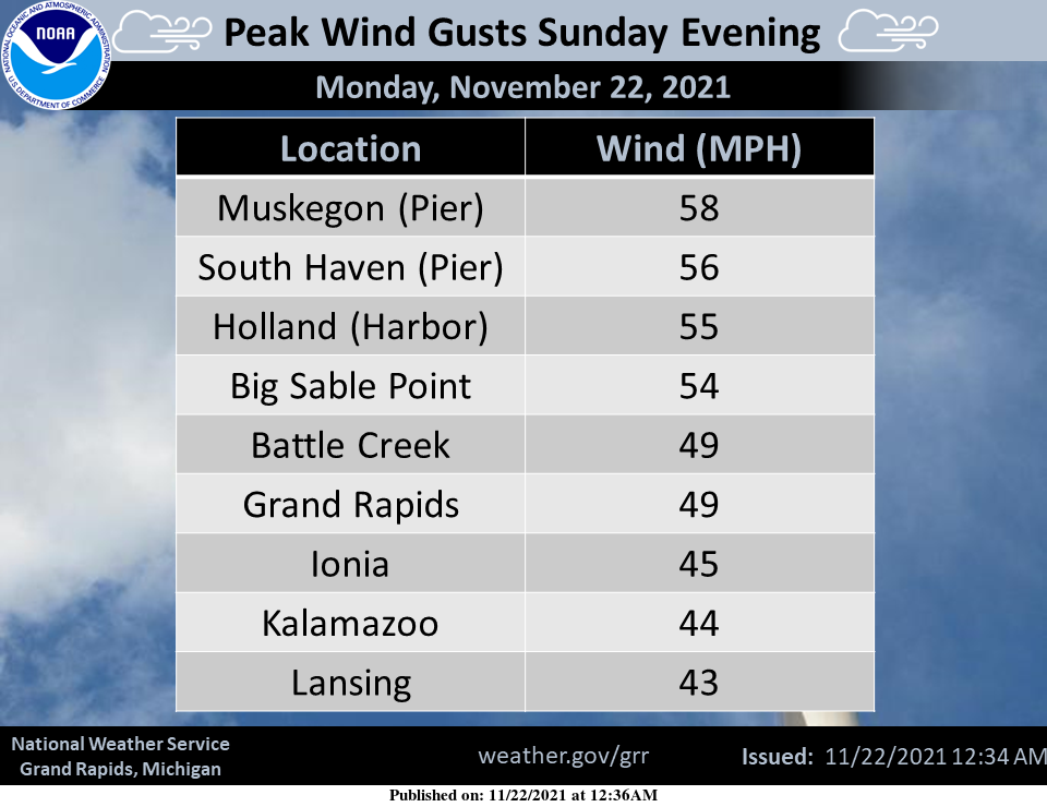
A strong cold front brought peak wind gusts of 40 to 60 mph on Sunday evening along with scattered power outages.
Forecast Discussion
- Quiet Weather Returns Today Through Wednesday -

Upper level ridging will move into the region starting today leading
to quiet and dry weather through the start of the work week. Surface
flow will turn southerly by Tuesday afternoon leading to a warming
trend through Wednesday. Early morning wind chills will be in the
teens today with high temperatures warming into the 30s this
afternoon, 40s for Tuesday, and up to near 50 by Wednesday. In
addition to warming temps, our lake effect snow and cloud cover
should diminish as delta T`s drop thanks to warm advection.

- More Active Weather Around Thanksgiving -

Our next system of note looks to approach the area around Wednesday
night then moves through the Great Lakes on Thanksgiving Day. Our
prolonged southerly flow will keep precipitation of the liquid
variety Wednesday evening before we see a transition over to snow
later in the day on Thursday as flow turns northwesterly. Some light
snow/slush accumulations will be possible, mainly in the afternoon
and evening after the precip transition occurs and temperatures
drop. Accumulations are not expected to be substantial, but some
travel impacts should be considered given the holiday. Light lake
effect snow is then expected to last Thursday night into Friday.

Winds will also turn gusty as this system approaches and the
pressure gradient between a high over the eastern seaboard is
pressed by the surface trough to our west. Ensembles suggest gusty
winds will ramp up Wednesday afternoon with gusts up to 40 MPH
possible into Thursday evening. The highest gusts will be along the
lakeshore.

- End of the Week Outlook -

Model disparity increases as we head into the end of the week, but
there seems to be consensus on an upper trough moving through the
region. Lake effect precipitation looks possible this weekend, with
overall details still muddled in model disagreement.
Lows in the 20’s most of this week! Incredible November cold!
27* degrees outside in my area coldd feels like December in November who knew??? InDY
Another wind event and another power outage last night. All the dead trees along the roads around here continue to fall on the power lines every time we get some strong gusts. Last night it was 200 yards down the road. Big tree fell on the lines and was sparking and burning as it lay on the power lines. The main trunk of the tree was glowing orange from the electricity flowing through it. Blew out power for several hundred houses around us. In other news, nice to see our below average snow trend continue. Each day the snow deficit… Read more »
Our lights blinked on and off about 4 times. The power outage was right near us. It was so nice to see the sunshine today even though it seemed much colder than yesterday.
Nothing like wind chills in the teens in November! Keep it coming!
Yes loving this below average November hard for some to take in its just the start …InDY
Just booked my little mid Winter break 4 days 3 nights in Boyne Mountain January should be a cold and snowy one can’t wait ..Indy
Sounds simply fantastic! Rock n roll will never die!
Here at my house there was a period of pea sized hail with the cold front last evening. Not much in the way of rain fall thought as just 0.02″ of rain with the front. The overnight low here was 29 and that is the current temperature with broken clouds.
Slim