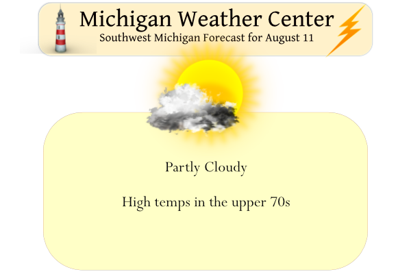
We have 65° at 6:30 this morning. Yesterday’s high was 79.5° after a morning low of 56°.
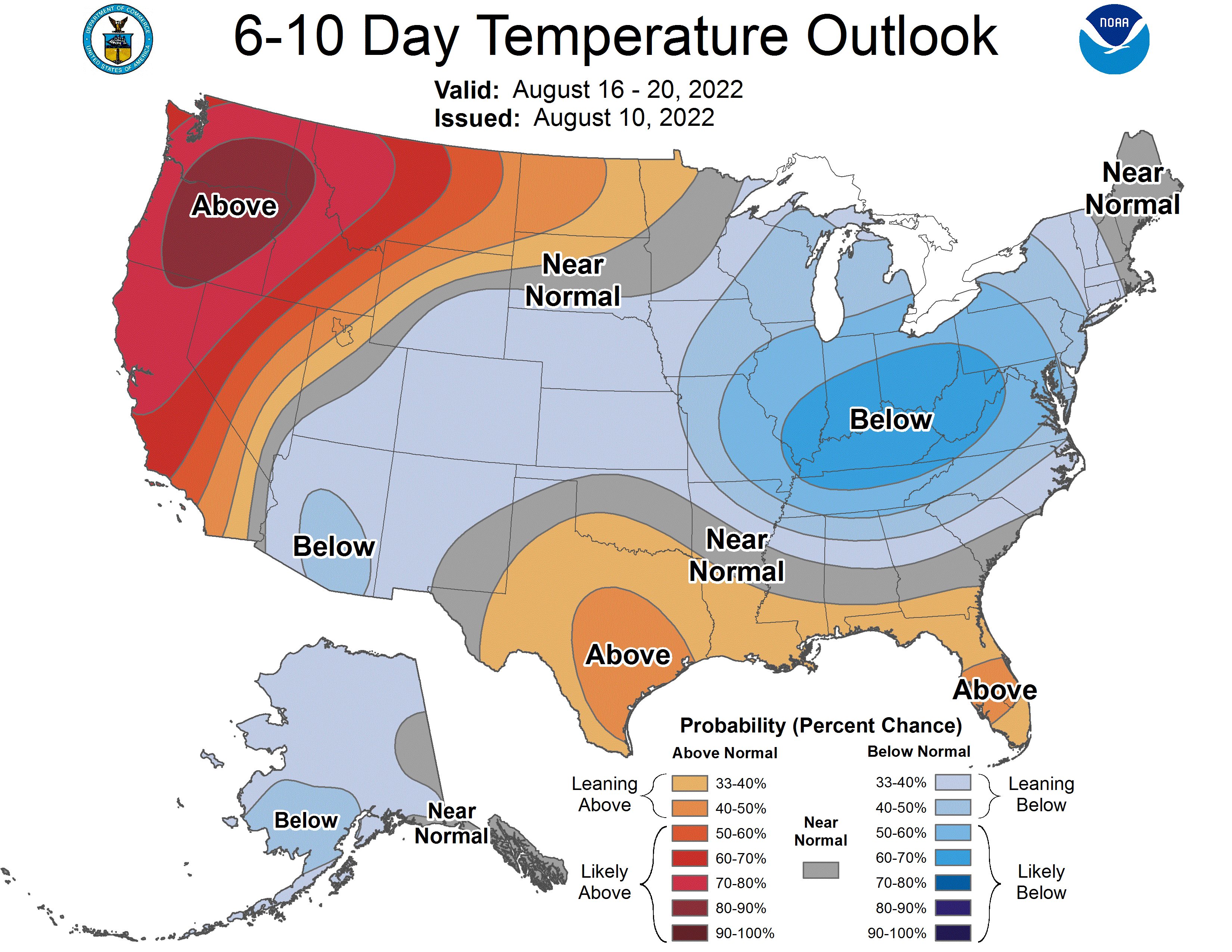
We are now entering a period of slightly below-average temperatures which may last through the rest of the month according to the CPC. Daytime highs are predicted to be in the upper 70s with overnight lows in the 50s. Precipitation is predicted to be below normal over the next week.
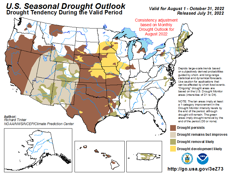 Drought conditions still persist in Michigan’s thumb while there is some improvement in the SW U.S. where there has been a persistent drought for quite some time.
North winds will increase in speed today and dangerous waves and currents will develop as a result on Lake Michigan. The worst of the conditions will be found from mid-afternoon through sunset. Waves of 3 to 6 feet are forecast. The north sides of the north piers will be the most dangerous beaches. Look for a partly to mostly sunny sky today with highs in the upper 70s.
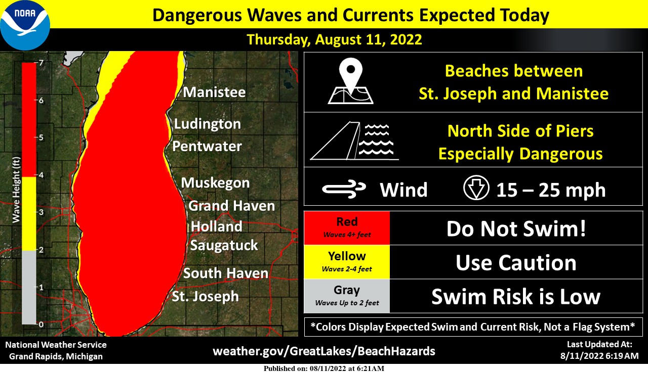
Dangerous swimming conditions will develop today beginning up towards Ludington around midday and building south through the afternoon. By evening all Western Lower Michigan Lake Michigan beaches south of Manistee will have a high swim risk. North sides of north piers will be the most dangerous places to swim such as… Stearns Park in Ludington, Mears State Park in Pentwater, Holland State Park and North Beach in South Haven.
Forecast Discussion
A cold front will continue to move south across our area early
this morning and bring scattered light rain showers to our
southeastern fcst area through around daybreak. Many locations
will not receive any measurable rainfall with fropa as a result of
rather limited moisture and little if any sfc convergence.

IR sat trends early this morning suggest skies will become mostly
clear after fropa. However we do expect that sct fair wx cu will
develop from around midday through the afternoon before
dissipating early this evening.

Canadian high pressure building se into our area will bring fair
wx with mostly clear skies tonight through Friday. Some mid to
high level cloud cover will move in from the west Friday night
well out ahead of the low pressure system moving into the upper
Midwest.

It will be mostly cloudy with showers Saturday due to increasing
moisture and isentropic upglide and moderate 1000-850 mb moisture
transport as the low pressure system continues to move east into
our area. A few thunderstorms are possible as well but convective
potential will be limited significantly by extensive cloud cover
and weak instability.

A few showers may linger into early Sunday until the weak low
pressure system moves further SE and away from our region. A
consensus of latest medium range guidance suggests that
predominantly fair wx with seasonable temps will return for most
of next week.

However I would not be surprised if there were a few showers from
time to time with the broad longwave trough in place over the
eastern CONUS and as several upper level disturbances move in from
the north to northwest. Those would be mostly diurnally driven
showers.
Get ready GGR for lows in the 40’s tonight! Now that is some incredible August cold! What a week and what a near perfect no heat wave summer! Rock n roll will never die!
While I don’t think this will happen it is none the less in the forecast.
MIZ085-120800-
NORTHERN SCHOOLCRAFT-
INCLUDING THE CITY OF SENEY
253 PM EDT THU AUG 11 2022
LATE THIS AFTERNOON
SUNNY. NORTH WINDS 5 TO 10 MPH.
TONIGHT
CLEAR. PATCHY FOG AND FROST AFTER MIDNIGHT. COOL WITH
LOWS IN THE UPPER 30S. LIGHT WINDS.
Yes that the says patchy fog and frost. Just goes to show you how shore summers really are in parts of Michigan!
Slim
Incredible!
Keep this great summer weather rocking!
The last decent rain we’ve had was back on July 24. Since then we’ve had 2 days with a trace of rain and 1 day with 0.04”, almost 3 weeks. Add in the heat and all the sunny days, this has been the driest I’ve seen in a long time. Our field has soy beans this year and the plants look terrible, withering away.
The near perfect summer continues! No heat waves, enough rain so minimal
watering is needed, near normal temps and this week into next week below normal temps! Wow just wow!!
The official high/low yesterday at Grand Rapids was 83/57 with low humidity it was another great summer day. There was a reported trace of rain all and for the day there was a reported 93% of possible sunshine. The overnight low both at GRR and here in MBY was 66 that is the current reading here in MBY with the sun now starting to show itself. For today the average H/L is 85/62 the record high of 96 was in 1947 and the record low of 43 was in 1967. The sun rise today is 6:44 and the sunset is… Read more »
This morning was the first morning in quite a while that I had turned on the kitchen light in order to make coffee.
We are now have10 days of August in the record books and at Grand Rapids the mean so far this month is 75.4 that is a departure of +3.2. There has been 0.78” of rain fall (of that 0.70” fell on the 3rd ) The official high for the month so far is 89 and the low so far is 57.
Slim
For the beach report I can tell you that on the ferry on Monday with reported 5 to 7 foot waves it can be a little rough on the lake even on a “big boat”
Slim