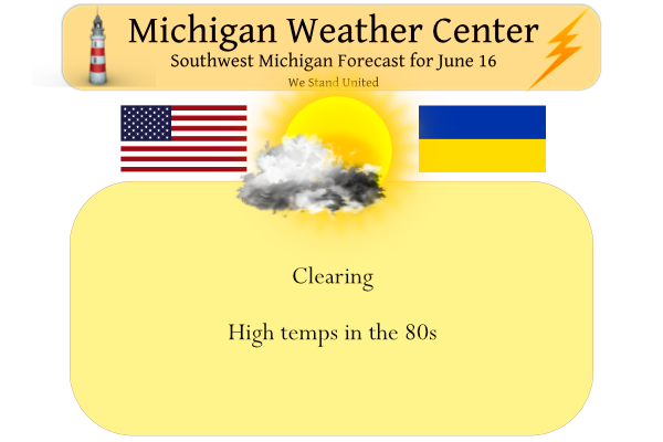
We have 80° at 3 am this morning with some rain moving through SW Michigan. Yesterday’s high was 93° and the low was 72°. We will see gradual clearing today with highs in the mid-80s.
Weather History for SW Michigan
June 12
1996: Extensive flash flooding in and around Mt. Pleasant was the result of 1.82 inches of rainfall in 30 minutes with storm totals exceeding 2 inches. At one point parking lots had water 12 inches deep, several fields and ditches were flooded, and some motor homes and campers were set afloat.
1998: A tornado touched down in Bedford Township in northwest Calhoun County, doing minor damage to a few homes and shearing off trees like a large weed whacker.
2008: Historic flash flooding results from up to a foot of rain near Ludington and Manistee. More than 40 roads were washed out and some of them were not repaired for several months. The torrential rains are preceded by a severe thunderstorm that drops two tornadoes. The first tornado came ashore north of Ludington at the Nordhouse Dunes Wilderness Area, downing hundreds of trees. A second tornado hit near Stronach in Manistee County.
June 13
1900: A tornado touched down near Marshall and passed north of Battle Creek, ending near Bellevue. Barns were destroyed at several farms along the path of the storm.
1994: A tornado struck Jackson County, producing a 16-mile damage path and injuring 2 people. More than a dozen homes were damaged or destroyed, along with other buildings.
2004: Severe weather struck across the region and a weak tornado touched down briefly in a field one mile northeast of Stanton in Montcalm County
June 14
1894: A week-long heat wave was underway with temperatures at or above 90 degrees across much of the region from June 10th to June 16th. Grand Rapids hit 95 degrees on the 13th, 96 degrees on the 14th and 97 degrees on the 15th.
1991: A tornado injures one person and damages several homes east of Jackson.
June 15
1960: More than 20 houses sustain damage as a tornado hits the southern part of the city of Jackson, Michigan.
1976: Tornadoes caused a quarter-million dollars in damage in Lower Michigan. In Kent County, a barn is destroyed and two houses were damaged by a tornado near Cedar Springs. In Allegan and Ottawa Counties, several buildings are damaged along a twelve-mile path, ending just south of Jenison. Mobile homes are damaged near Walton in Wexford County.
1982: A series of strong tornadoes struck central Lower Michigan. In Gratiot County, several homes were damaged, two of them severely as a tornado moved from near Pompeii to North Star. In Jackson County, a tornado kills one person and injures another as it moves about 5 miles west of Munith.
June 16
1974: Cool and cloudy weather prevailed for the middle of June with high temperatures only in the middle 50s across the region on both June 16th and 17th.
June 17
1975: A tornado struck two miles northeast of Newaygo. A tree fell on and killed a 14-year-old girl who was camping with her parents. Tornadoes also hit Roscommon County, where damage was done to some boats on the southwest shore of Houghton Lake. Another tornado damaged several farm buildings north of Zeeland in Ottawa County.
1992: Over a dozen, mostly weak tornadoes struck across Lower Michigan, including south of Coopersville in Ottawa County, near Cedar Springs in Kent County, Harrison in Clare County and Pewamo in Ionia County.
June 18
1976: Three tornadoes cause minor damage across Lower Michigan. The first tornado moved northwest of Lansing, damaging a house and destroying a barn and shed. Another tornado blew down barns near Reese in Saginaw County. The final tornado destroyed a barn and damaged a garage in Gladwin County, north of Edenville.
1994: An early-season heat wave peaked with temperatures in the mid and upper 90s across the region. The temperature hit 98 at Lansing, 96 at Grand Rapids and 91 at Muskegon.
Weather History for SE Michigan
June 12
On June 12, 2021, an isolated supercell developed near Mount Pleasant and tracked south-southeast toward Ann Arbor during the late afternoon and evening. This storm produced baseball-sized hail in Ovid (Clinton County) and golf ball-sized hail near Laingsburg (Shiawassee County) as well as isolated wind damage to trees in its path.
On June 12, 1984, an F3 tornado hit Bay County at 6:20 PM and caused $2,500,000 in damage. Two individuals were reported injured, but there were no deaths. This was the strongest tornado ever reported in Bay County.
June 13
On June 13, 2004, an F1 tornado hit Huron County at 5:00 PM, causing $25,000 in damage. One property in this county lost 44 trees because of this tornado; many of the trees were very large and older than 100 years!
June 14
On June 14, 1966, an F2 tornado hit Wayne County and caused $3,000 in damage.
June 15
On June 15, 1982, an F3 tornado struck Washtenaw County. The tornado moved from 5 miles west-southwest of Munith in Jackson County to 8 miles northwest of Chelsea. The tornado was 1500 feet wide, and it resulted in one death and one injury in Jackson County. Overall, 7 houses were destroyed and 15 buildings were damaged by the tornado.
June 16
On June 16, 1998, lightning struck and killed a person at 6 PM in Wayne County.
June 17
On June 17, 2009, three to six inches of rain fell in and around the I 69 corridor during the daytime hours including 3.46 inches at Flint. That made it the 2nd wettest June day and the 9th wettest day all-time for Flint. This amount of rain, coupled with the wet spring, lead to flooding across a few counties. Road closures and basement flooding were common.
On June 17, 1992, 10 tornadoes touched down in Southeast Lower Michigan as a squall line ripped across the region. All of the tornadoes were rated F0 and F1. Temperatures ahead of the squall line soared into the 90s which was one of only three such days during the cold summer of 1992.
Also on this date in 1935, the record for the greatest amount of precipitation for the month of June in Saginaw was reached, with a rainfall estimate of 2.98 inches.
June 18
On June 18, 2014, As a line of thunderstorms moved through Southeast Michigan, Adrian airport measured a severe thunderstorm wind gust of 81 mph!
Also on June 18, 2010, a severe squall line developed over Northern Illinois and raced across Southern Lower Michigan. The line of severe thunderstorms produced 28 reports of severe winds and wind damage, mostly along and south of highway M-59. Significant winds in excess of 70 mph were noted from the wind damage in Huntington Woods.
Also on June 18, 1999, Flint had a record cold temperature of 41 degrees, breaking the old record of 43 degrees set back in 1986.
Forecast Discussion
--Quite Breezy, Less Humid Thursday--

Still rather warm behind the cold front on Thursday with highs
well into the 80s, but arrival of dew points in the 50s from the
west will usher in less oppressive conditions. Once deeper mixing
develops in the afternoon and 40-45kt westerly low level jet
arrives within base of upper trough digging into the nrn
GrtLks region, expect some healthy gusts of 30 to 40 mph in the
afternoon. Strongest wind gusts are expected to be north of I-96
and could even approach wind advisory criteria near/north of Hwy
U.S. 10.

--Cool and Comfortable Weekend--

A large cool/dry Canadian sfc high impacts the region Friday
through Sunday, keeping humidity in check and providing highs in
the mid to upper 70s. Even some chilly overnight low temps
expected, especially Friday night, when lows could dip into the
40s in some spots. The next chance of convection commences on
Sunday as warm front begins to shift back in our direction,
although confidence low as to coverage/timing of that risk.

--Heat and Humidity Returns Next Week--

Strong ensemble support for at least a few days of temps back up
near 90 next Monday through Wednesday, although frontal boundary
progged to slip south through the area Wed night may bring a
round of storms followed by cooler temps/lower humidities.
I am surprised at how warm it got today. I was expecting it to be somewhat cooler.
Well 90 is cooler than 94. Air was a lot drier today though so you could breathe.
You are right on that. The humidity was less. The breeze today was wonderful!
Enjoying the longest daylight streach of the year for another week or so and highs in the 70’s weekend even better forget the heat …INDY
90 here. Warmer than forecasted, but the DP has dropped 15 degrees in the past five hours.
We hit 90 at my house as well.
Topped out at 90 here as well. 3rd day in a row, 5th overall.
The updated CPC’s outlook out now out. Here is July’s
https://www.cpc.ncep.noaa.gov/products/predictions/long_range/lead14/index.php
And here is JAS
https://www.cpc.ncep.noaa.gov/products/predictions/long_range/seasonal.php?lead=1
and just for the fun of it here is the guess for next winter
https://www.cpc.ncep.noaa.gov/products/predictions/long_range/seasonal.php?lead=6
now the next question is just how accurate are their long range guesses?
“On balance, the Climate Prediction Center notes that seasonal outlooks are fairly accurate — “40 percent better than a random forecast (averaged over a 4-year period)” — and that the outlooks are more accurate some seasons and less accurate in others because of natural variability.”
Slim
Some fun facts. Yesterdays official high of 94 was the warmest high at Grand Rapids since 2018 when GR had a 7 day “heat wave” it was also 94 in June of 2011. Now for some fun facts. Some think that just because it gets hot in June it will be hot all summer long. Well in June of 2009 there was a 3 day “heat wave” and the temperature toped out at 96. But July of 2009 was the coolest July of record at Grand Rapids. Of course the “heat” came back in August for a one days “heat… Read more »
2009 was one of the worst summers I ever remember. The temps were chilly and I sadly lost my grandma later that year. I was taking care of my grandma and did not have a license at the time so I would petal on my bike to get the things she needed at meijer on The Beltline and Knapp and petal up to Plainfield to get any food she was craving. It was chilly I wore jeans quite a bit. The tires on the bike I think both had a hole so I rode around on 2 flat tires everywhere… Read more »
Yes 2009 was definitely the worst summer I remember. I was on the swim team (I was 11 at the time) and had to swim 7:30AM every day that summer when it was in the 40s and 50s.
Sorry about your grandma but give me a cool summer like 2009 every single year baby!
The rest of June is looking very warm. And today CPC’s newly released monthly guess is for a warm July as well.
I took a drive down Jordan Lake Rd this morning and took a look how things look in the area where the tornado hit in June of last year. The house that was completely destroyed is being rebuilt. Looks like they just need to work on the inside and put siding on it. The chunk of woods that was hit still shows it’s signs of the tornado. Sheered trees and others bent in the direction the tornado went. That was a crazy afternoon in West MI. Probably the most tornado warnings I’ve ever seen NWS GR issue in a day.
Ton of lightning last night and some crazy load thunder that made us all fall out of bed. 3 tenths of rain. Yesterday was our 4th 90 degree day here already. 2 in May and now 2 in June.
It was quite a light show! It had us up too.
We had .24 of an inch of rain from the storms moving through this morning – 2.55 inches for the month.
Currently 76 degrees with a 70 dp
Wow 94 yesterday! Welcome to day 5 of the warm temps. Today June flips to warmer than average.
Rain just passed through here about an hour ago (Lansing). Still pretty humid outside but I’d imagine this will improve throughout the day.
Got a nice thunderstorm to roll through my area at about 5am LOTS of frequent lightning. Was a nice treat to wake up to. I have 70 now with the sun peaking out.
Still cloudy here with the same 70.
Slim
“We have 80° at 3 am this morning”. Wow!
74 here, very humid with a thundershower. Feels like Florida.
It did indeed have a Florida feel for a while yesterday. At the current time it is cloudy and 70 here and even with a Dew Point of 68 it feels much cooler now that it did late last night.
Slim
There were several new records set yesterday. The official high/low yesterday at Grand Rapids was 94/77. The low of 77 was the 3rd warmest minimum the warmest for the month of June. The record warmest minimum for June is 79 on June 20th, 1953 with 78 the 2nd warmest on June 28th 1958 and June 30th 2018. A new record high of 95 was set a Lansing and a new record high of 92 was set at Muskegon. At Holland the high/low was 93/80 that 80 is a new record low for the dated and ties June 20th 1953 for… Read more »